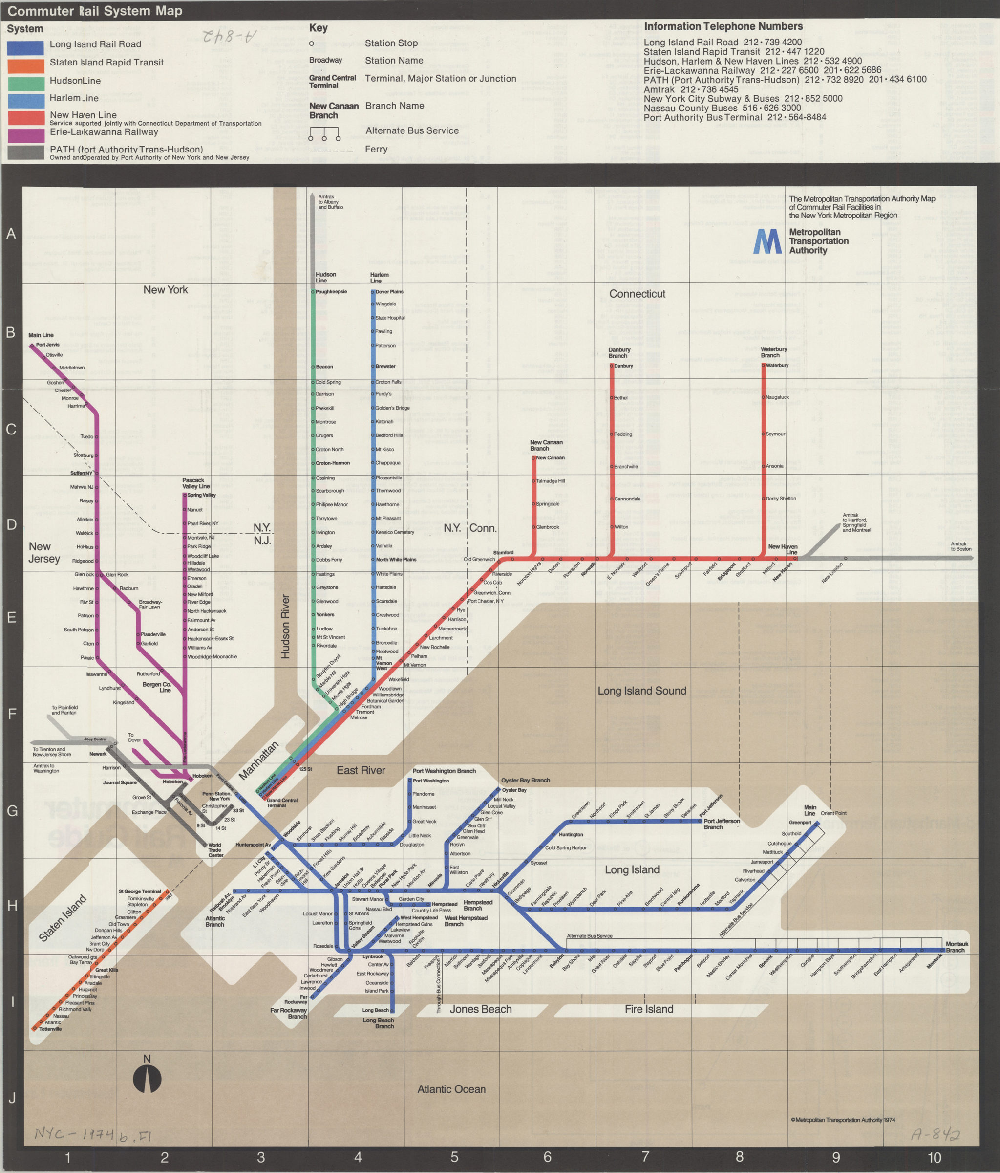
Commuter rail system map [ca. 1974]
Map No. NYC-1974b.Fl
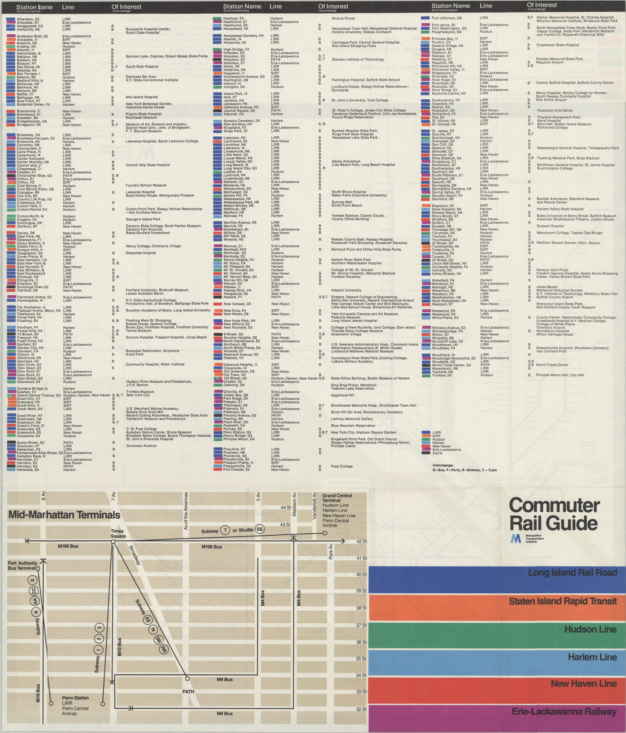
Schematic route map. Index of stations and map of “Mid-Manhattan terminals” on verso.
Subjects
Map area shown
Genre
Transportation mapsRelation
Full catalog recordSize
46 × 46 cmDownload
Low Resolution Image
Creator
New York (State); Metropolitan Transportation Authority,Publisher
Brooklyn Historical SocietyCitation
Commuter rail system map; [ca. 1974], Map Collection, NYC-1974b.Fl; Brooklyn Historical Society.Scale
Not drawn to scaleLoading zoom image... 