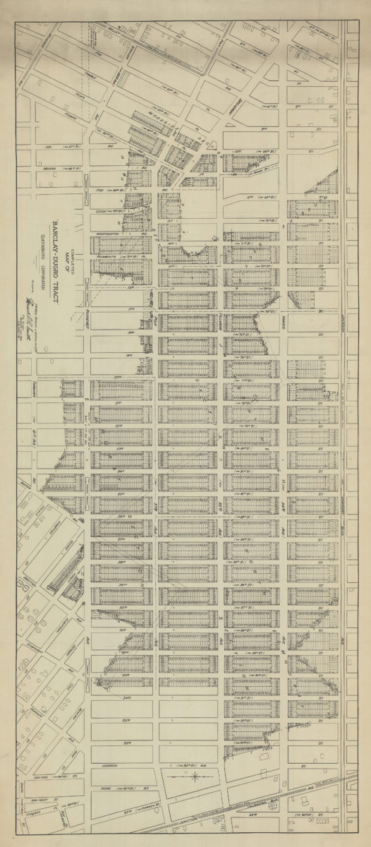
Completed map of the Barclay-Dugro tract 1911
Map No. Q-1911.Fl
Cadastral map showing property plots in Queens from Northern Boulevard to 42nd Avenue, and 57th Street to Junction Boulevard.
Places
Map area shown
Genre
Cadastral mapsRelation
Full catalog recordSize
50 × 118 cmDownload
Low Resolution Image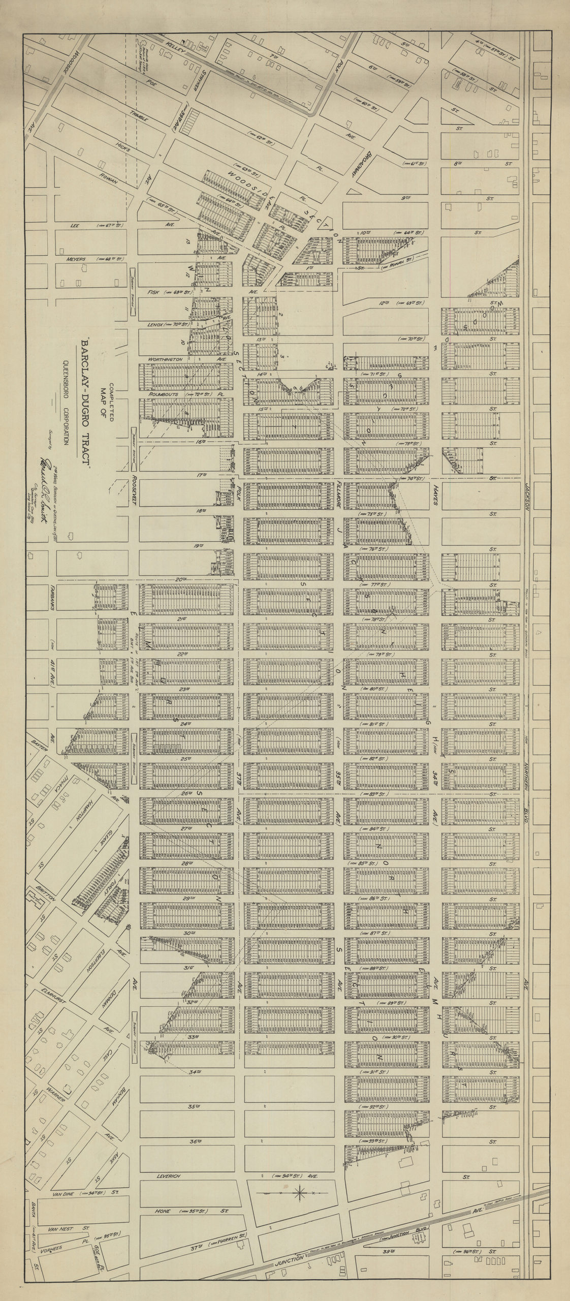
Creator
Smith, Leonard.,Publisher
Brooklyn Historical SocietyCitation
Completed map of the Barclay-Dugro tract; 1911, Map Collection, Q-1911.Fl; Brooklyn Historical Society.Scale
Scale not givenLoading zoom image...