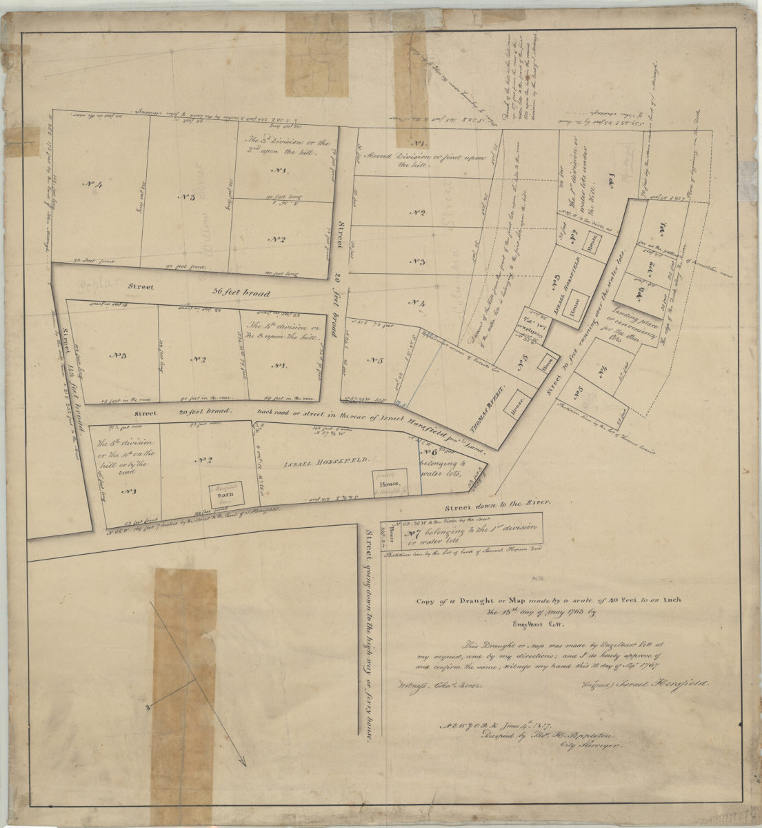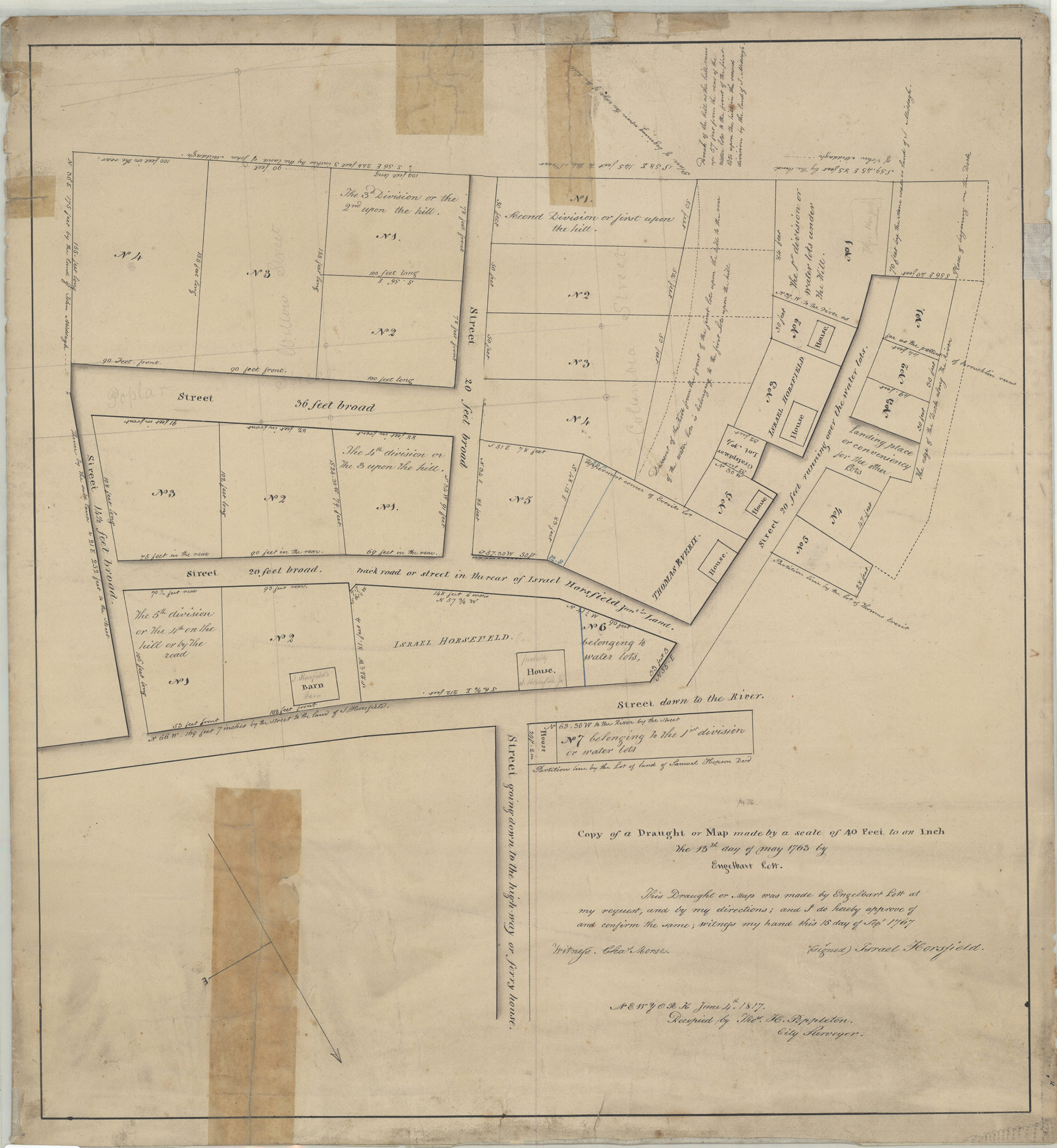

Copy of a draught or map made by a scale of 40 feet to an inch, the 13th day of May 1763: by Engelbart Lott ; recopied by Thos. H. Poppleton, city surveyor, New York, June 4th, 1817 [1817]
Map No. B P-1763 (1817?).Fl
Cadastral map covering area in modern-day Brooklyn Heights. Shows property (including lots, dimensions, and buildings), names of landowners, and street measurements. Oriented with north to the lower right. Includes notes. “This Draught or Map was made by Engelbart Lott at my request, and by my directions and I do hereby approve and confirm the same writing my hand this 15 day of Sept. 1767. (Signed) Israel Horsfield.” “Ludlows estate, H.B. Pierrepont”–Handwritten on verso. BHS has 2 copies.
Map area shown
Genre
Cadastral mapsRelation
Full catalog recordSize
49 × 45 cmDownload
Low Resolution Image
Creator
Lott, Engelbart, Lott, Engelbart,Publisher
Brooklyn Historical Society, Brooklyn Historical SocietyCitation
Copy of a draught or map made by a scale of 40 feet to an inch, the 13th day of May 1763: by Engelbart Lott ; recopied by Thos. H. Poppleton, city surveyor, New York, June 4th, 1817; [1817], Map Collection, B P-1763 (1817?).Fl; Brooklyn Historical Society.Scale
Scale [1:480] 1 in to 40Loading zoom image...