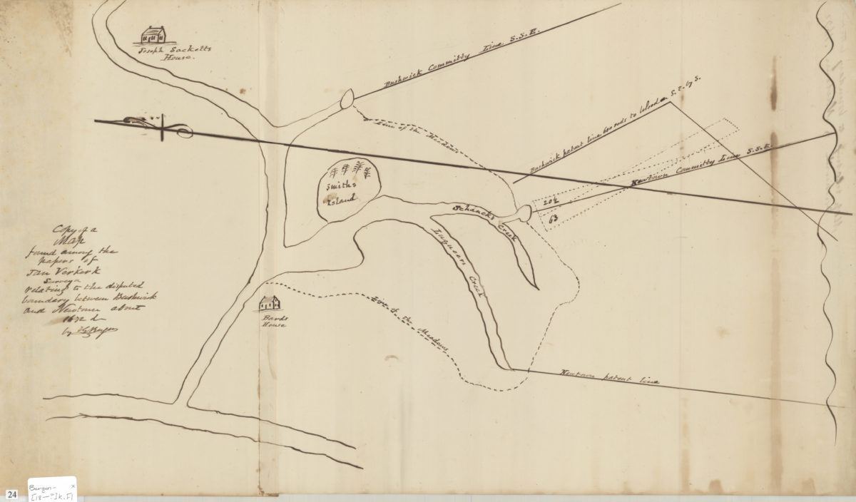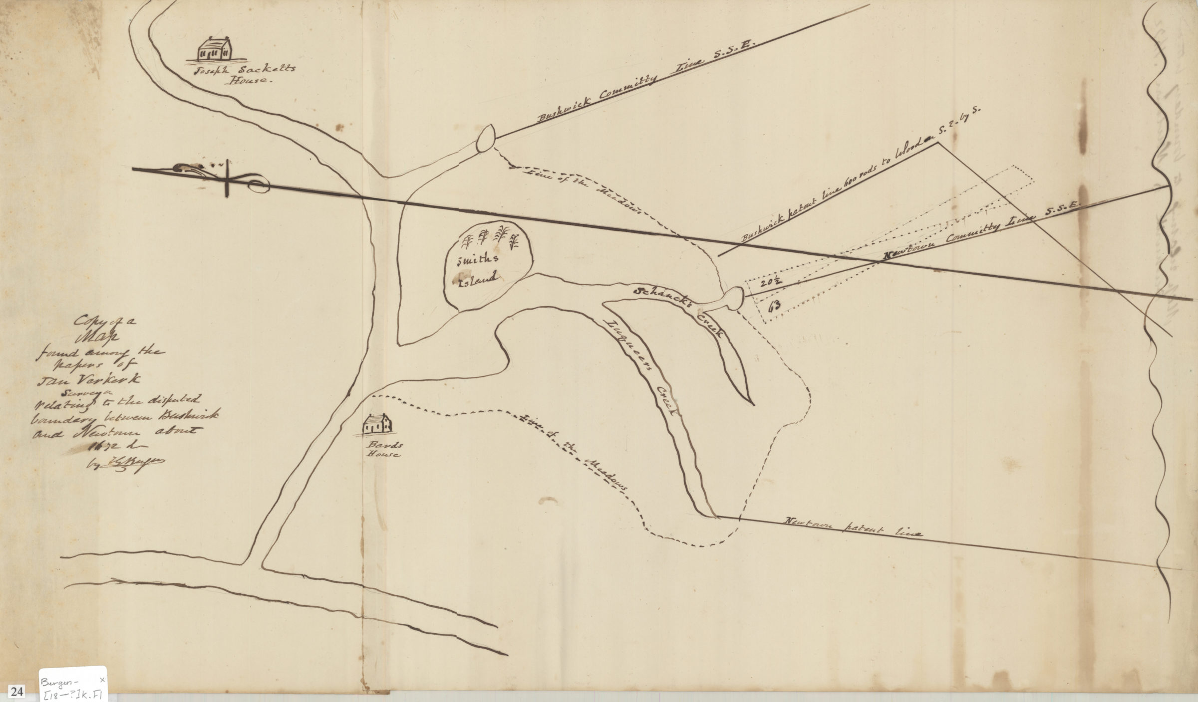
Copy of a map found among the papers of Jan Verkerk, surveyor, relating to the disputed boundary between Bushwick and Newtown about 1672: by T.G. Bergen [18??]
Map No. Bergen-[18--?]k.Fl
Also shows patent lines, creeks, names of landowners, meadows, and Smiths Island. Relief shown pictorially. Oriented with north to the left.
Places
Map area shown
Genre
Manuscript mapsRelation
Full catalog recordSize
32 × 38 cmDownload
Low Resolution Image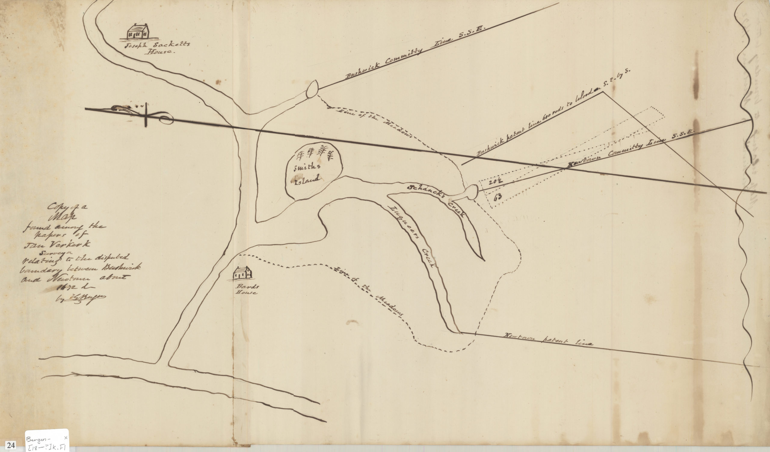
Creator
Bergen, Teunis G.,Publisher
Brooklyn Historical SocietyCitation
Copy of a map found among the papers of Jan Verkerk, surveyor, relating to the disputed boundary between Bushwick and Newtown about 1672: by T.G. Bergen; [18??], Map Collection, Bergen-[18--?]k.Fl; Brooklyn Historical Society.Scale
Scale not givenLoading zoom image...