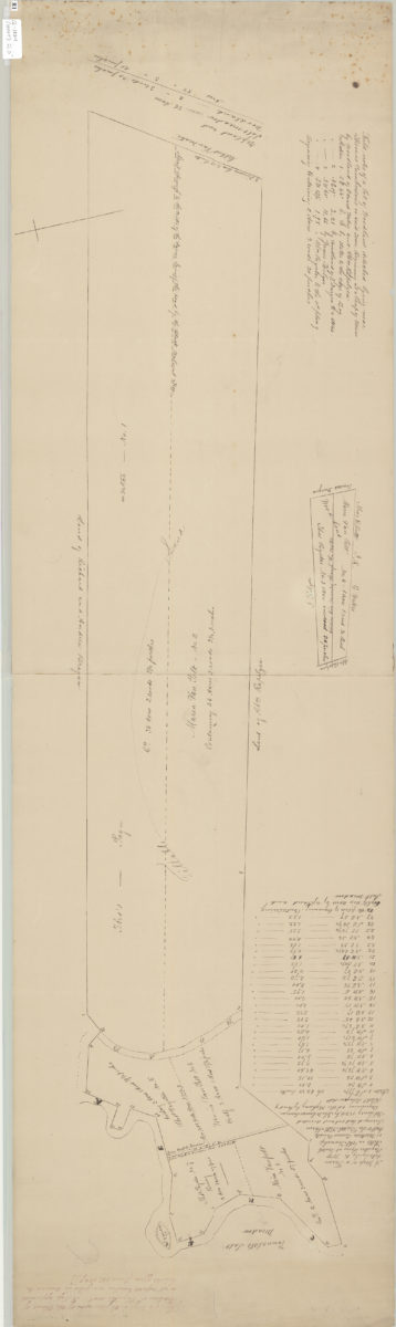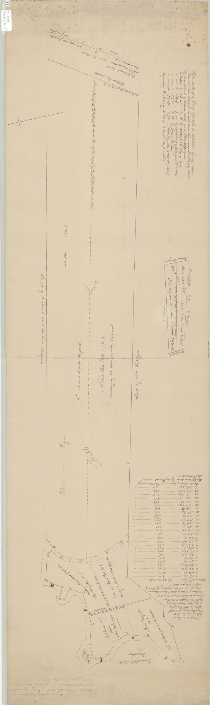
Copy of a map in the possession of the heirs of Thomas S. Payntar, decd [1849]
Map No. Q-1834 (1849?).Fl.O
Cadastral map. Shows property (including acreages), and names of landowners. Manuscript copy of map with original title: A map of a farm beloning to Wm. Payntar lying at Dutch Kills in the township of Newtown, Queens County call’d the Dutch Kills Farm : surveyed, laid out and divided February 1834 beginning at the highway of land of Richd. Bragam, dec’d / by John W. Loweree, surveyor. Oriented with north to the right. “A Map apparently in all respects similar was filed in Queens Co. Clerks Office, June 15, 1849.” Includes notes.
Map area shown
Relation
Full catalog recordSize
118 × 34 cmDownload
Low Resolution Image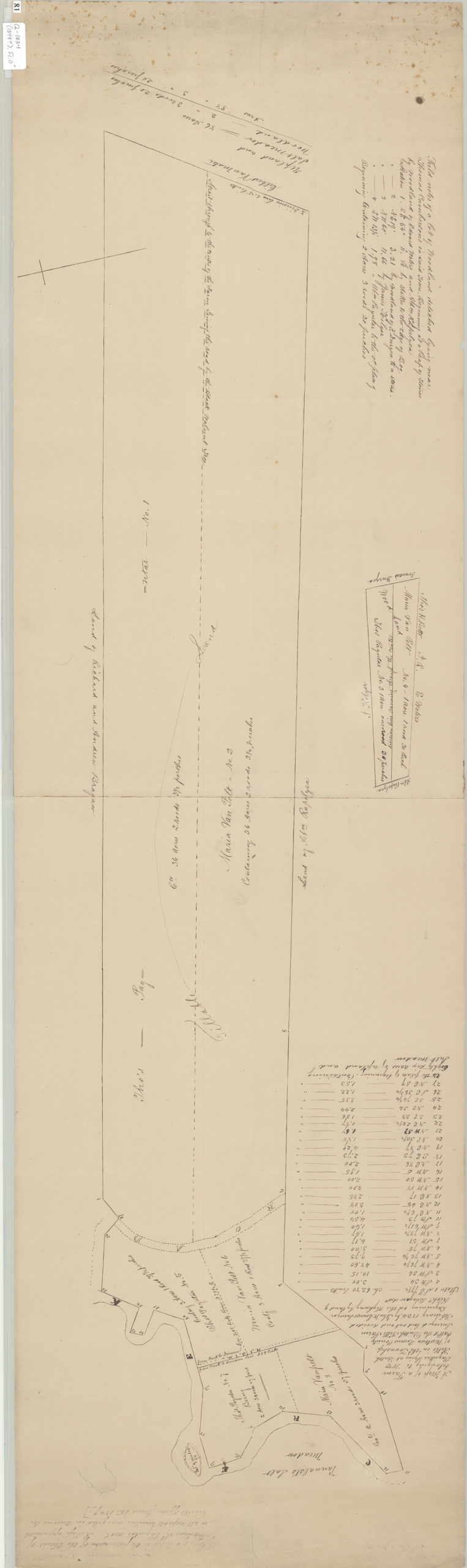
Creator
Loweree, John W.,Publisher
Brooklyn Historical SocietyCitation
Copy of a map in the possession of the heirs of Thomas S. Payntar, decd; [1849], Map Collection, Q-1834 (1849?).Fl.O; Brooklyn Historical Society.Scale
Scale not givenLoading zoom image...