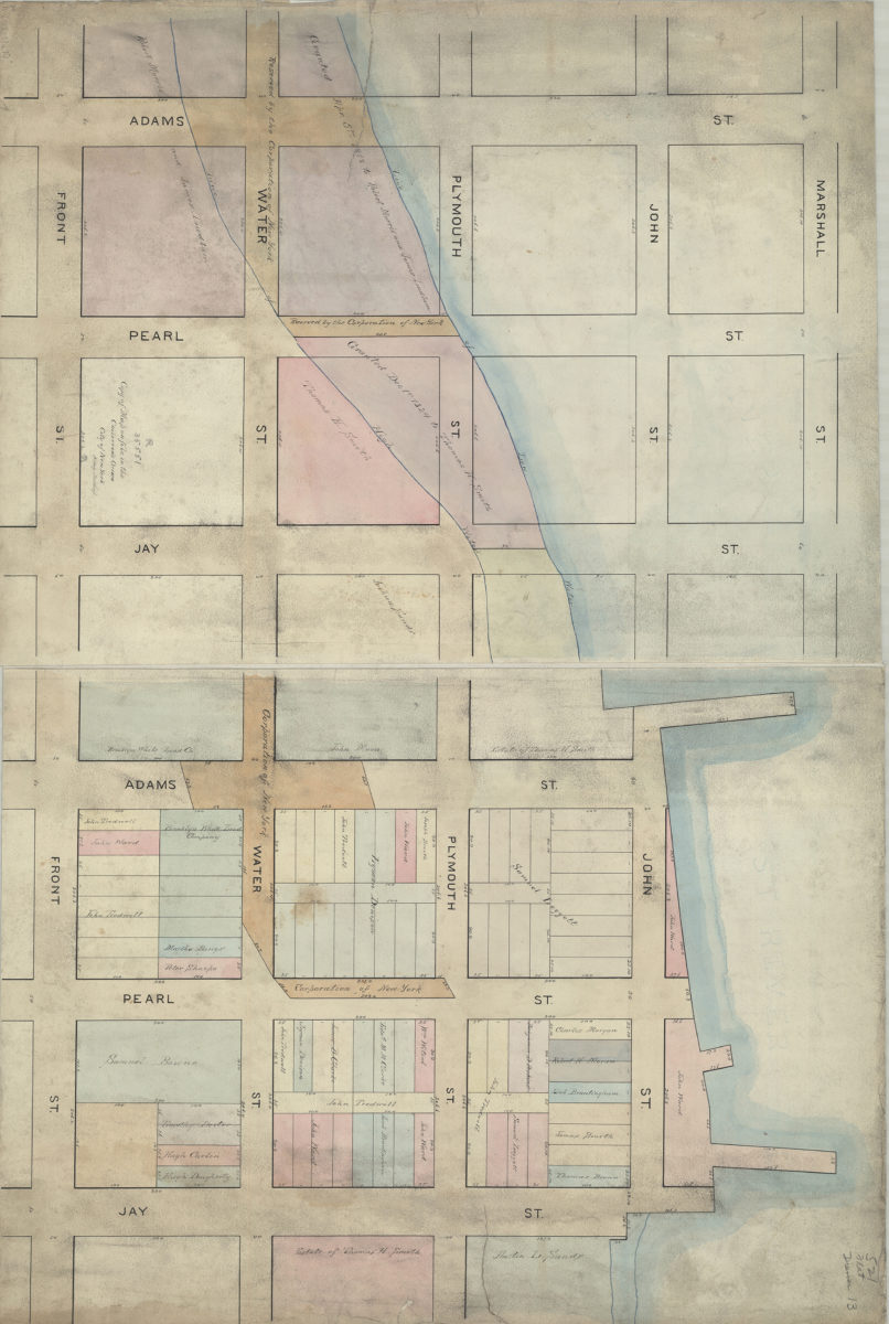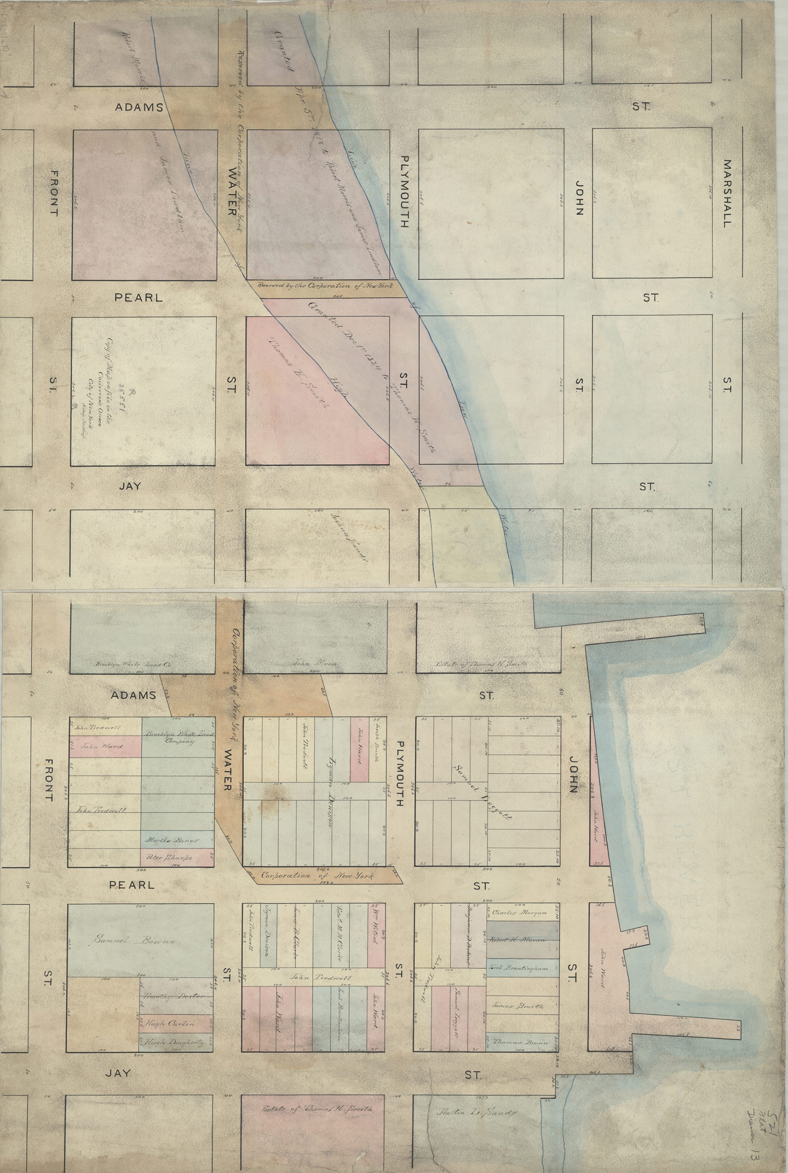
Copy of map on file in the Collector’s Office, City of New York: N. Aug. Northup [188?]
Map No. B A-[188-?]a.Fl
Cadastral map covering area bounded by Front St., Jay St. and Adams St. (modern-day DUMBO and Vinegar Hill). Shows property (including lots and dimensions), names of landowners, historial land grants, street extensions, and high/low water lines.
Subjects
Places
Map area shown
Relation
Full catalog recordSize
68 × 102 cmDownload
Low Resolution Image
Creator
Northup, Nicholas A.,Publisher
Brooklyn Historical SocietyCitation
Copy of map on file in the Collector’s Office, City of New York: N. Aug. Northup; [188?], Map Collection, B A-[188-?]a.Fl; Brooklyn Historical Society.Scale
Scale not givenLoading zoom image...