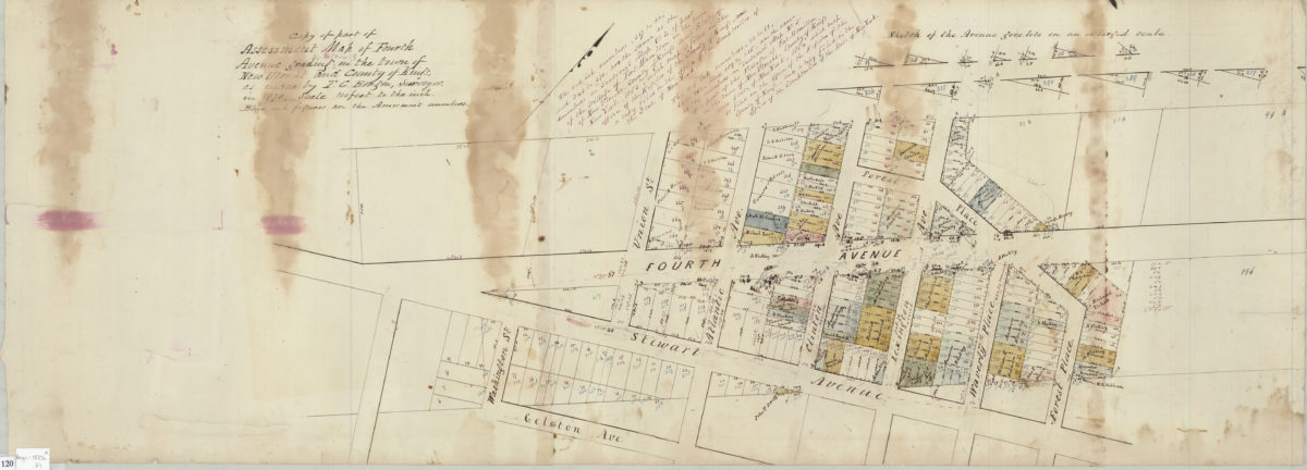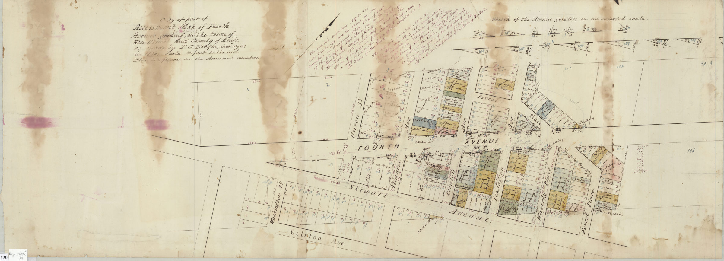
Copy of part of assessment map of Fourth Avenue grading in the town of New Utrecht and County of Kings: as made by T.G. Bergen, surveyor 1870
Map No. Bergen-1870a.Fl
Cadastral map showing lots (including numbers and dimensions) along 4th Avenue in modern-day Fort Hamilton section of Bay Ridge. Includes text and inset: Sketch of the Avenue gore lots on an enlarged scale. Oriented with north to the upper right.
Subjects
Places
Map area shown
Relation
Full catalog recordSize
36 × 99 cmDownload
Low Resolution Image
Creator
Bergen, Teunis G.,Publisher
Brooklyn Historical SocietyCitation
Copy of part of assessment map of Fourth Avenue grading in the town of New Utrecht and County of Kings: as made by T.G. Bergen, surveyor; 1870, Map Collection, Bergen-1870a.Fl; Brooklyn Historical Society.Scale
Scale [1:1200] 1 in to 10Loading zoom image...