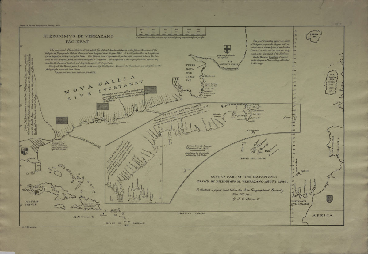
Copy of part of the Mapamundi drawn by Hieronimus de Verrazano about 1529: to illustrate a paper read before the Am. Geographical Society, Nov. 28th, 1871 by J.C. Breevort [1873]
Map No. N. Amer.-1529 (1873?).Fl
Facsimile. Covers coast from Terra Laborato to Ispagnola sive Sancto Domingo. Scale: “Contiene dal una alaltra picolo punta miglia 50 che sono leghe 12 1/2 computado miglia 4 per leghe.” “Comprised between the parallels 20 and 70 degrees North, and about 83 degrees of longitude.” “Report of the Am. Geographical Society, 1873”–Upper left margin. Includes inset: Extract from the Spanish Mapamundi of 1527 / copied from the facsimile published by J.G. Kohl. “Pl. II”–Upper right margin.
Map area shown
Genre
Early mapsRelation
Full catalog recordSize
31 × 50 cmDownload
Low Resolution Image
Creator
Verrazzano, Girolamo da,Publisher
Brooklyn Historical SocietyCitation
Copy of part of the Mapamundi drawn by Hieronimus de Verrazano about 1529: to illustrate a paper read before the Am. Geographical Society, Nov. 28th, 1871 by J.C. Breevort; [1873], Map Collection, N. Amer.-1529 (1873?).Fl; Brooklyn Historical Society.Scale
Scale [ca. 1:13,305,600]Loading zoom image...