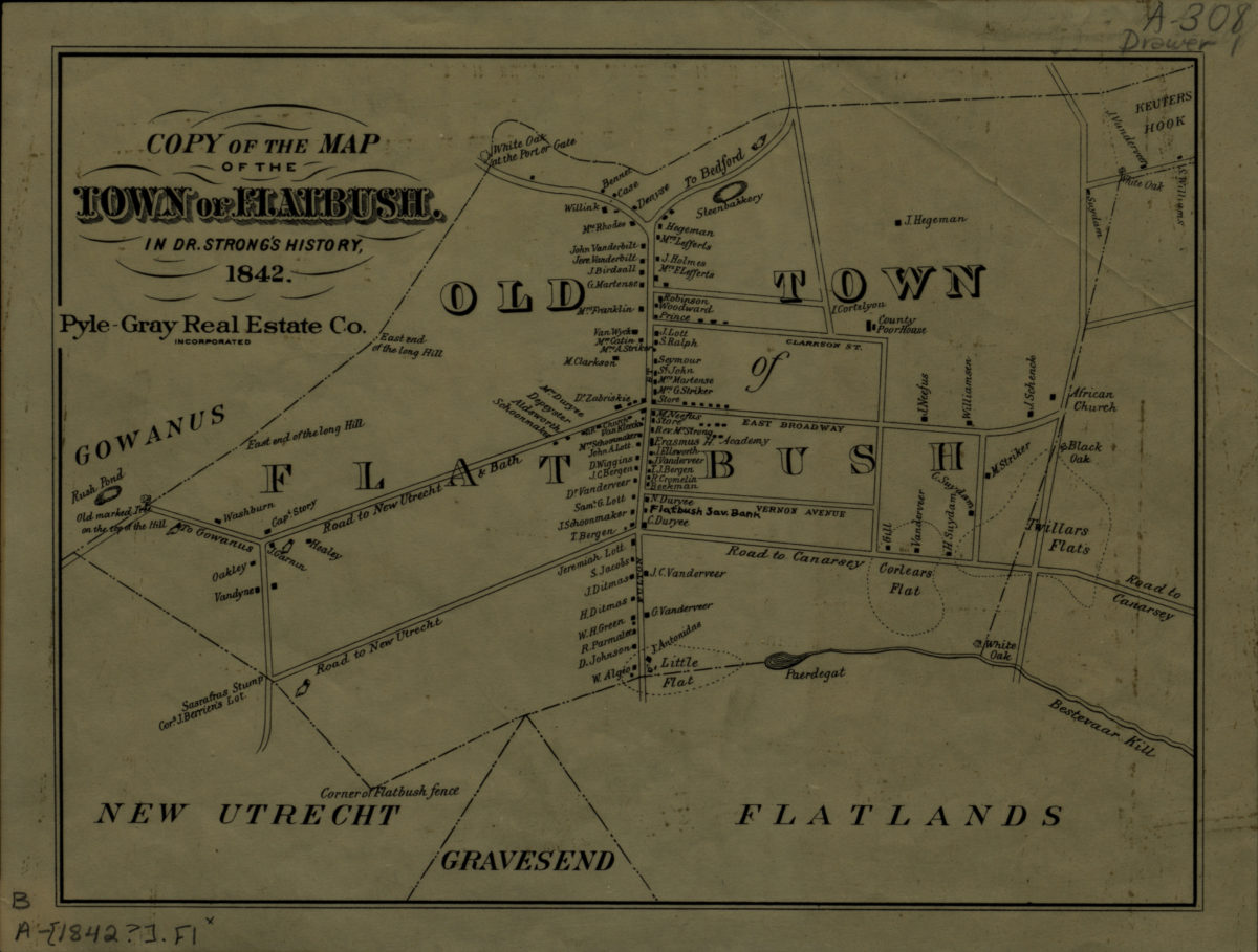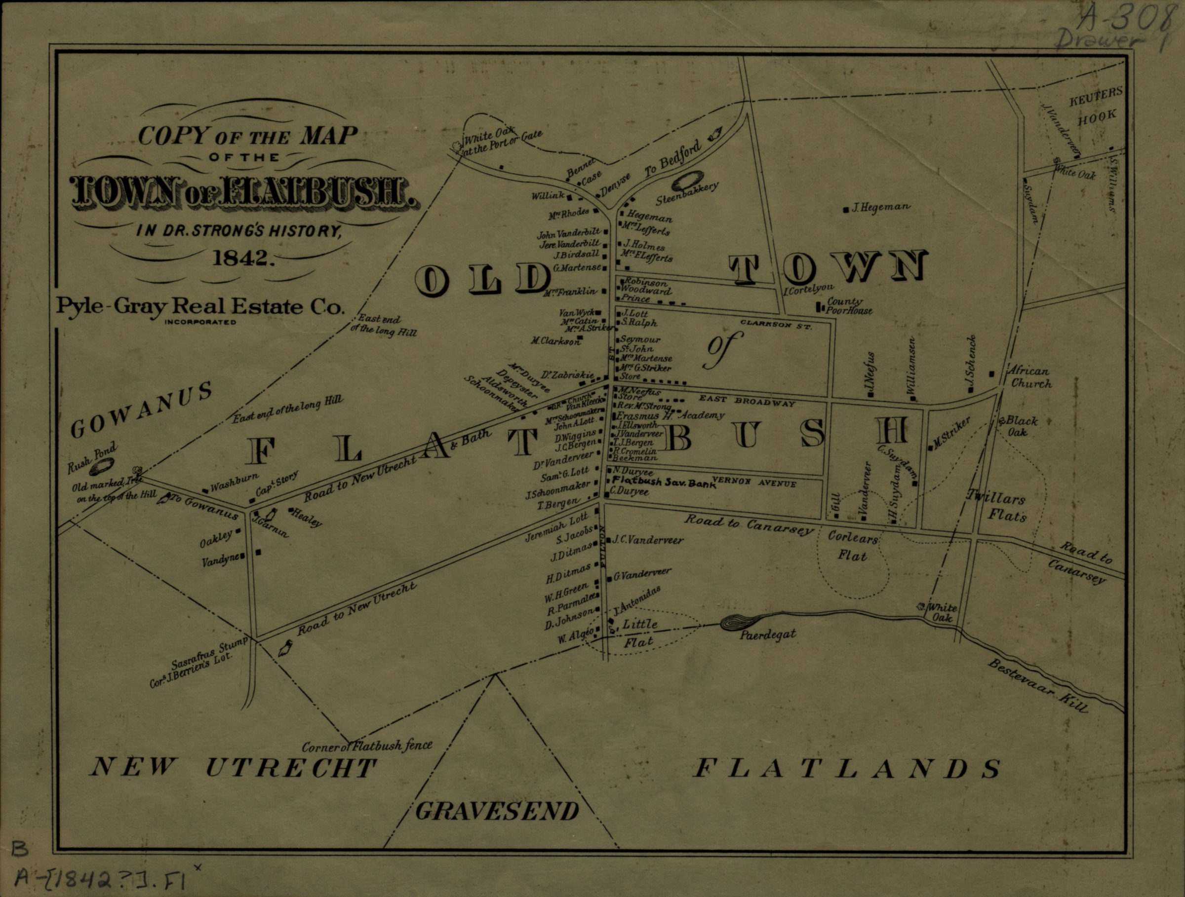
Copy of the map of the town of Flatbush in Dr. Strong’s history, 1842 [19??]
Map No. B A-1842 (19--?).Fl;B A-1842 (19--?).Fl c.2
Facsimile. Covers the “Old Town of Flatbush” east from Rush Pond to Bestevaar Kill and north to Keuters Hook. Shows the county poorhouse, an African-American church, and names of property owners. BHS has 2 copies.
Map area shown
Genre
Cadastral mapsRelation
Full catalog recordSize
19 × 26 cmDownload
Low Resolution Image
Creator
Strong, Thomas M.,Publisher
Brooklyn Historical SocietyCitation
Copy of the map of the town of Flatbush in Dr. Strong’s history, 1842; [19??], Map Collection, B A-1842 (19--?).Fl;B A-1842 (19--?).Fl c.2; Brooklyn Historical Society.Scale
Scale not givenLoading zoom image...