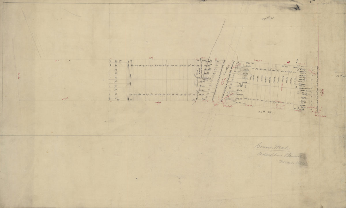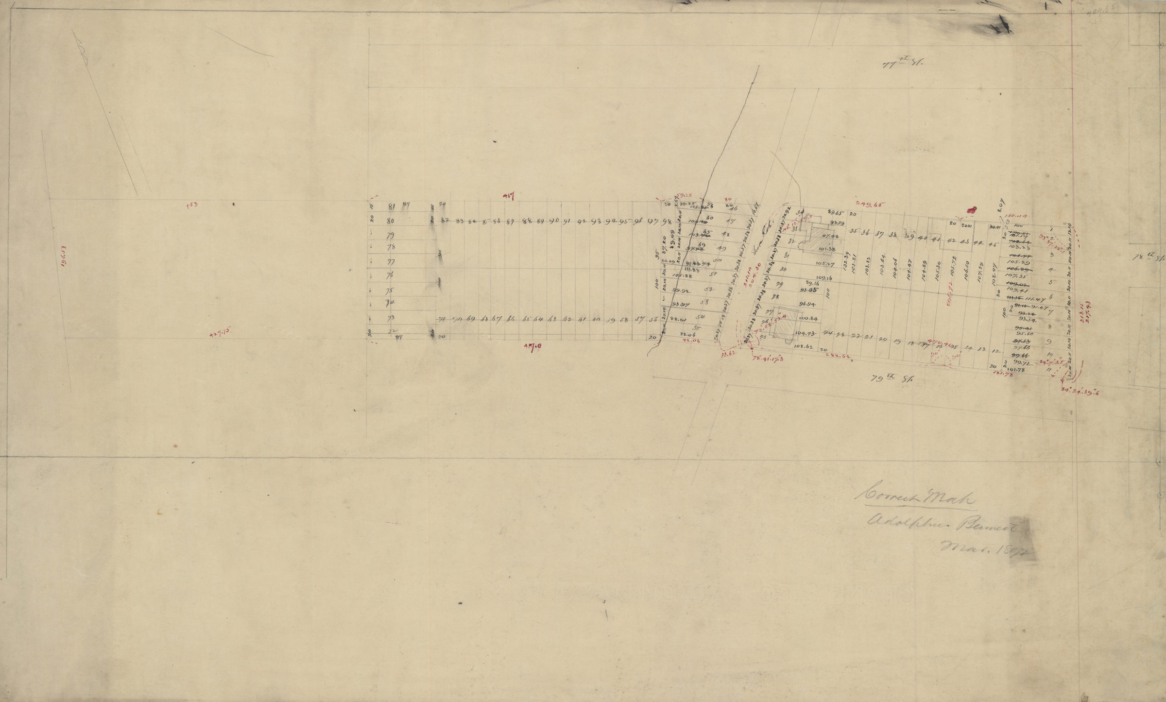
Correct map, Adolphus Bennett March 1892
Map No. Bergen-1892b.Fl
Cadastral map covering Shore Rd. between 77th St. and 79th St. (modern-day Bay Ridge). Shows property (inclduing lot numbers, buildings, and dimensions). Likely attributed to Van Brunt Bergen, based on handwriting on piece. Oriented with north to the upper left. Watermark: Crane & Co. Dalton Mass. 1889. Bond No. 29.
Map area shown
Relation
Full catalog recordSize
42 × 71 cmDownload
Low Resolution Image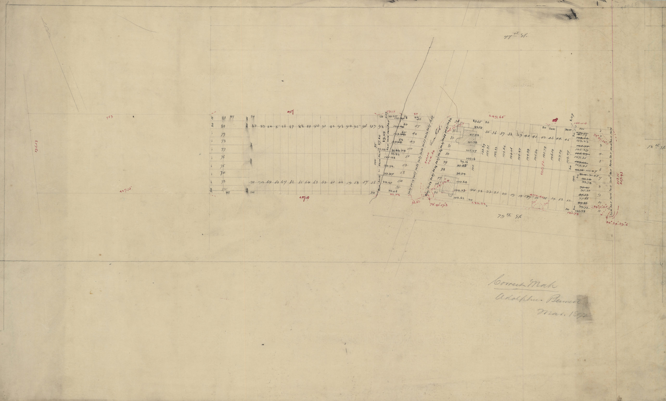
Creator
Bergen, Van Brunt,Publisher
Brooklyn Historical SocietyCitation
Correct map, Adolphus Bennett; March 1892, Map Collection, Bergen-1892b.Fl; Brooklyn Historical Society.Scale
Scale not givenLoading zoom image...