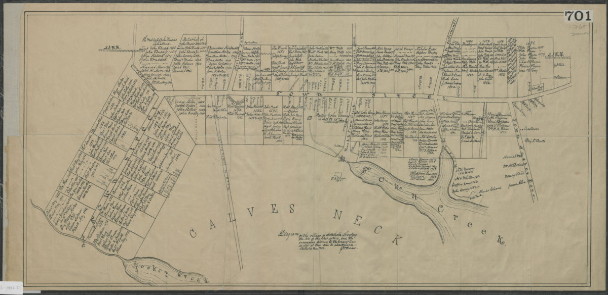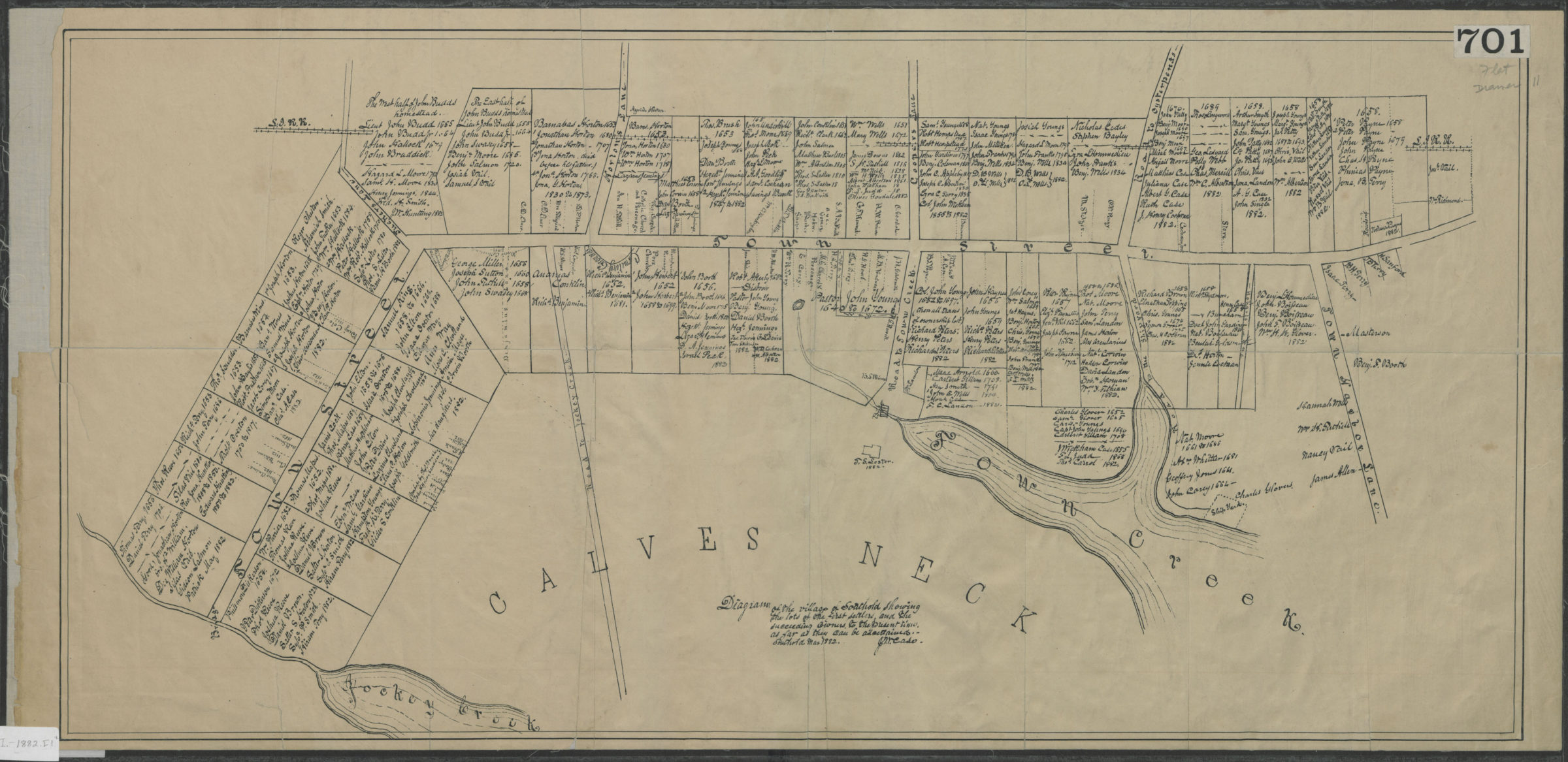
Diagram of the village of Southold showing the lots of the first settlers, and the succeeding owners, to the present times, as far as they can be ascertained: J.M. Case March 1882
Map No. L.I.-1882.Fl
Cadastral map covering Town St. east from approximately Jockey Creek to Town Creek. Shows names of property owners both contemporary (as of 1882) and historical. Oriented with north to the upper right. Includes text.
Map area shown
Relation
Full catalog recordSize
36 × 75 cmDownload
Low Resolution Image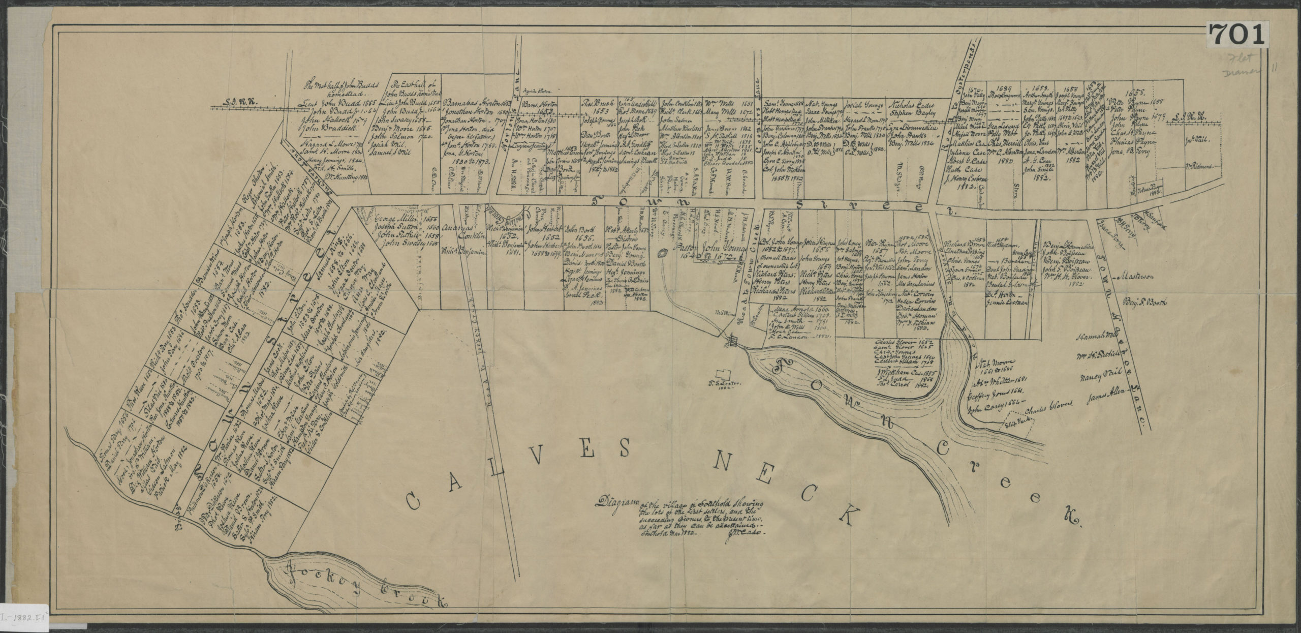
Creator
Case, J. M.,Publisher
Brooklyn Historical SocietyCitation
Diagram of the village of Southold showing the lots of the first settlers, and the succeeding owners, to the present times, as far as they can be ascertained: J.M. Case; March 1882, Map Collection, L.I.-1882.Fl; Brooklyn Historical Society.Scale
Scale not givenLoading zoom image...