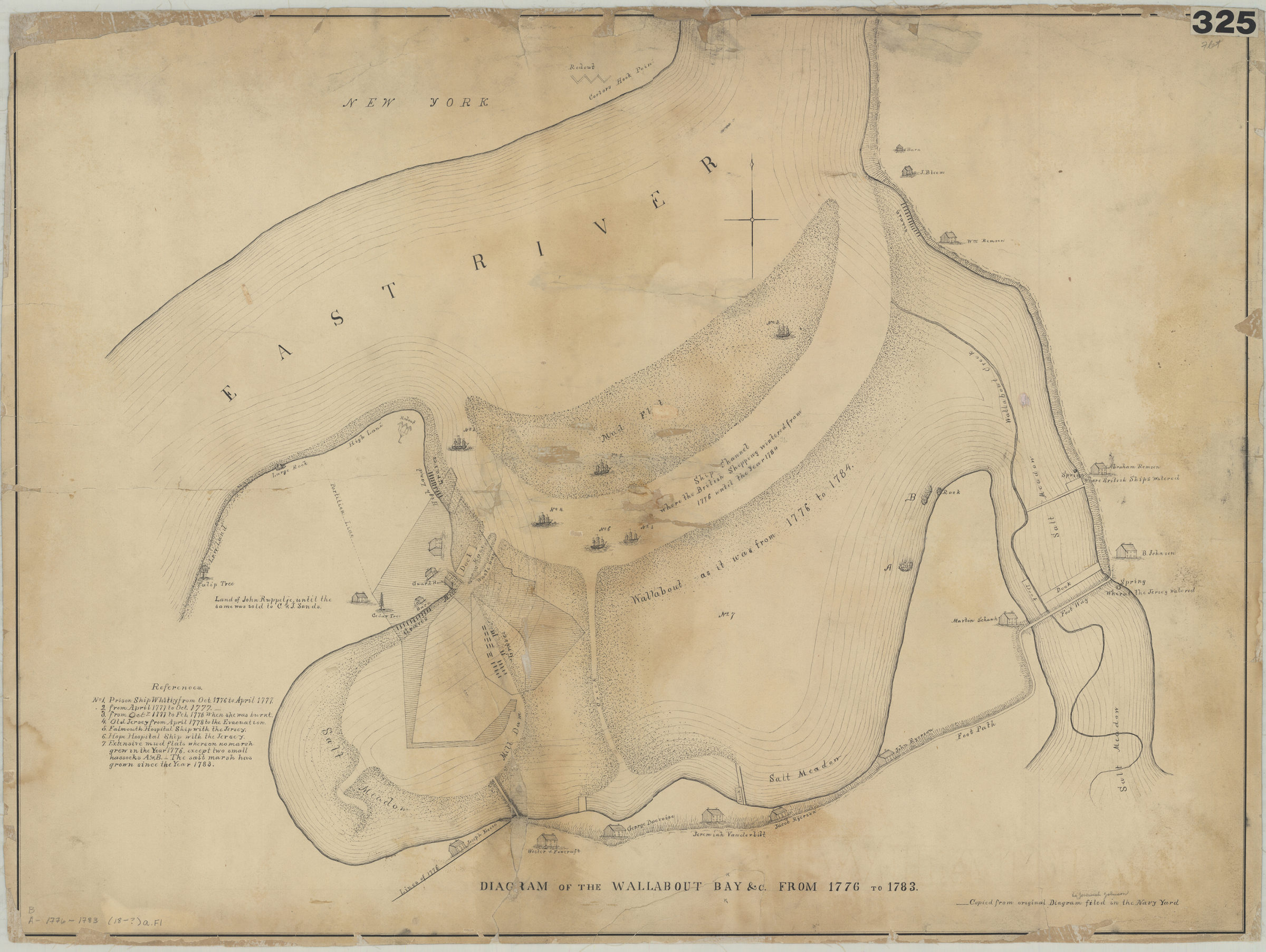
Diagram of the Wallabout Bay &c. from 1776 to 1783 [18??]
Map No. B A-1776-1783 (18--?)a.Fl
Covers area of modern-day Brooklyn Navy Yard. Shows properties and names of landowners. Relief shown by hachures. Buildings, landmarks, and ships shown pictorially. “Copied from original diagram filed in the Navy Yard.” Includes notes and index.
Subjects
Places
Map area shown
Relation
Full catalog recordSize
60 × 81 cmDownload
Low Resolution Image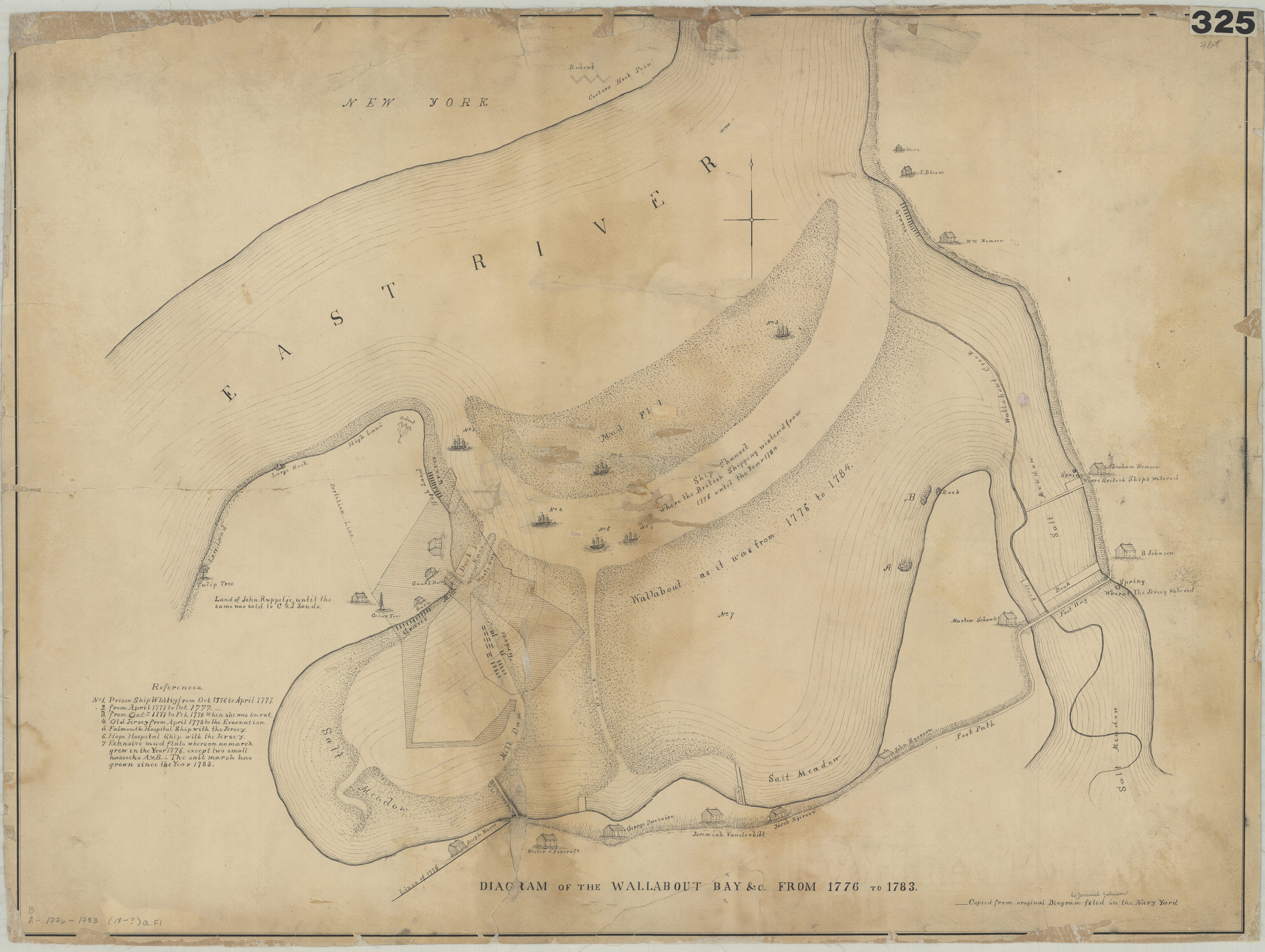
Creator
Publisher
Brooklyn Historical SocietyCitation
Diagram of the Wallabout Bay &c. from 1776 to 1783; [18??], Map Collection, B A-1776-1783 (18--?)a.Fl; Brooklyn Historical Society.Scale
Scale not givenLoading zoom image... 