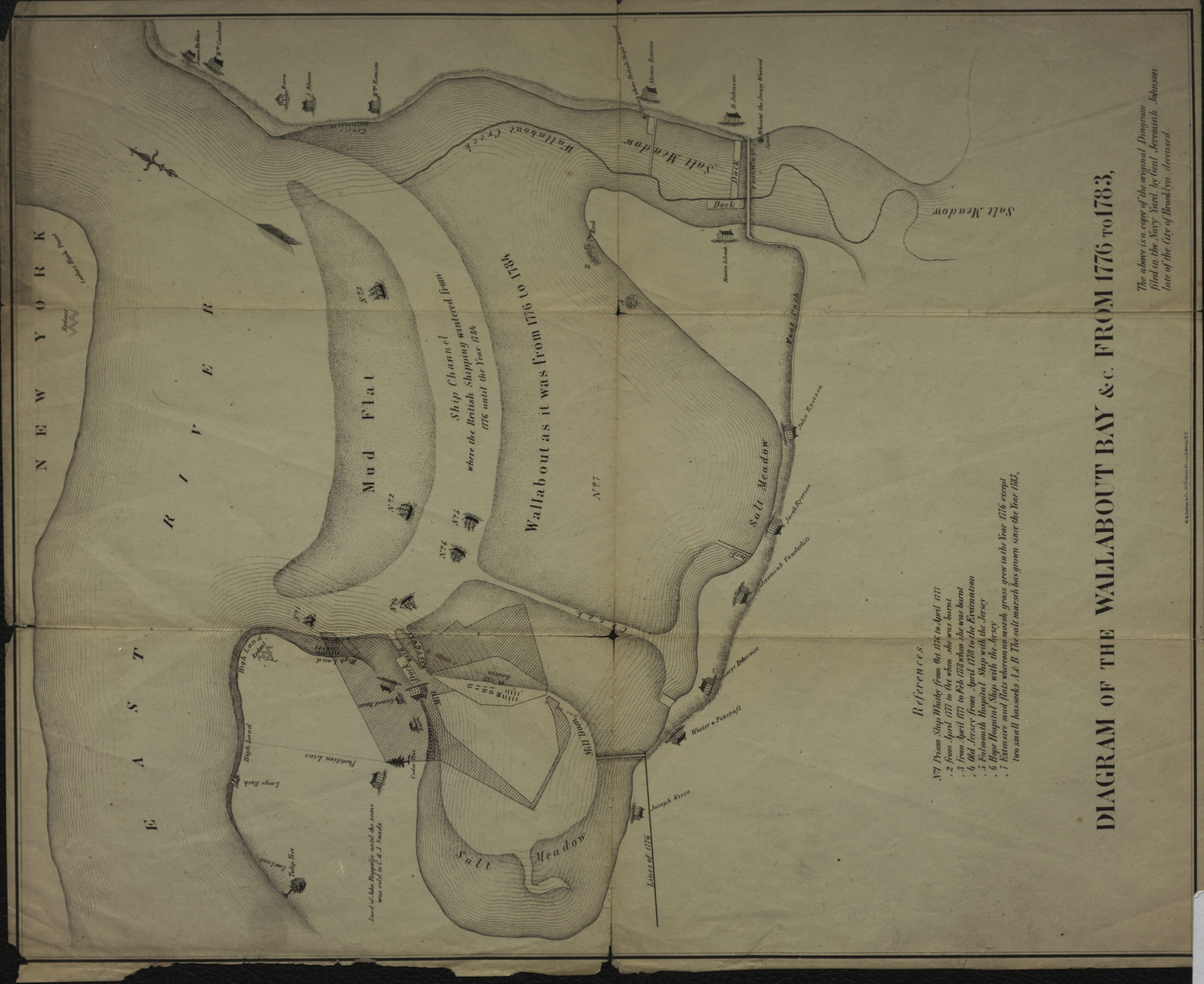
Diagram of the Wallabout Bay &c. from 1776 to 1783 [18??]
Map No. B A-1776-1783 (18--?).Fl
Covers area of present-day Brooklyn Navy Yard. Shows property owners. Relief shown by hachures structures and ships shown pictorially. “The above is a copy of the original diagram filed in the Navy Yard by Genl. Jeremiah Johnson, late of the city of Brooklyn, deceased.” Oriented with north to the upper right. Includes index for prison ships and mudflats.
Subjects
Places
Map area shown
Relation
Full catalog recordSize
40 × 31 cmDownload
Low Resolution Image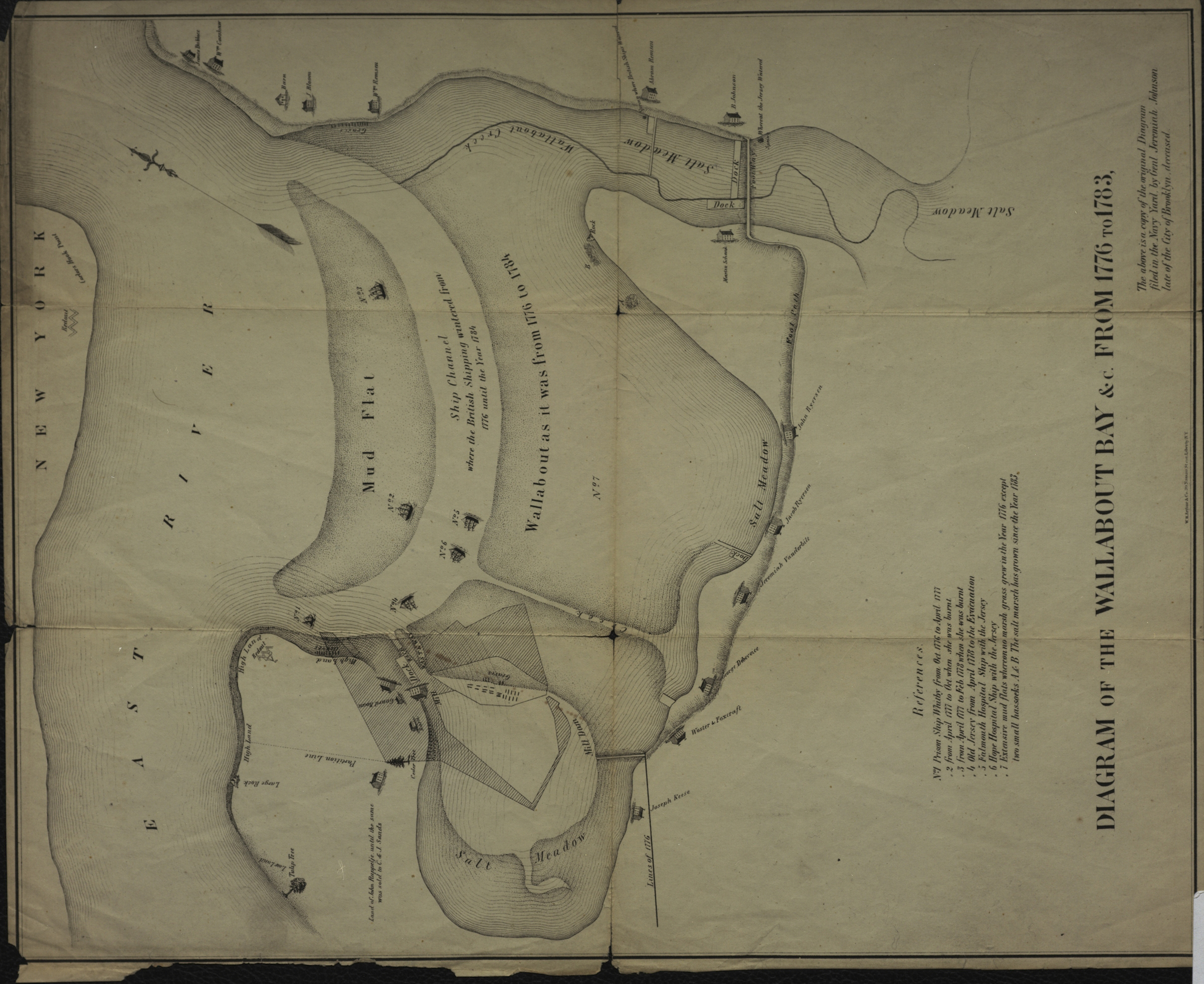
Creator
W.H. Arthur & Co.,Publisher
Brooklyn Historical SocietyCitation
Diagram of the Wallabout Bay &c. from 1776 to 1783; [18??], Map Collection, B A-1776-1783 (18--?).Fl; Brooklyn Historical Society.Scale
Scale not givenLoading zoom image... 