Discover Flatiron map: Flatiron 23rd Street Partnership [2011]
Map No. M-2011.Fl
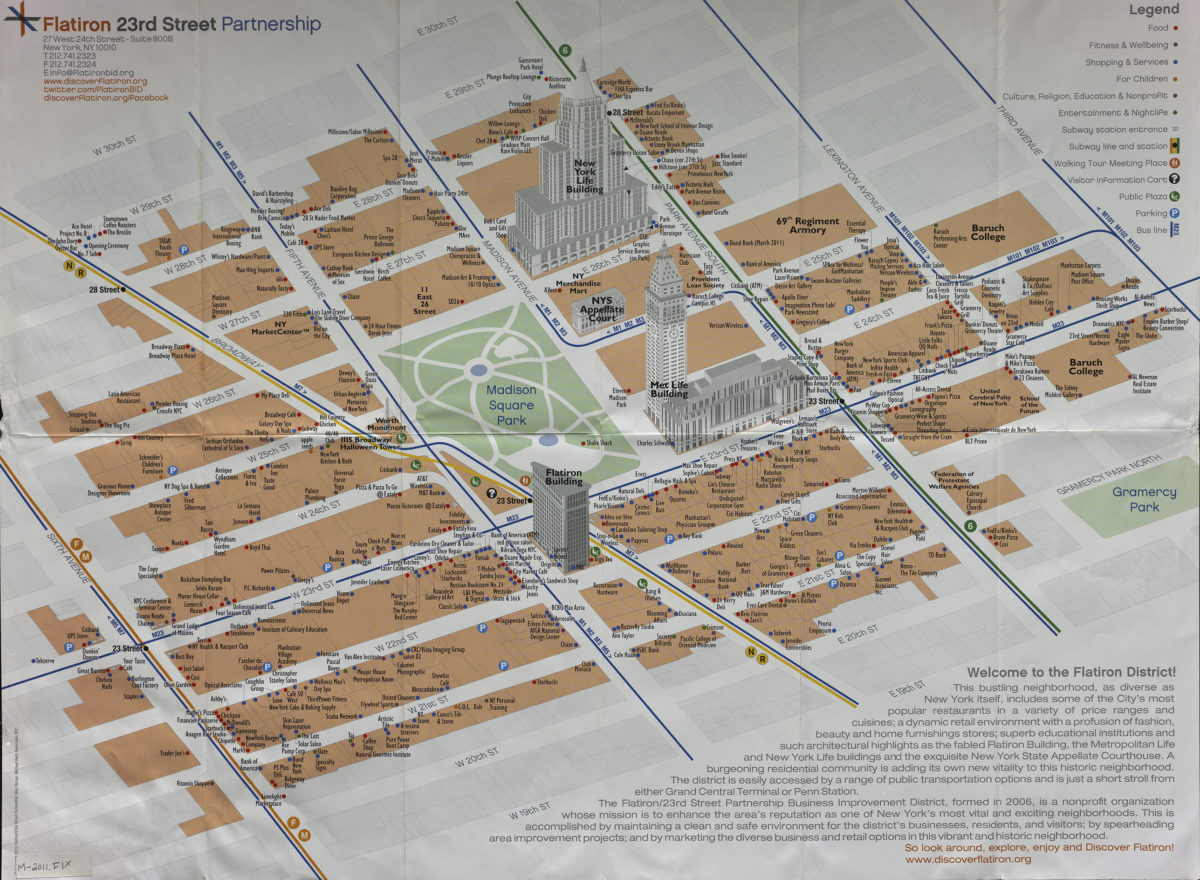
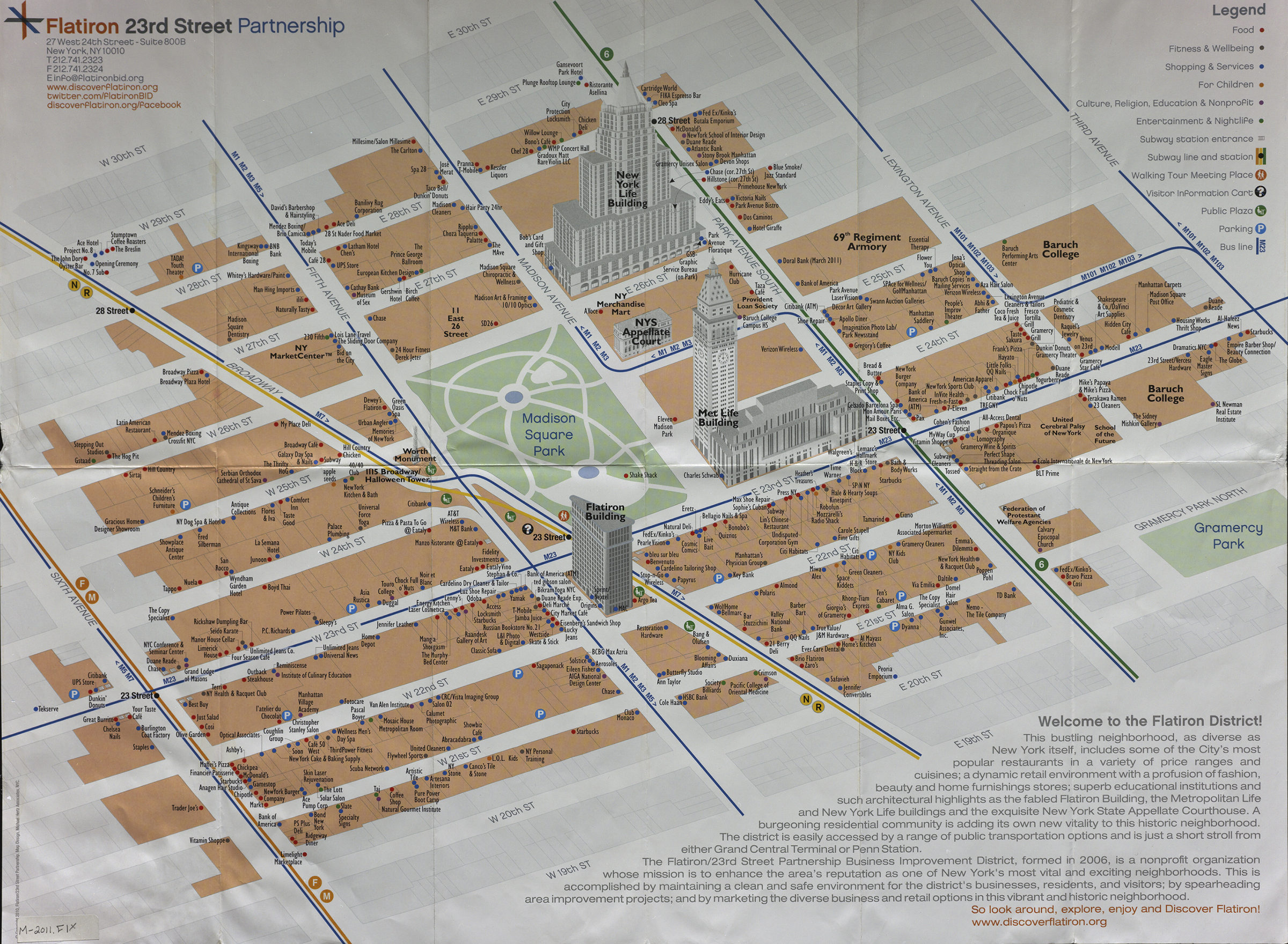
Covers area between 6th Avenue and 3rd Avenue, and between 19th Street and 30th Street in Manhattan. Shows selected buildings pictorially. Panel title. “Updated for 2011.” Includes text. Classified index to retail businesses and services, advertisements, and Manhattan subway map on verso.
Map area shown
Genre
Tourist mapsRelation
Full catalog recordSize
46 × 61 cmDownload
Low Resolution Image
Creator
Flatiron 23rd Street Partnership,Publisher
Brooklyn Historical SocietyCitation
Discover Flatiron map: Flatiron 23rd Street Partnership; [2011], Map Collection, M-2011.Fl; Brooklyn Historical Society.Scale
Scale not givenLoading zoom image...