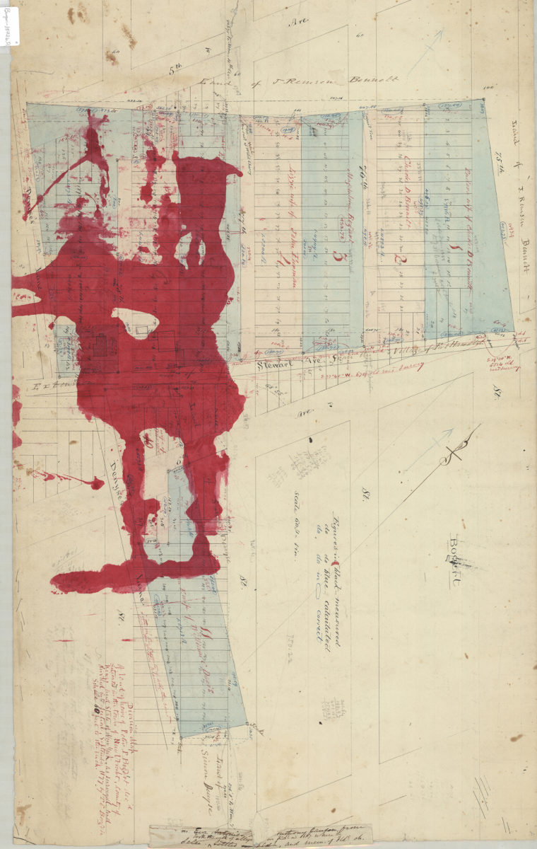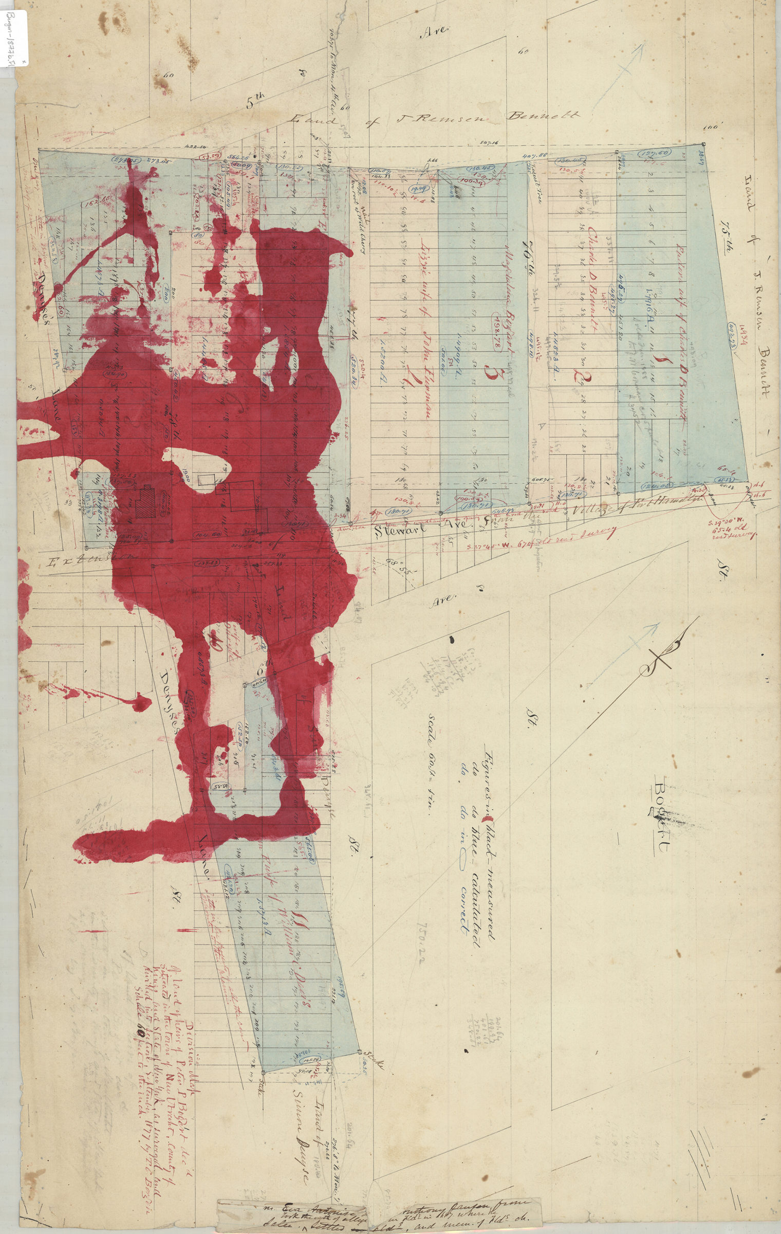

Division map of land of Peter P. Bogert, decd., situated in the town of New Utrecht, county of Kings, and state of New York, as surveyed and divided into sections: by T.G. Bergen Sept. 1877
Map No. Bergen-1877b.Fl
Cadastral map covering area roughly bounded by 5th Ave., Denyse’s Ln., 7th Ave. and 75th St. (modern-day Bay Ridge). Shows property (including lots, dimensions and buildings), and names of landowners. Oriented with north to the upper left. Includes key. On verso: Pencil draft of portion of main map.
Map area shown
Relation
Full catalog recordSize
47 × 77 cmDownload
Low Resolution Image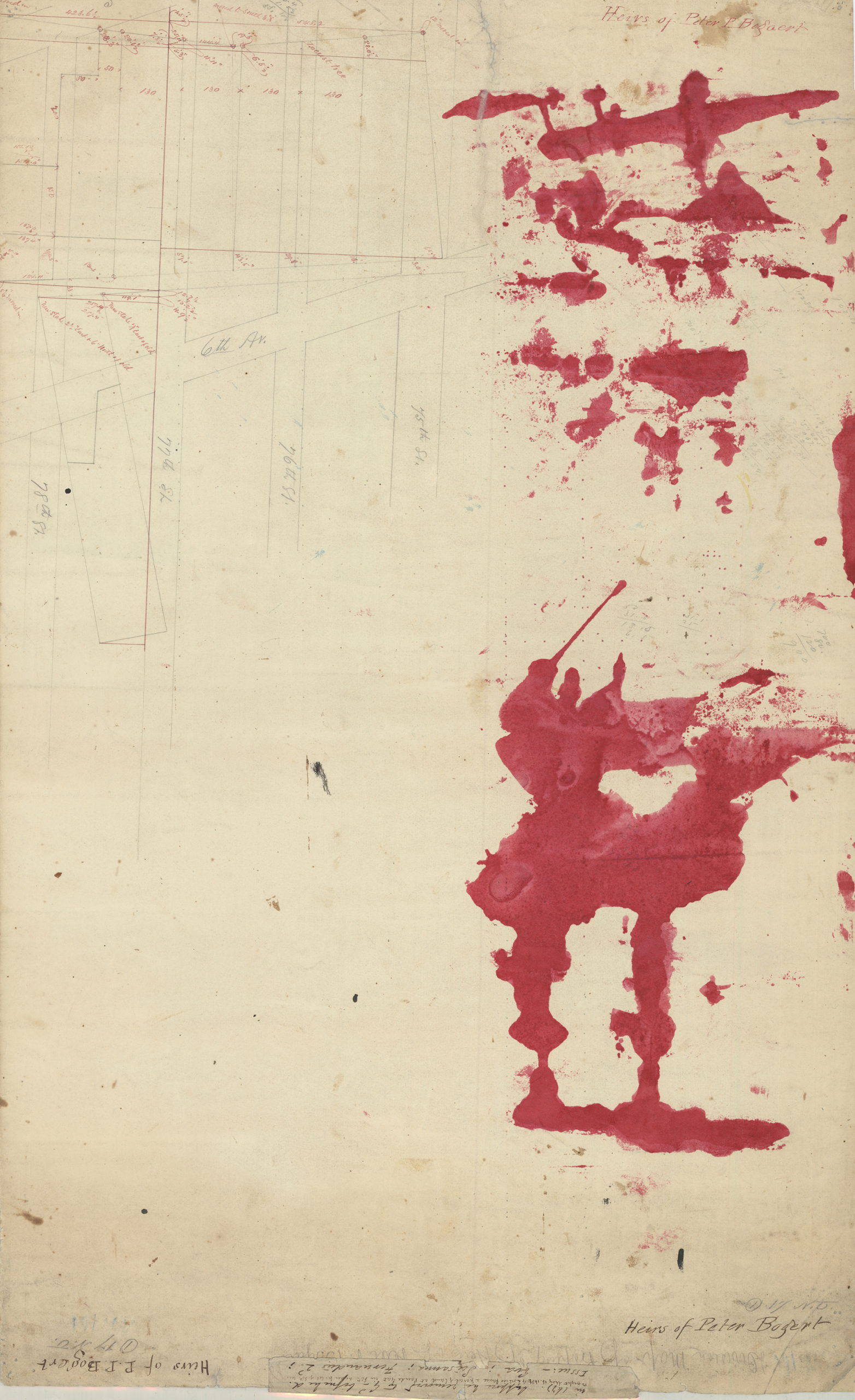
Creator
Bergen, Teunis G.,Publisher
Brooklyn Historical SocietyCitation
Division map of land of Peter P. Bogert, decd., situated in the town of New Utrecht, county of Kings, and state of New York, as surveyed and divided into sections: by T.G. Bergen; Sept. 1877, Map Collection, Bergen-1877b.Fl; Brooklyn Historical Society.Scale
Scale [1:720] 1 in to 60Loading zoom image...