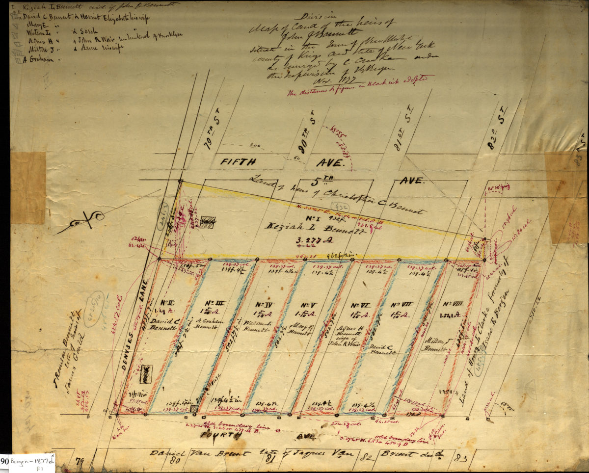
Division map of land of the heirs of John J. Bennett situated in the Town of New Utrecht, County of Kings in the State of New York: as surveyed by C. [text illegible] under the supervision of T. G. Bergen, Nov. 1877 November 1877
Map No. Bergen-1877d.Fl
Cadastral map covering area bounded by Fifth Avenue, 83rd Street, Fourth Avenue and Denyses Lane (modern-day Bay Ridge). Shows property, lot numbers, dimensions and names of landowners. Includes notes. “The distances & figures in black ink adopted.” Oriented with north to the lower left.
Map area shown
Relation
Full catalog recordSize
36 × 44 cmDownload
Low Resolution Image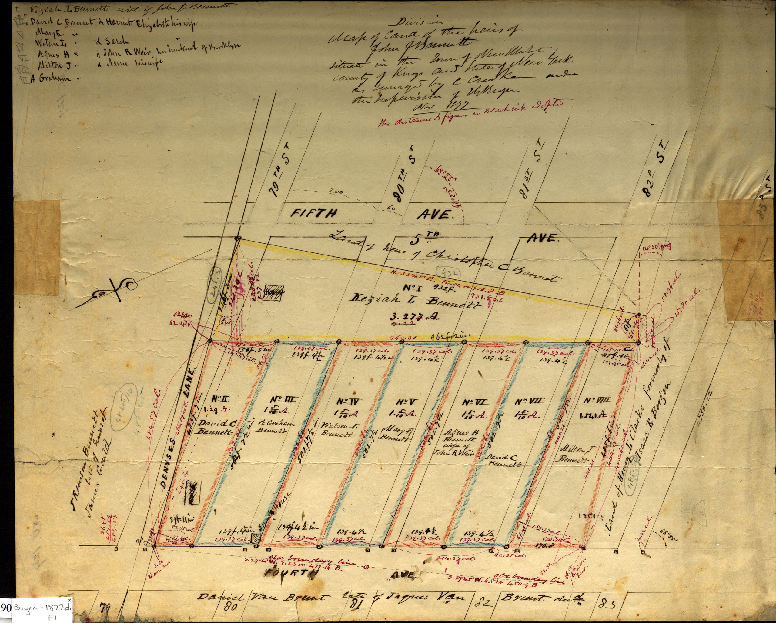
Creator
Bergen, Teunis G.,Publisher
Brooklyn Historical SocietyCitation
Division map of land of the heirs of John J. Bennett situated in the Town of New Utrecht, County of Kings in the State of New York: as surveyed by C. [text illegible] under the supervision of T. G. Bergen, Nov. 1877; November 1877, Map Collection, Bergen-1877d.Fl; Brooklyn Historical Society.Scale
Scale not givenLoading zoom image...