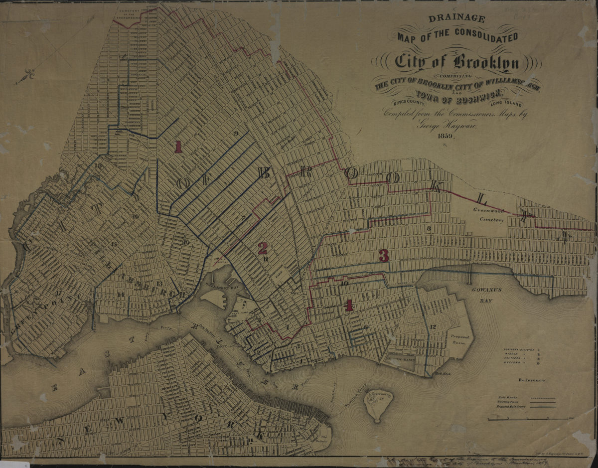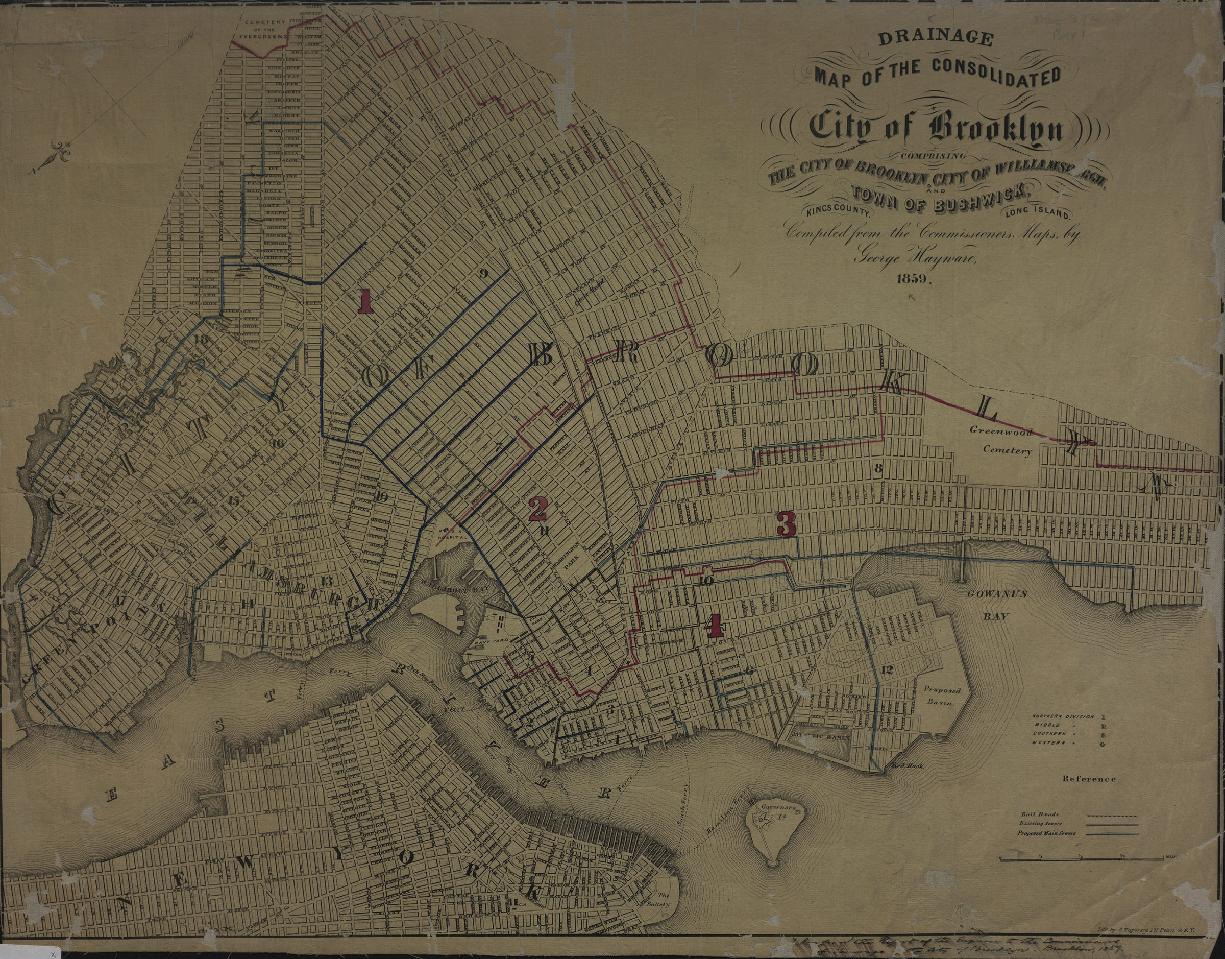
Drainage map of the consolidated city of Brooklyn: comprising the city of Brooklyn, city of Williamsburgh and town of Bushwick, Kings County, Long Island: compiled from the commissioners maps by George Hayward ; lith. by G. Hayward 1859
Map No. B A-1859.Fl
Sewerage map. Covers modern Brooklyn south to 60th Street and east to the Cemetery of the Evergreens and Greenwood Cemetery. Shows existing and proposed sewers, ward and town boundaries, railroads. Oriented with north to lower left of sheet. Includes key. NYHS copy soiled, dissected, cropped and mounted on cloth. Encapsultated. M008357
Map area shown
Genre
Public utility mapsRelation
Full catalog recordSize
41 × 53 cmDownload
Low Resolution Image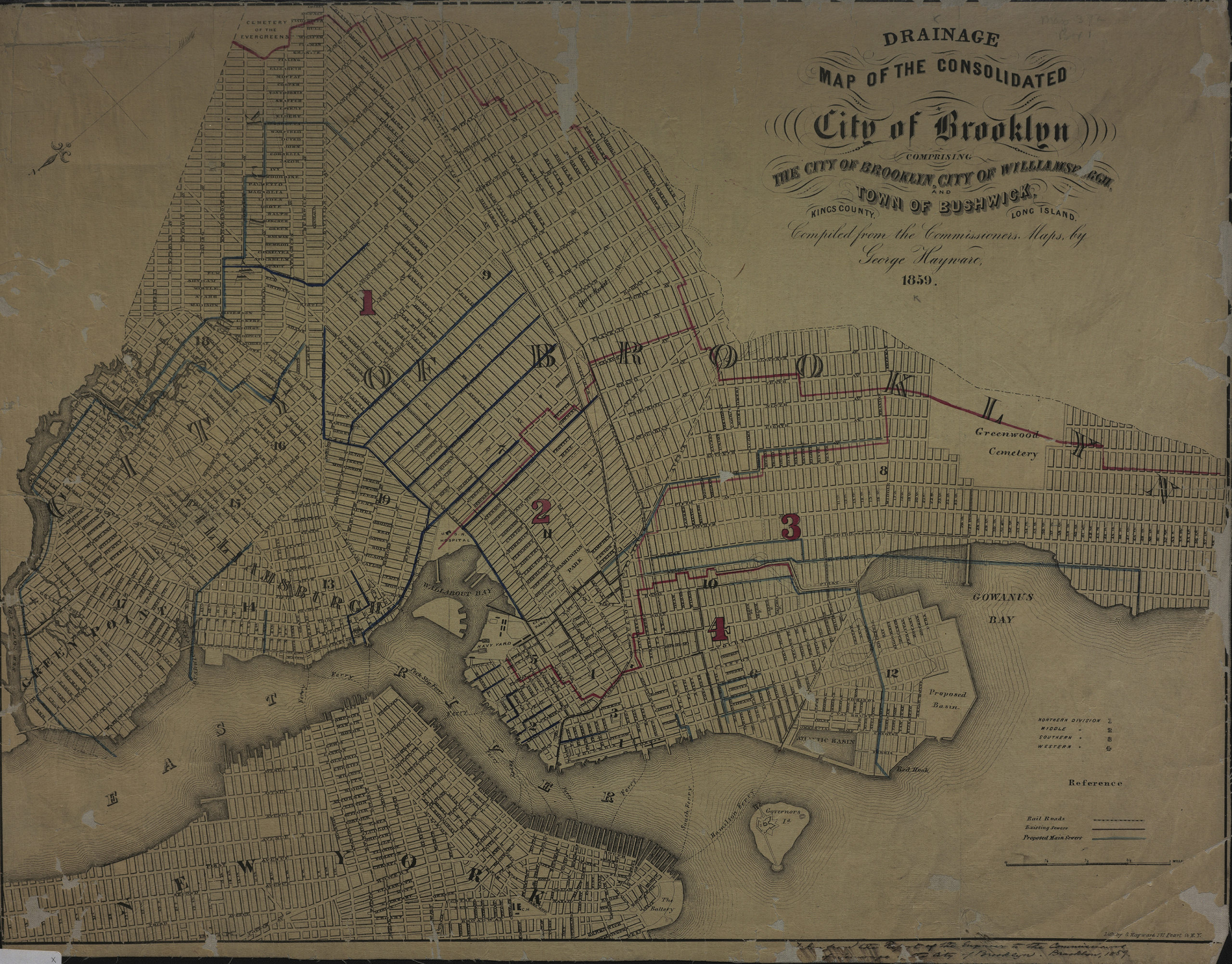
Creator
Hayward, George,Publisher
Brooklyn Historical SocietyCitation
Drainage map of the consolidated city of Brooklyn: comprising the city of Brooklyn, city of Williamsburgh and town of Bushwick, Kings County, Long Island: compiled from the commissioners maps by George Hayward ; lith. by G. Hayward; 1859, Map Collection, B A-1859.Fl; Brooklyn Historical Society.Scale
Scale [ca. 1:22,500]Loading zoom image...