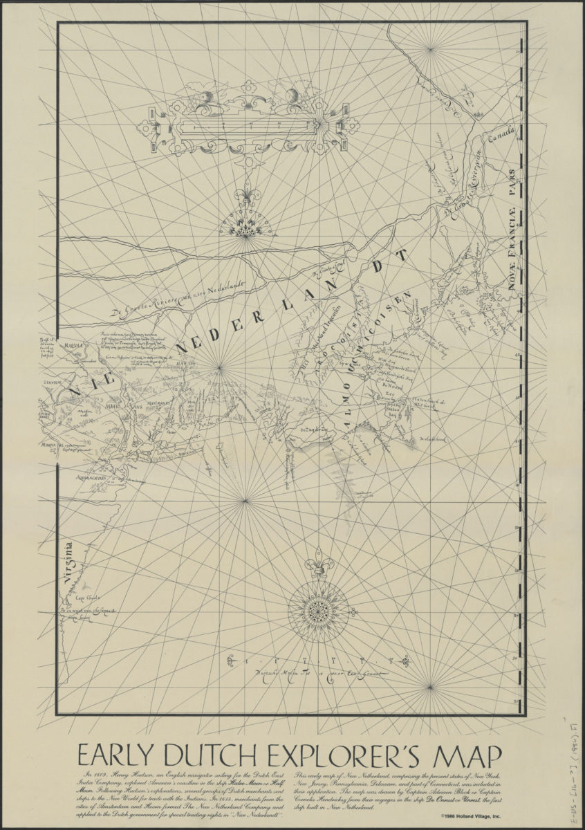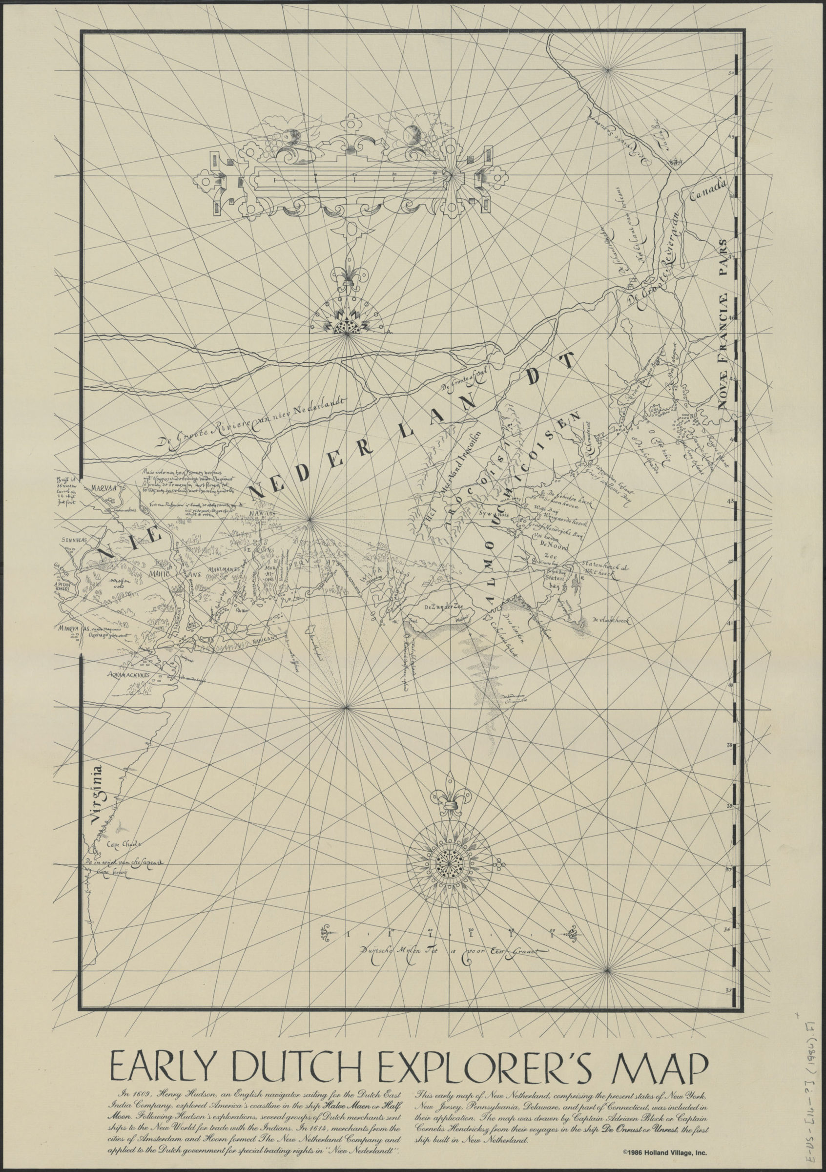
Early Dutch explorer’s map [ca. 1968]
Facsimile with non-original title and text added at bottom. Focuses on New Netherland at the mouth of the Hudson River, but includes the east coast of North America from the Virginia Capes to Québec. Shows Native American territories in New Netherland. Relief shown pictorially. Shows rhumb lines. “In 1614, merchants from the cities of Amsterdam and Hoorn formed the New Netherland Company and applied to the Dutch government for special trading rights in Nieu Nederland. This early map of New Netherland, comprising the present states of New York, New Jersey, Pennsylvania, Delaware, and part of Connecticut, was included in their application. The map was drawn by Captain Adriaen Block or Captain Cornelis Hendricksz …” Includes text.
Map area shown
Genre
Early mapsRelation
Full catalog recordSize
64 × 47 cmDownload
Low Resolution Image
Creator
Block, Adriaen; Heynrickz, Cornelis; Holland Village, Inc.,Publisher
Brooklyn Historical SocietyCitation
Early Dutch explorer’s map; [ca. 1968], Map Collection, E-US-[16--?] (1986).Fl; Brooklyn Historical Society.Scale
Scale not given