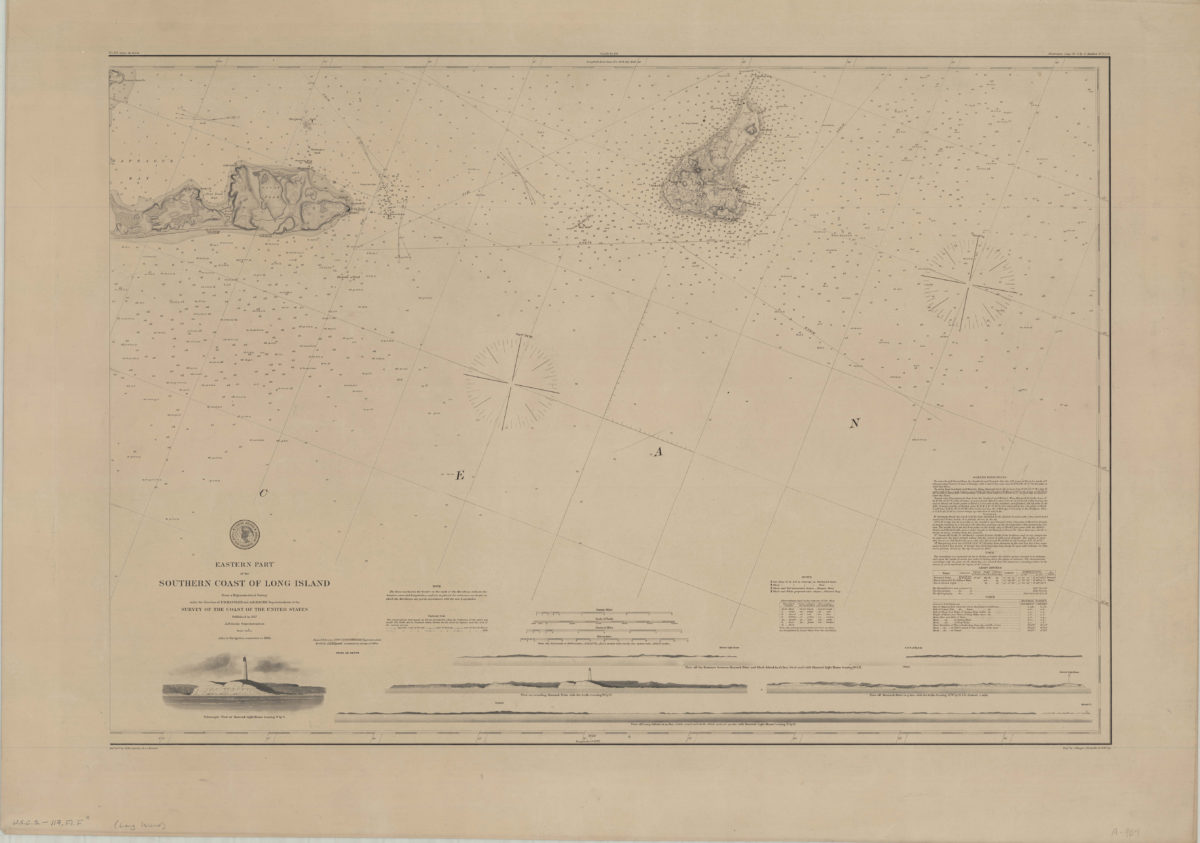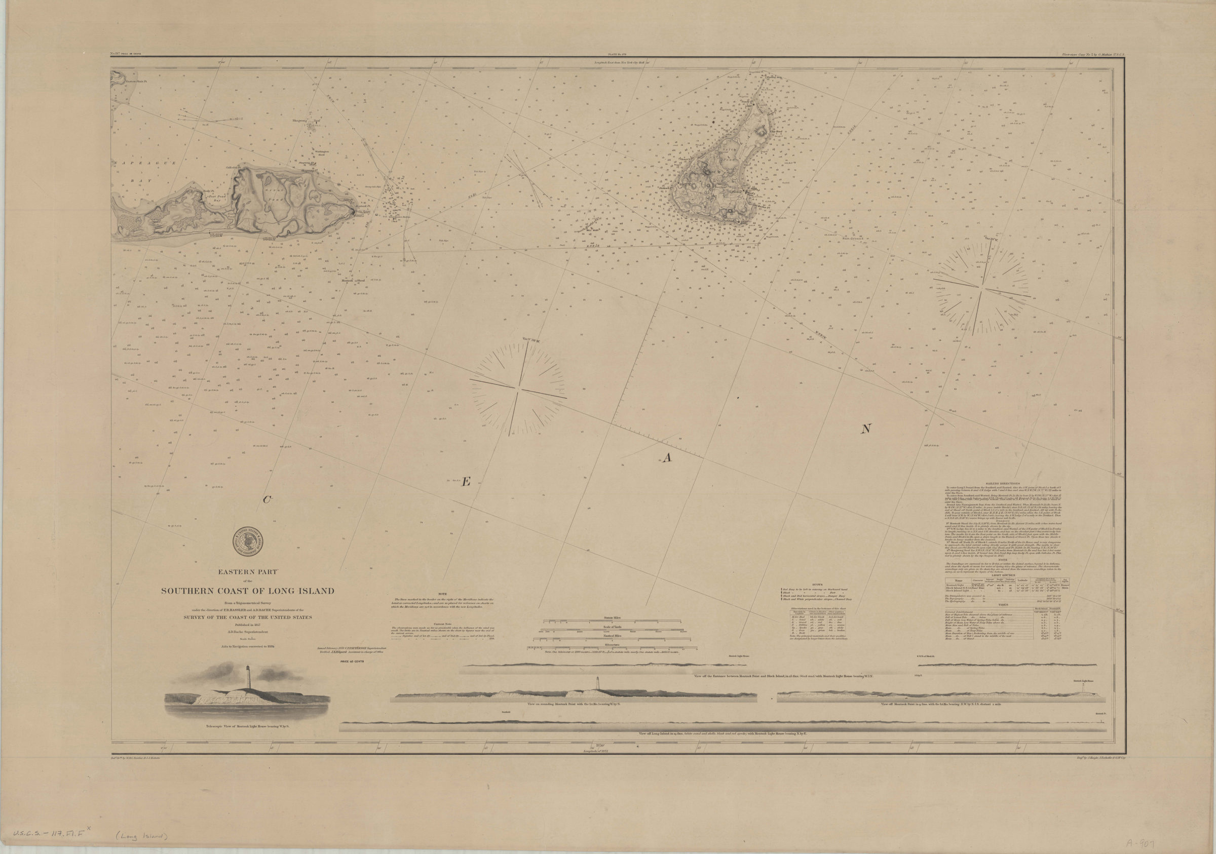
Eastern part of the southern coast of Long Island: from a trigonometrical survey under the direction of F.R. Hassler and A.D. Bache superintendent of the Survey of the Coast of the United States 1878
Nautical chart covering Long Island east from Eastern Plain Point, and Block Island. Shows buoys, lights, sea floor cover, and life saving stations. Relief shown by hachures and shading. Depths shown by gradient tints and soundings. Oriented with north to the upper right. “Redd. Drng. by W.M.C. Fairfax & J.J. Ricketts”–Lower left margin. “Verified J.E. Hilgard Assistant in charge of Office.” “Issued February 1878 C.P. Patterson Superintendent.” “Aids to navigation corrected to 1885.” Includes seal, notes, keys, sailing information, tidal table, table of lighthouses, 4 coastal profiles, and a view of Montauk Light House. Coastal profiles: View off the entrance between Montauk Point and Block Island, in 25 fms. (black mud) with Montauk Light House bearing W. 1/2 N. — View on rounding Montauk Point with the Lt. Ho. bearing W. by S. — View off Montauk Point in 9 fms. with the Lt. Ho. bearing N.W. by N. 1/2 N. distant 1 mile — View off Long Island in 19 fms. (white sand and shells, black and red specks) with Montauk Light House bearing N. by E. “No. 117”–Upper left margin. “Plate No. 979”–Upper center margin. “Electrotype copy No. 2 by G. Mathiot U.S.C.S.”–Upper right margin.
Places
Map area shown
Genre
Nautical chartsRelation
Full catalog recordSize
60 × 88 cmDownload
Low Resolution Image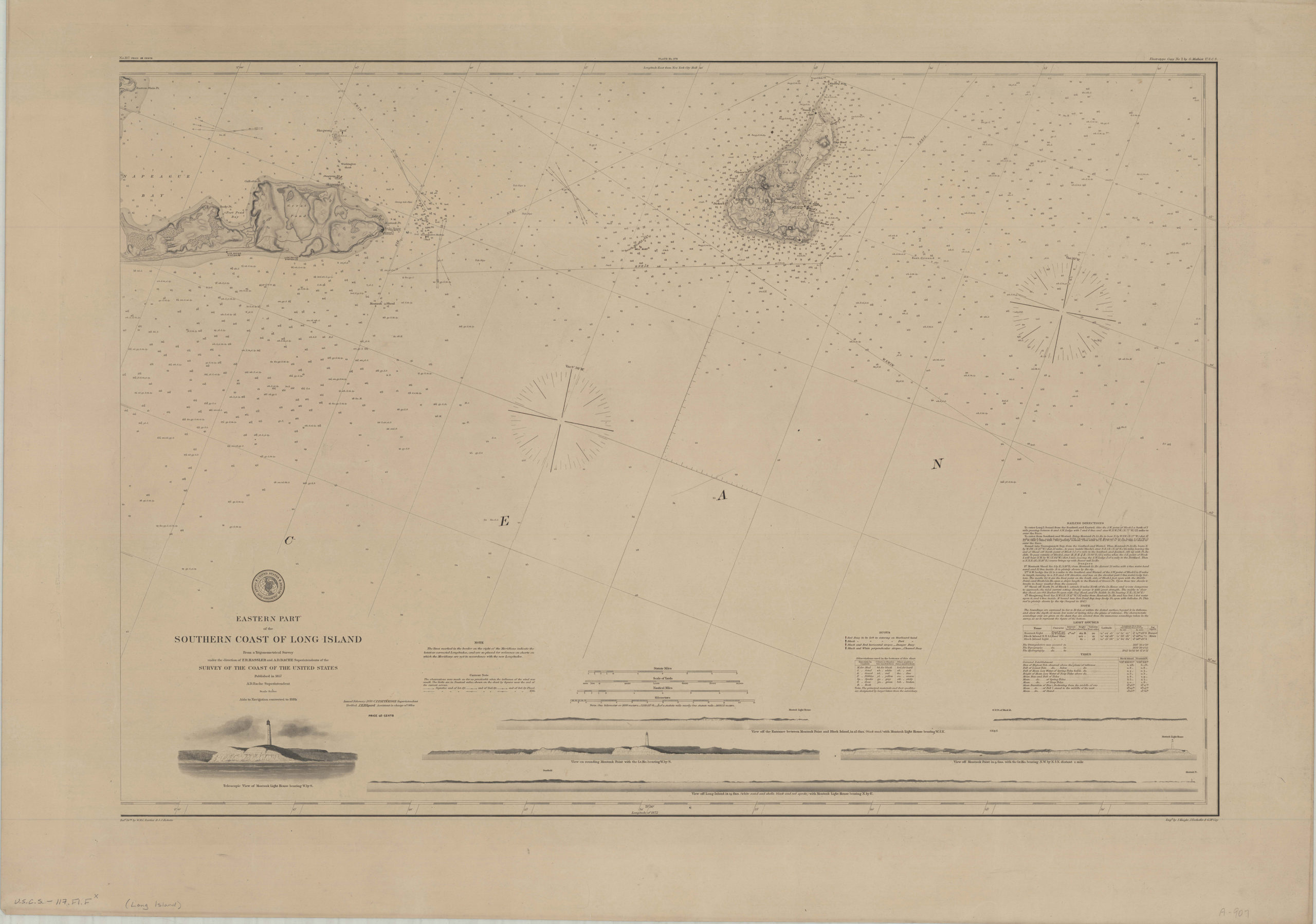
Creator
U.S. Coast and Geodetic Survey,Publisher
Brooklyn Historical SocietyCitation
Eastern part of the southern coast of Long Island: from a trigonometrical survey under the direction of F.R. Hassler and A.D. Bache superintendent of the Survey of the Coast of the United States; 1878, Map Collection, U.S.C.S.-117.Fl.F; Brooklyn Historical Society.Scale
Scale 1:80,000