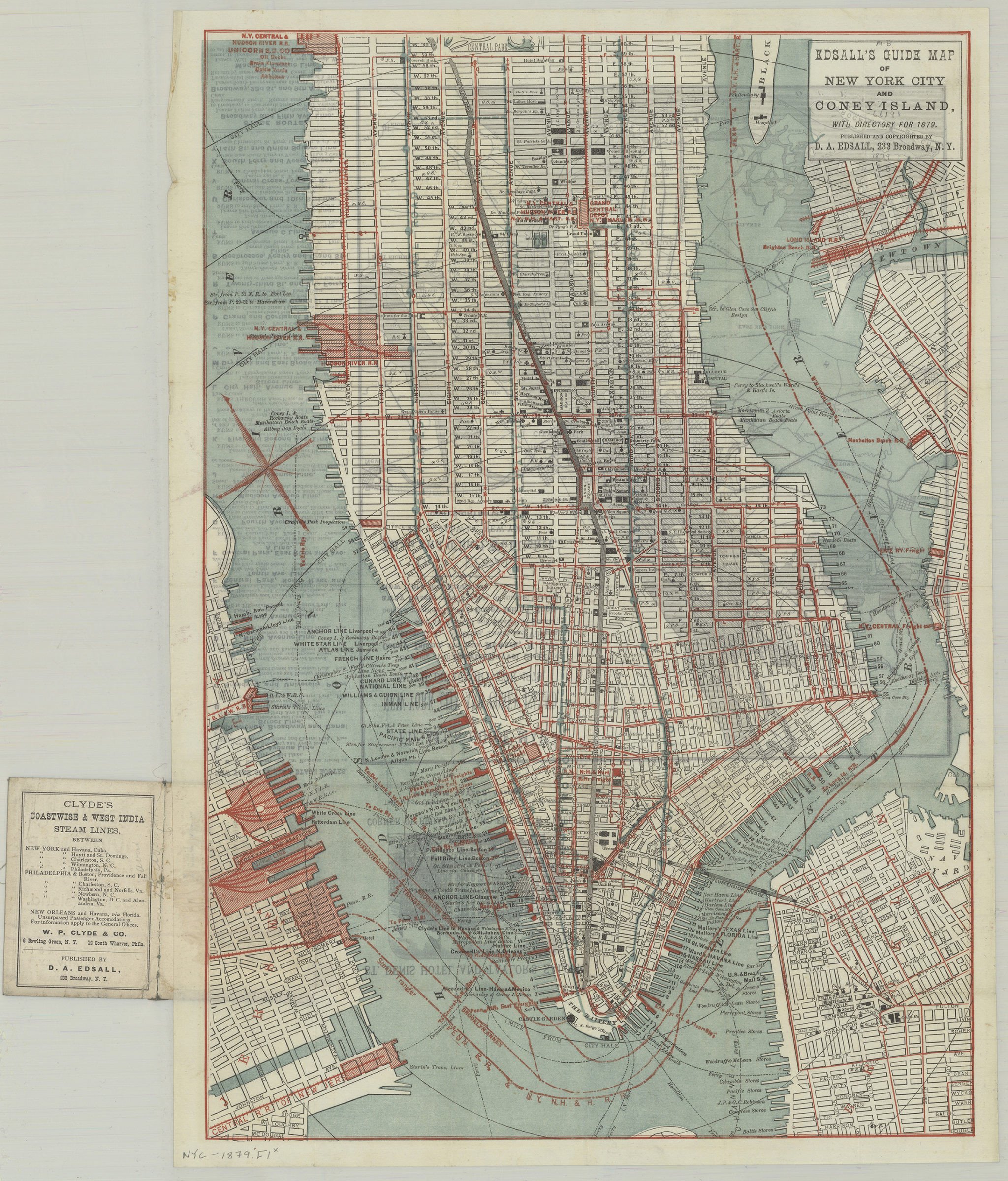
Edsall’s guide map of New York City and Coney Island: with directory for 1879 1879
Covers Manhattan north to 60th St. also covers portions of Brooklyn Heights, Williamsburg, Greenpoint, southern Queens, Blackwells Island, and Jersey City. Shows slips (including names of docking lines), piers, stores, railroads, ferry lines, and distances from City Hall. Main map does not show Coney Island. Oriented with north to the upper left. Cover title in gilt on green fabric cover. On cover: Advertisements. On verso: Ill., index to New York City car and stage routes, text, and Edsall’s guide map of New York City and Coney Island, with directory for 1879, showing from SpuytenDuyvel Creek to Coney Island, and from Newark, N.J. to Jamaica, L.I., all cities, towns and villages, together with all railroad and steamboat routes, being a complete guide to Coney Island, Rockaway Beach, and all points of interest around New York and Brooklyn.
Map area shown
Genre
Tourist mapsRelation
Full catalog recordSize
48 × 33 cmDownload
Low Resolution Image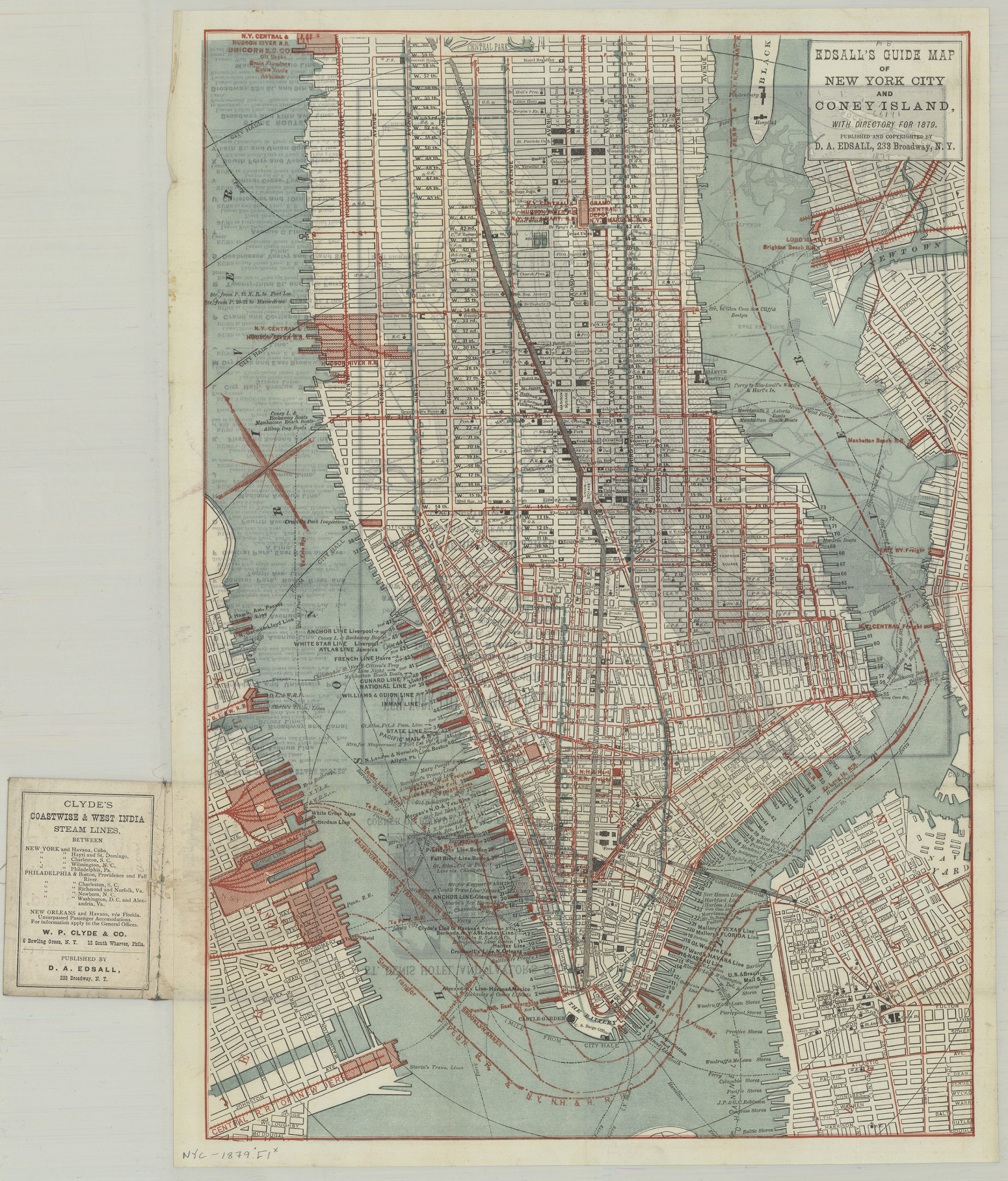
Creator
Edsall, D. A.,Publisher
Brooklyn Historical SocietyCitation
Edsall’s guide map of New York City and Coney Island: with directory for 1879; 1879, Map Collection, NYC-1879.Fl; Brooklyn Historical Society.Scale
Scale not given