
#ERROR! [ca. 2011]
Map No. NYC-2011a.Fl
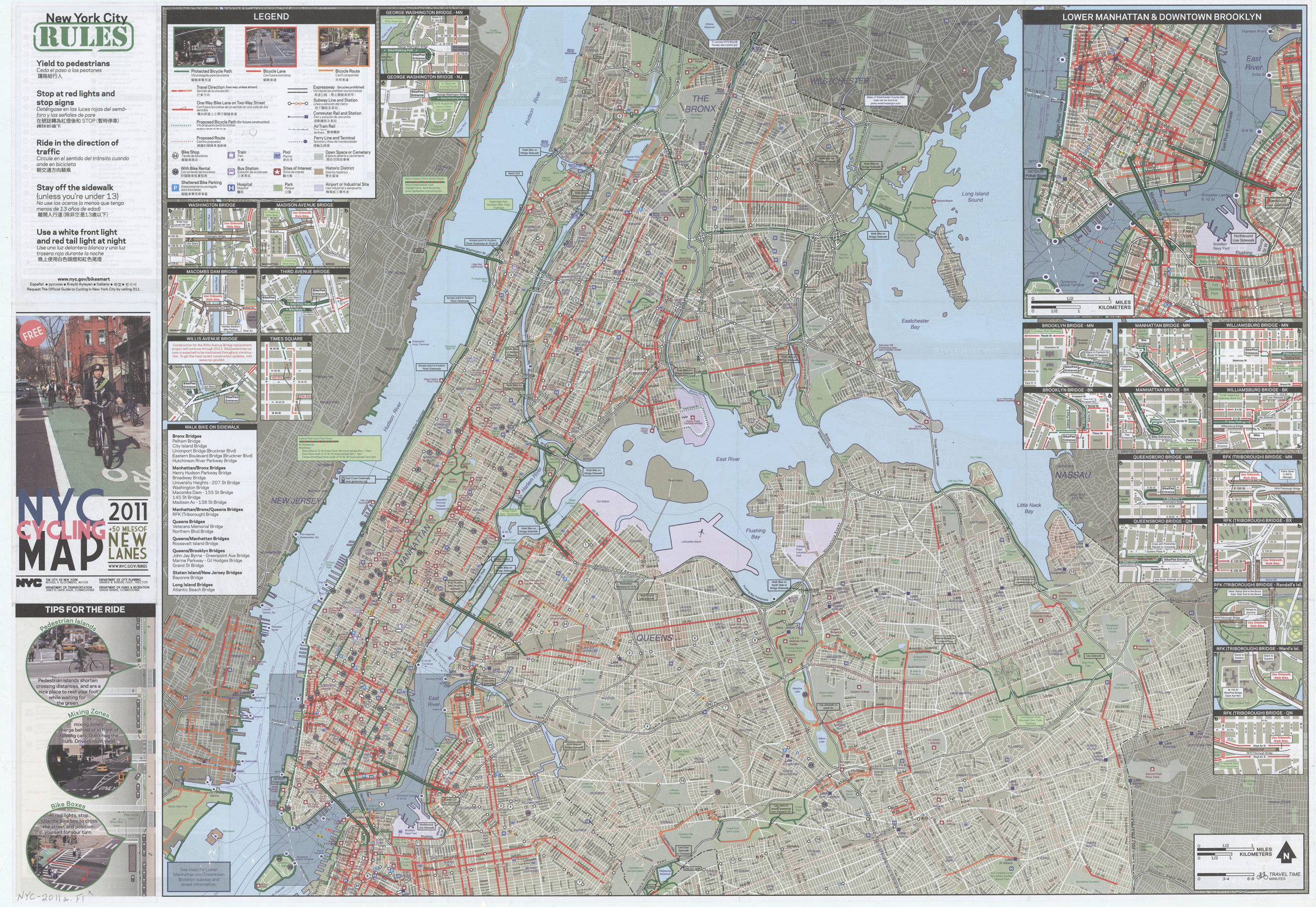
Shows bike paths, lanes, and routes, existing and proposed. Also shows bike shops, parks, transit facilities, hospitals, and other places of interest. Panel title. “Updated versions of the Cycling map and information about current projects can be found at: nyc.gov/planning or nyc.gov/dot.” Includes notes and col. ill. 24 insets of bridges and bridge approaches, Times Square inset, 2 insets of ferry connections, Prospect Park circle inset, and insets of Staten Island and lower Manhattan with downtown Brooklyn col. ill., diagrams, and text regarding bike laws and safety information about taking bikes on mass transit and index/directory to bike shops.
Map area shown
Genre
Road mapsRelation
Full catalog recordSize
62 × 89 cmDownload
Low Resolution Image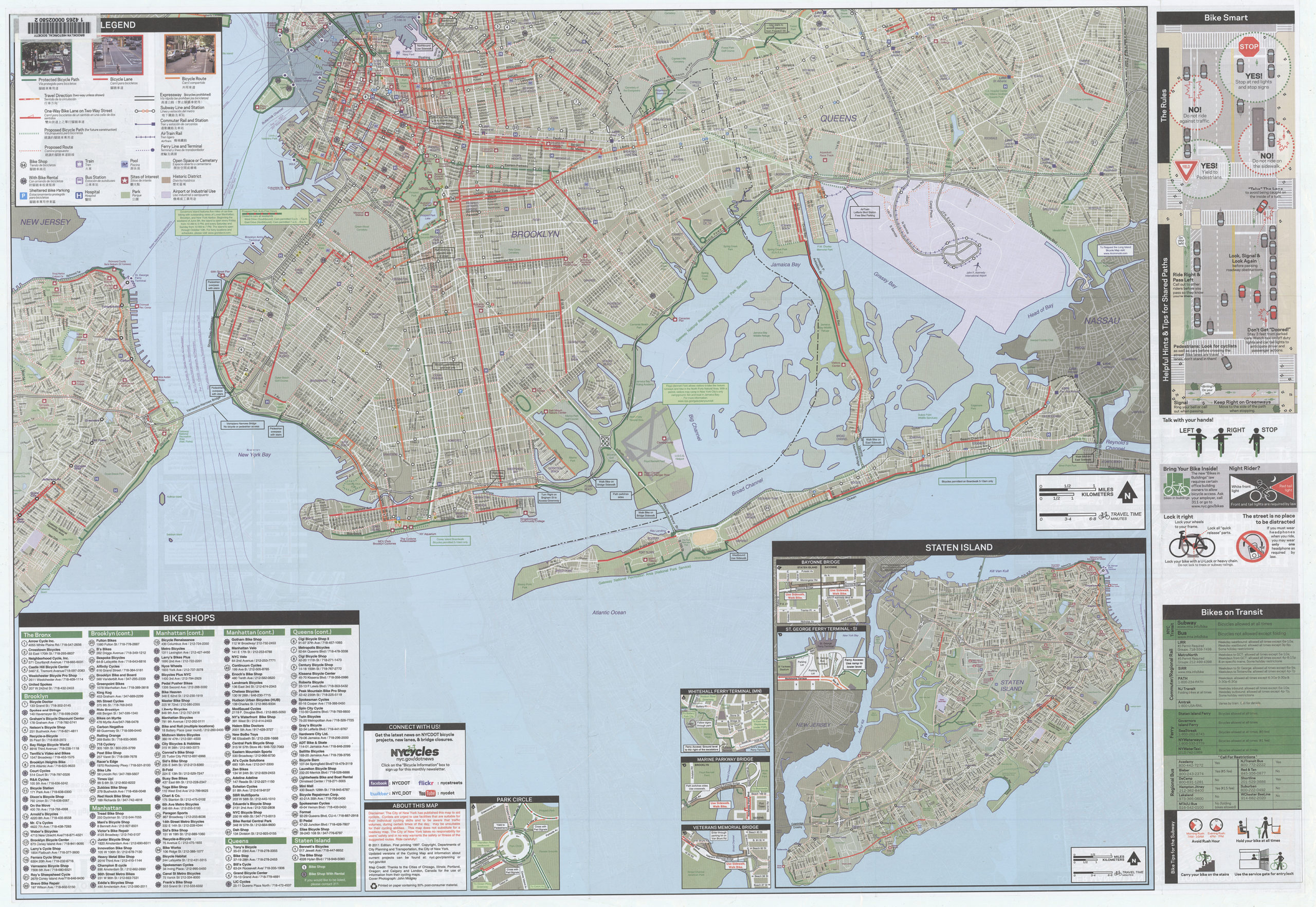
Creator
New York (N.Y.).; Department of Transportation,Publisher
Brooklyn Historical SocietyCitation
#ERROR!; [ca. 2011], Map Collection, NYC-2011a.Fl; Brooklyn Historical Society.Scale
Scale [ca. 1:41,500]Loading zoom image... 