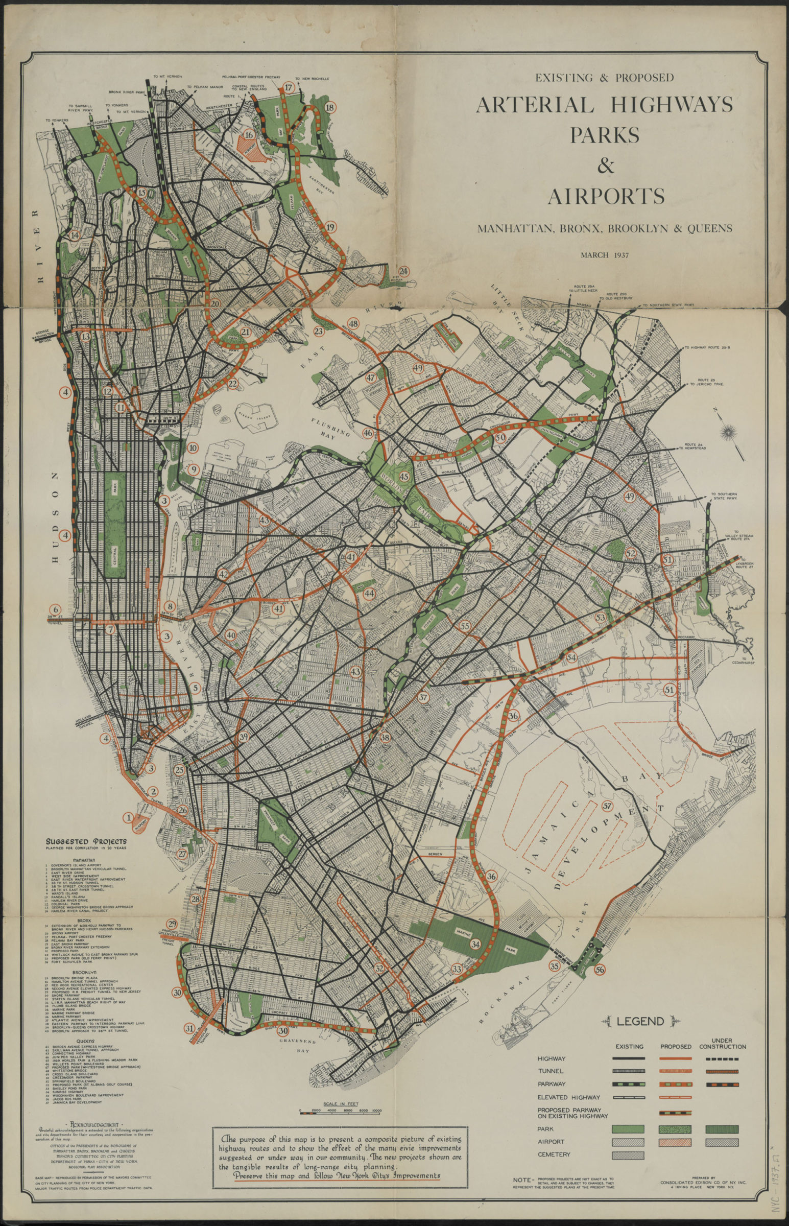
Existing & proposed arterial highways, parks & airports, Manhattan, Bronx, Brooklyn & Queens: prepared by Consolidated Edison Co. of N.Y., inc 1937
Map No. NYC-1937.Fl
Shows highways, tunnels, parkways, parks, airports and cemeteries as existing, proposed, and under construction. Oriented with north to the upper left. “Base map:- reproduced by permission of the Mayor’s Committee on City Planning of the City of New York.” “Major traffic routes from police department data.” “March 1937.” Includes index of suggested projects to be completed in 20 years, key, and text. BHS copy not mounted on linen.
Map area shown
Relation
Full catalog recordSize
81 × 53 cmDownload
Low Resolution Image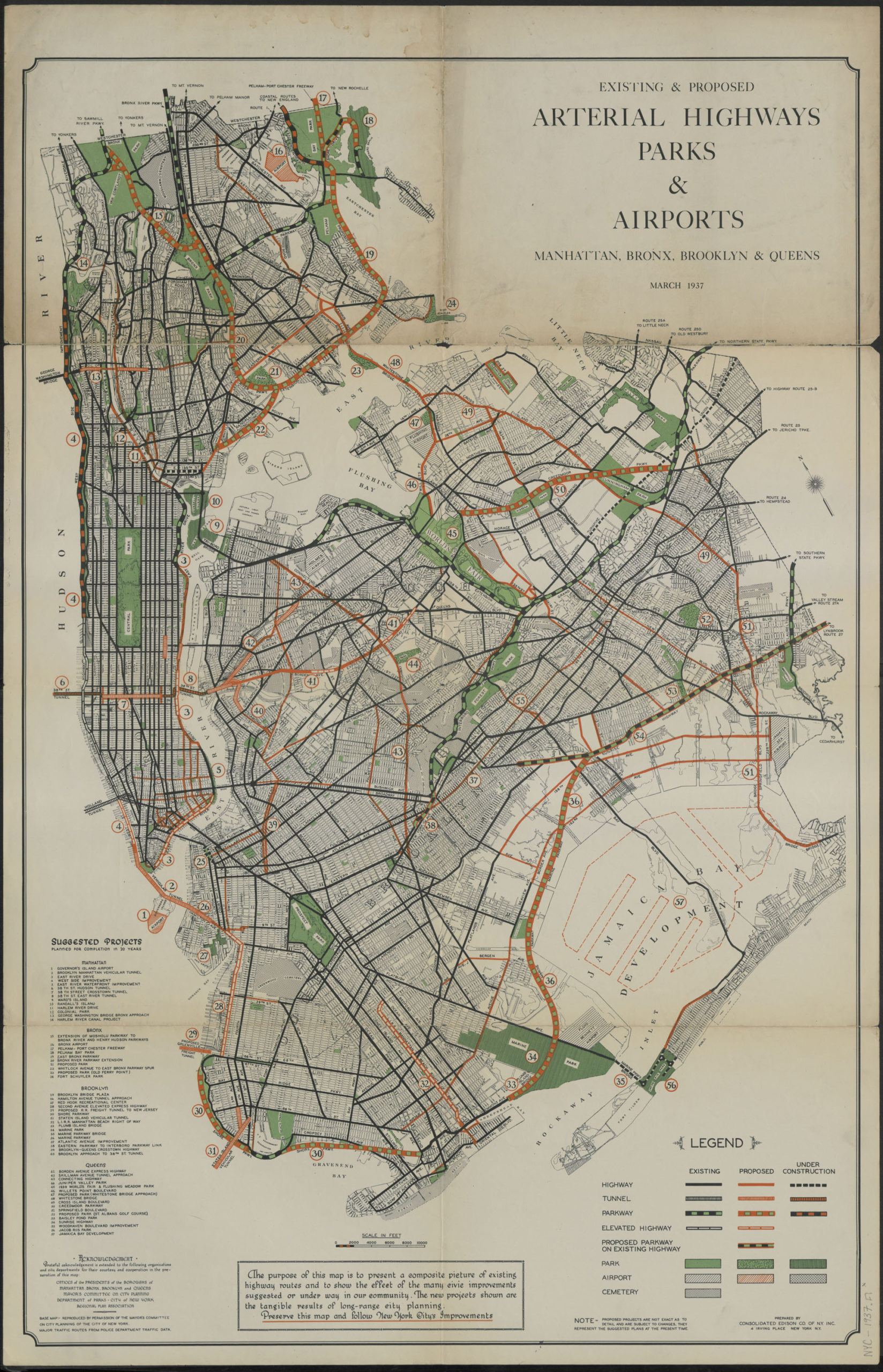
Creator
Consolidated Edison Company of New York, inc.,Publisher
Brooklyn Historical SocietyCitation
Existing & proposed arterial highways, parks & airports, Manhattan, Bronx, Brooklyn & Queens: prepared by Consolidated Edison Co. of N.Y., inc; 1937, Map Collection, NYC-1937.Fl; Brooklyn Historical Society.Scale
Scale [ca. 1:54,000]Loading zoom image... 