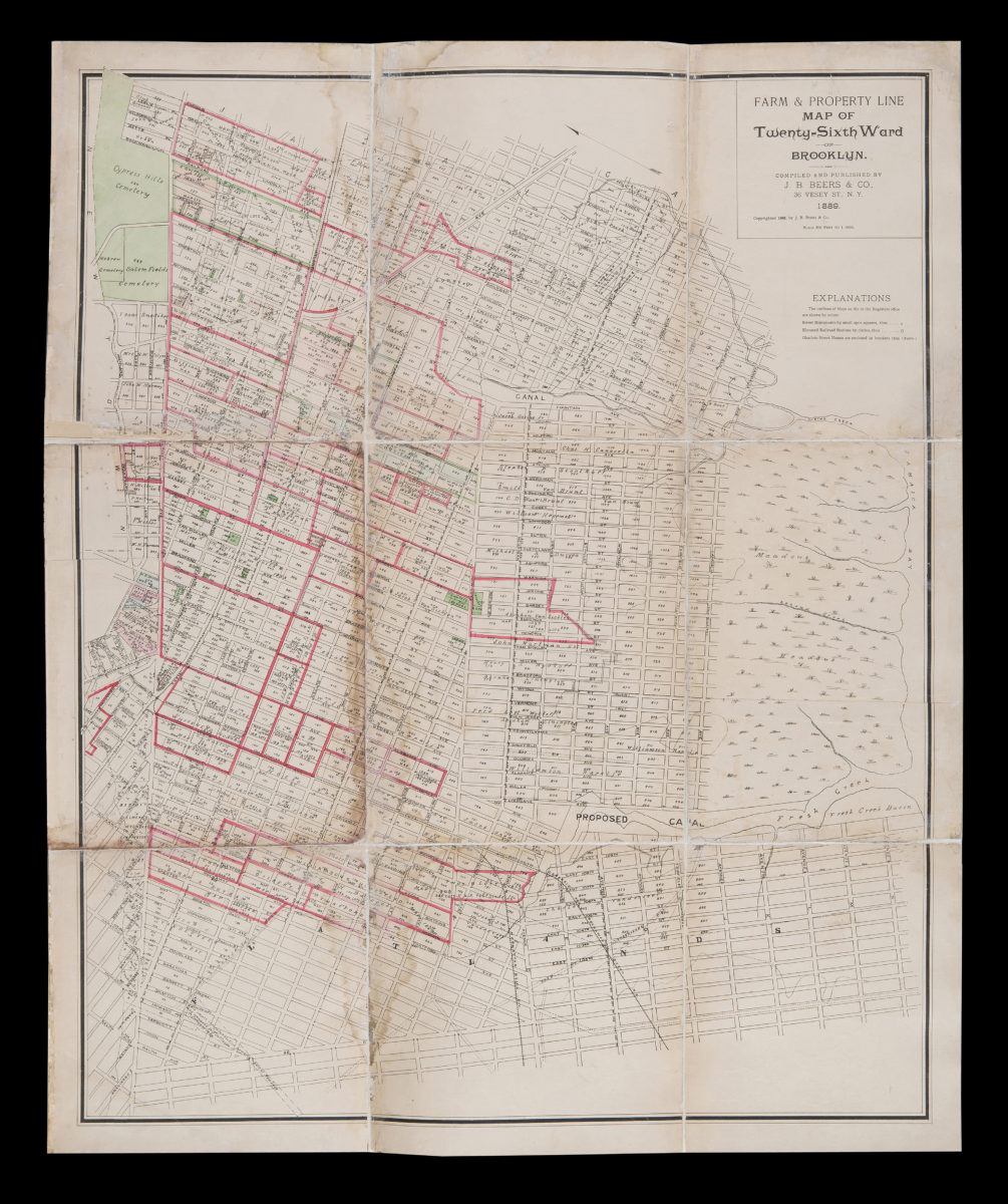
Farm & property line map of Twenty-sixth Ward of Brooklyn: compiled and published by J.H. Beers & Co 1889
Map No. B P-1889.Fd.Folio
Cadastral map covering area north from E. 98th St. to Sapphire St. and east from Cypress Hills Cemetery to Jamaica Bay (modern-day Cypress Hills, East New York, and Canarsie). Shows property, names of landowners, street monuments, elevated railroads, and obsolete street names. Oriented with north to the upper left. “The outlines of Maps on file in the Registers office are shown by colors.” Includes key.
Subjects
Places
Map area shown
Genre
Cadastral mapsRelation
Full catalog recordSize
100 × 81 cmDownload
Low Resolution Image
Creator
J.B. Beers & Co.,Publisher
Brooklyn Historical SocietyCitation
Farm & property line map of Twenty-sixth Ward of Brooklyn: compiled and published by J.H. Beers & Co; 1889, Map Collection, B P-1889.Fd.Folio; Brooklyn Historical Society.Scale
Scale [1:6,000] 1 in to 5Loading zoom image...