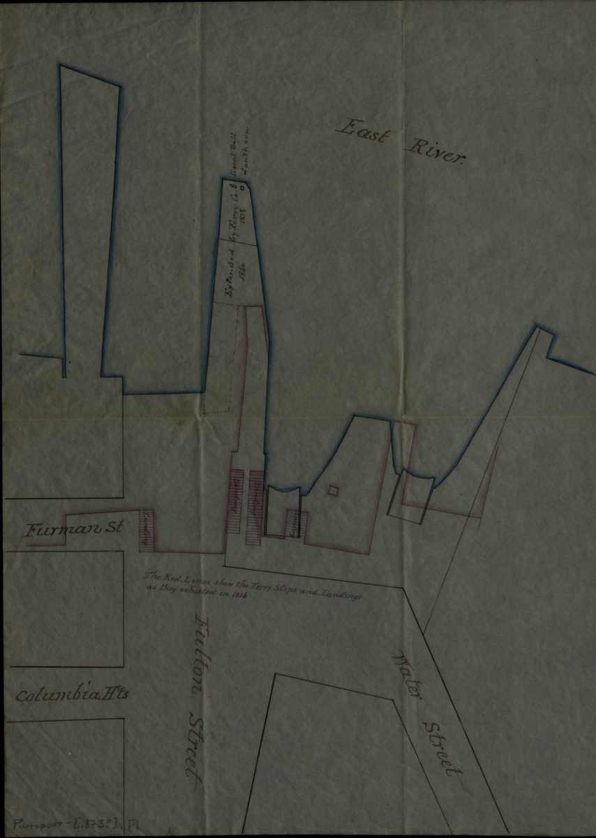
[Ferry slips, landings, and piers at Fulton St.]. [1873]
Map No. Pierrepont-[1873?].Fl
Shows ferry slips, landings, and piers as they were in 1816 (in red) and 1873? (in blue). Covers area in modern-day Fulton Ferry. Title devised by cataloger. Oriented with north to the right. Date of creation conjectured from notes on map. Includes notes.
Subjects
Places
Map area shown
Genre
Manuscript mapsRelation
Full catalog recordSize
41 × 29 cmDownload
Low Resolution Image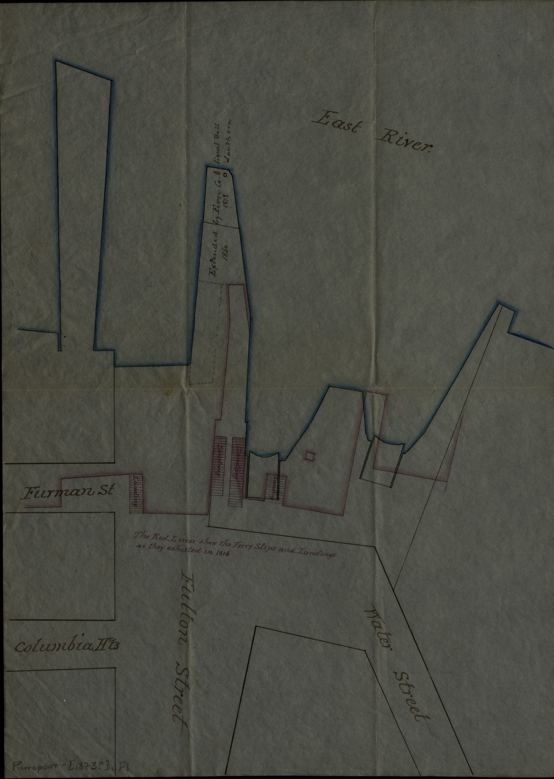
Creator
Publisher
Brooklyn Historical SocietyCitation
[Ferry slips, landings, and piers at Fulton St.].; [1873], Map Collection, Pierrepont-[1873?].Fl; Brooklyn Historical Society.Scale
Scale not givenLoading zoom image...