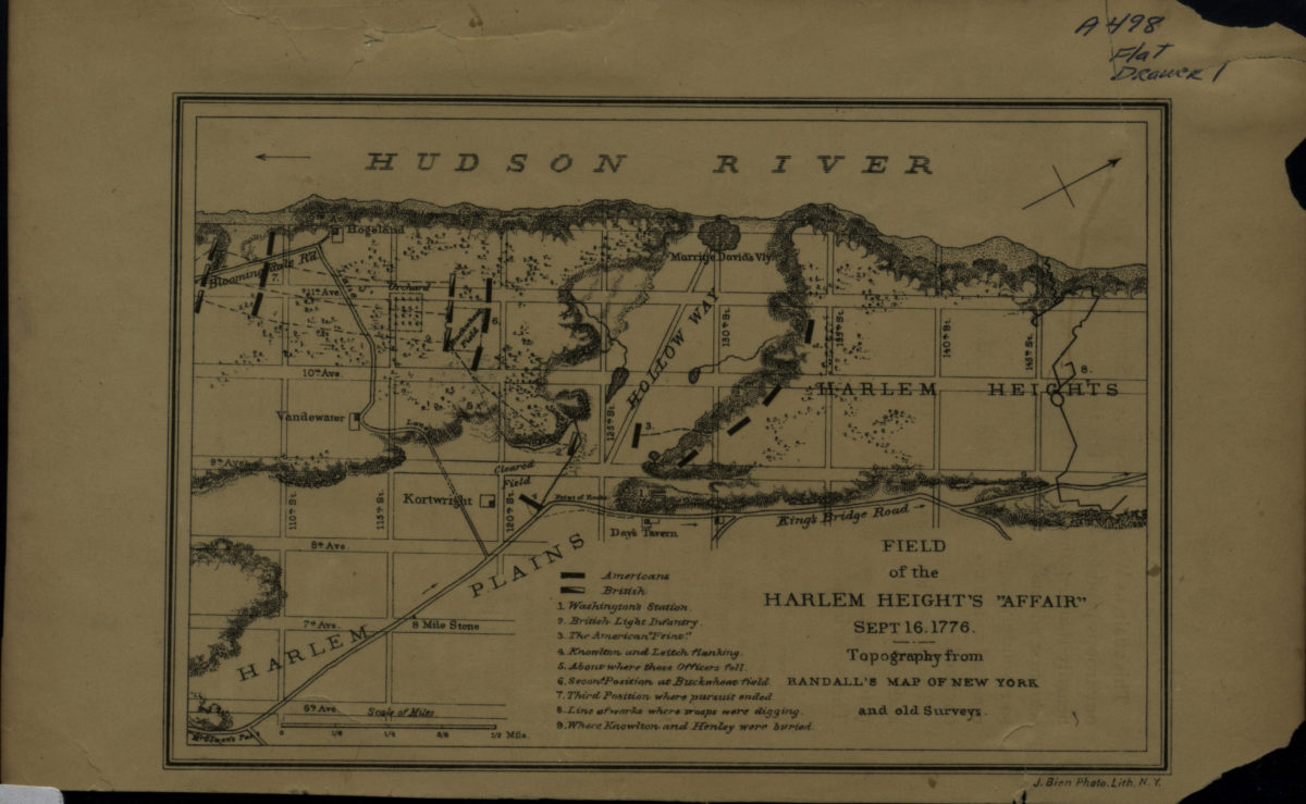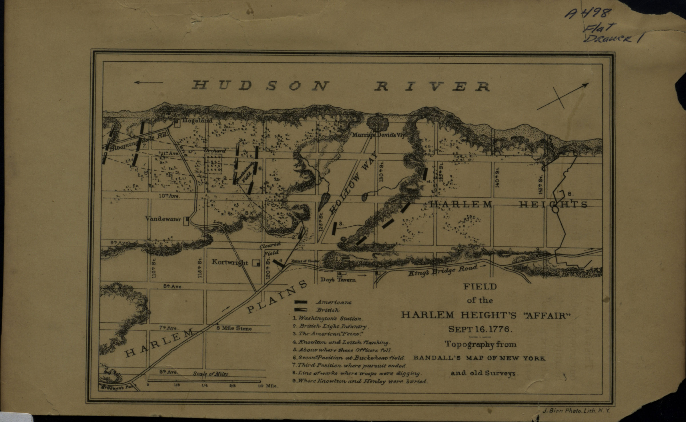
Field of the Harlem Heights “Affair,” Sept. 16, 1776 [18??]
Map No. Rev. War-1776 (18--?)b.Fl
Covers Manhattan north from approximately 110th St. to 145th St. Shows troop movements, buildings, and names of some property owners. Overlaid over the modern city grid. Relief shown by hachures. Oriented with north to the upper right. “Topography from Randall’s Map of New York and old Surveys.” Includes index and key.
Map area shown
Genre
Historical mapsRelation
Full catalog recordSize
12 × 17 cmDownload
Low Resolution Image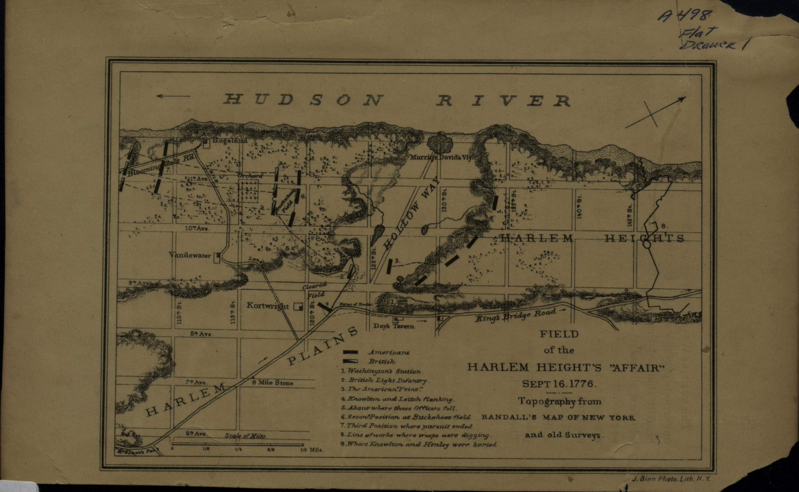
Creator
Bien, Julius,Publisher
Brooklyn Historical SocietyCitation
Field of the Harlem Heights “Affair,” Sept. 16, 1776; [18??], Map Collection, Rev. War-1776 (18--?)b.Fl; Brooklyn Historical Society.Scale
Scale [ca. 1:21,120]Loading zoom image...