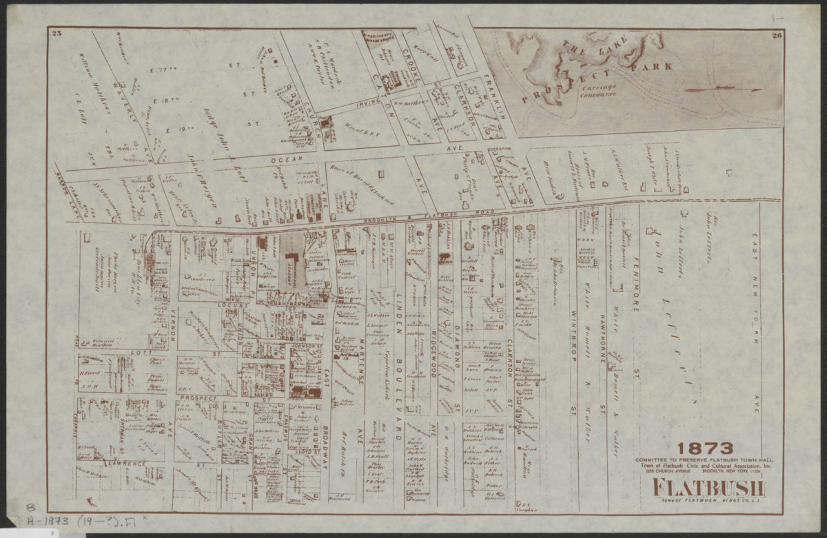
Flatbush, town of Flatbush, Kings Co., L.I. [19??]
Map No. B A-1873 (19--?).Fl
Facsimile. Cadastral map. Covers area north from the Road to Canarsie to East New York Ave. and east from Irving Pl. to Lawrence St. (modern-day Prospect-Lefferts Gardens, Flatbush, and Prospect Park South). Shows property (including lots and buildings), names of landowners, schools, and churches. Oriented with north to the right.
Subjects
Places
Map area shown
Genre
Cadastral mapsRelation
Full catalog recordSize
26 × 39 cmDownload
Low Resolution Image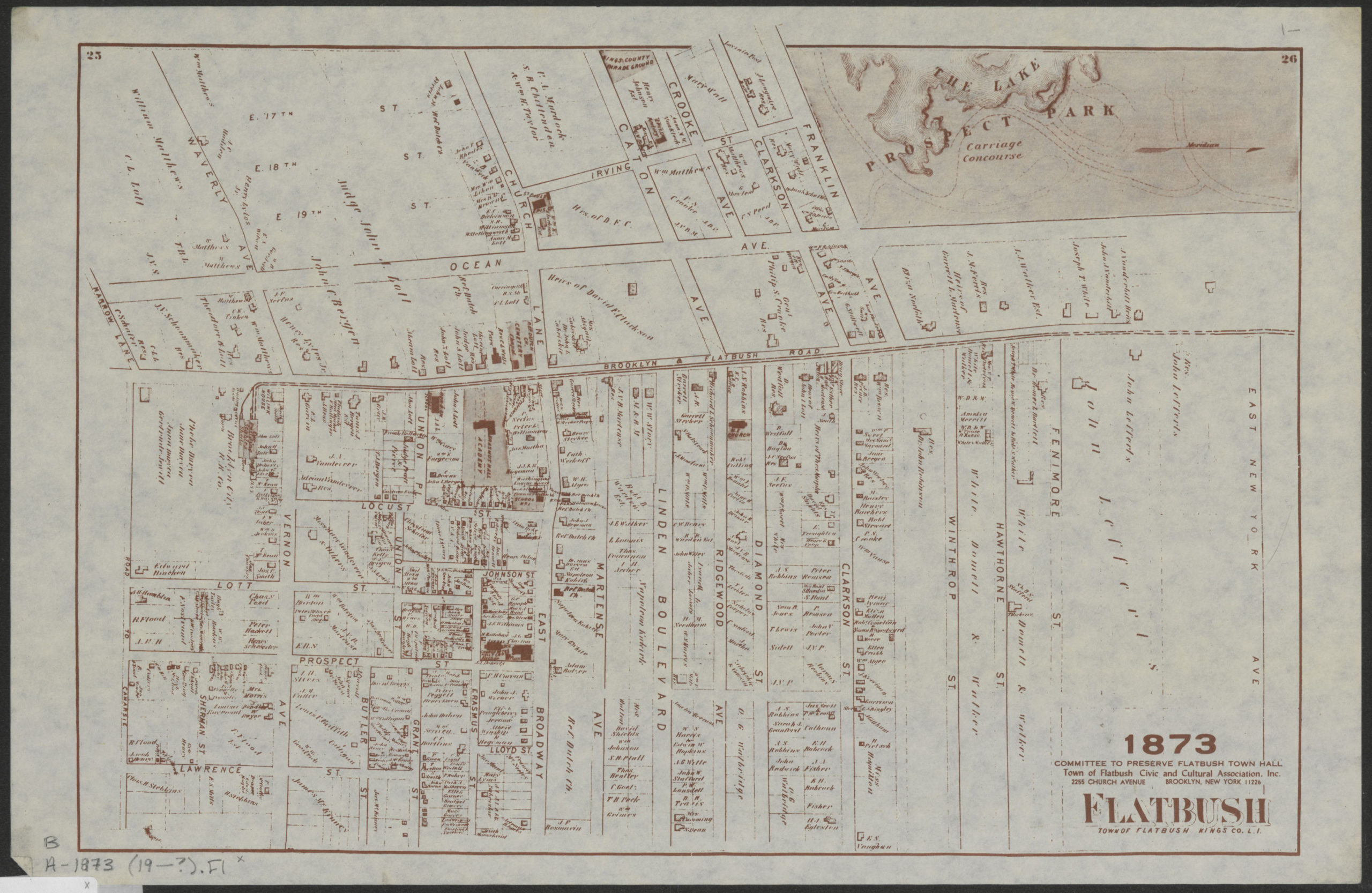
Creator
Beers, F. W.; Beers, Comstock & Cline; Committee to Preserve Flatbush Town Hall (Brooklyn, New York, N.Y.),Publisher
Brooklyn Historical SocietyCitation
Flatbush, town of Flatbush, Kings Co., L.I.; [19??], Map Collection, B A-1873 (19--?).Fl; Brooklyn Historical Society.Scale
Scale not givenLoading zoom image...