Flushing, Queens Co., L.I. [1873]
Map No. Q-[1873]h.Fl
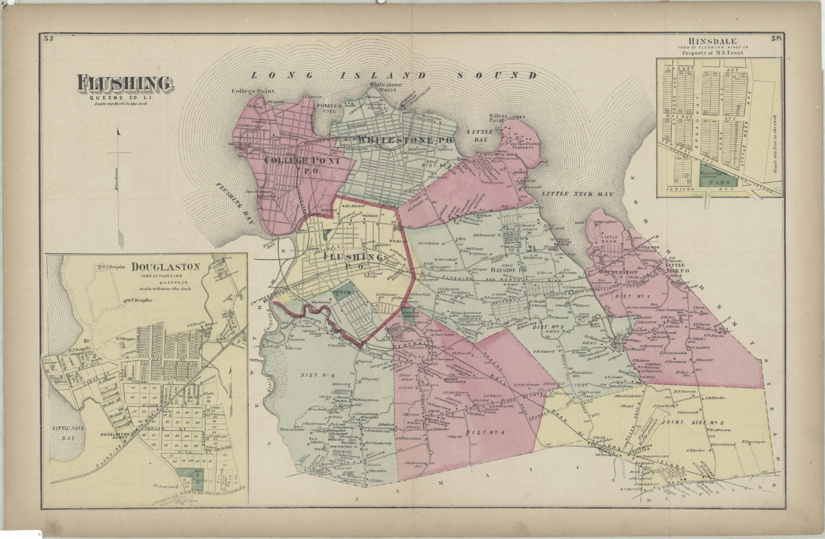
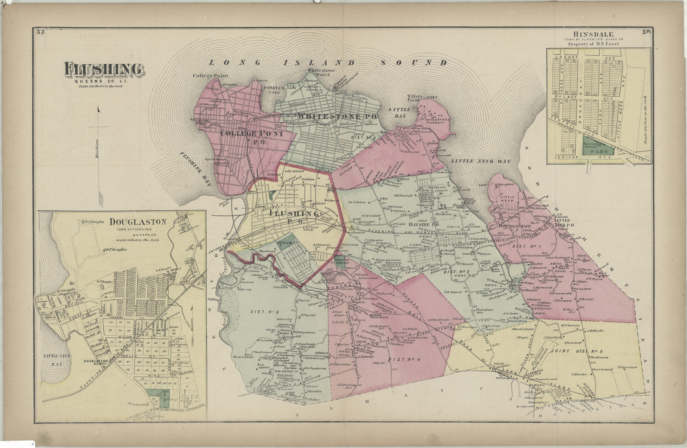
Cadastral map. Shows property (including lots and buildings), names of landowners, railroads, and administrative divisions. Extracted from: Atlas of Long Island, New York. New York : Beers, Comstock & Cline, 1873, p. 57-58. Includes 2 insets. Insets: Douglaston, town of Flushing, Queens Co. (Scale [1:7,920]. 40 rods to the in.) — Hinsdale, town of Flushing, Kings Co., property of M.S. Frost (Scale [1:1,200]. 100 ft to the in.).
Subjects
Places
Map area shown
Genre
Cadastral mapsRelation
Full catalog recordSize
36 × 56 cmDownload
Low Resolution Image
Creator
Beers, F. W.; Beers, Comstock & Cline,Publisher
Brooklyn Historical SocietyCitation
Flushing, Queens Co., L.I.; [1873], Map Collection, Q-[1873]h.Fl; Brooklyn Historical Society.Scale
Scale [1:31,680] 1 in toLoading zoom image...