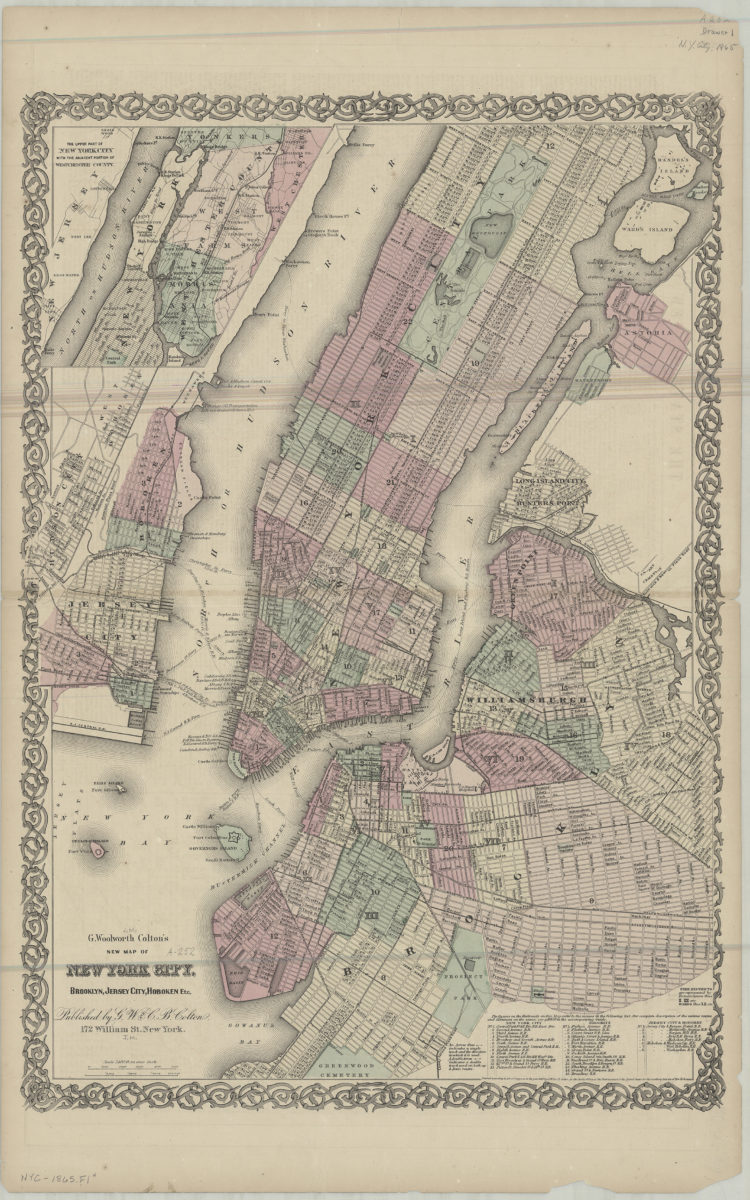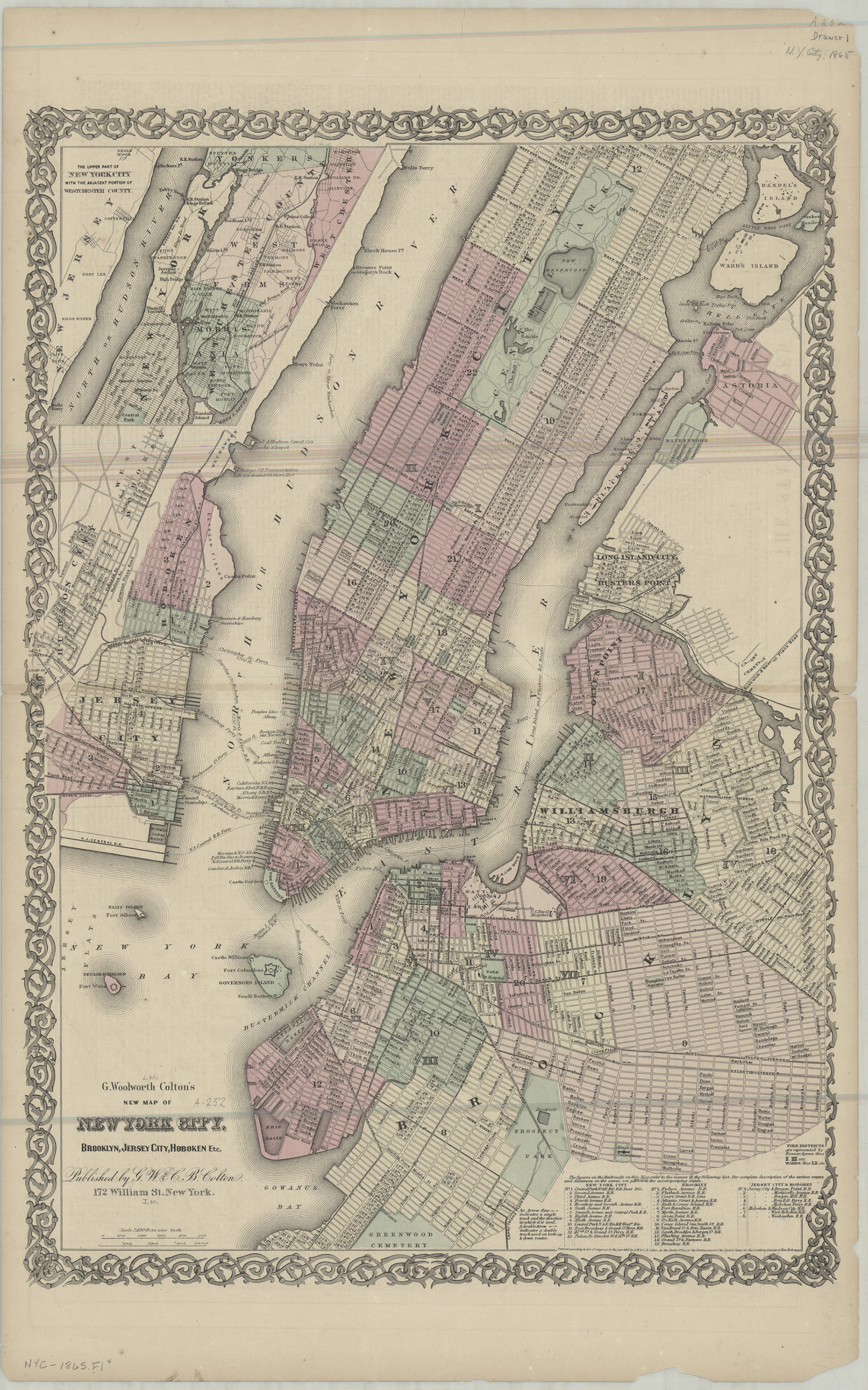
G. Woolworth Colton’s new map of York City, Brooklyn, Jersey City, Hoboken etc [ca. 1865]
Covers the entirety of Manhattan also covers Randel’s Island, Ward’s Island, Blackwell’s Island, Ellis Island, Bedloes Island, Governors Island, Jersey City, and Hoboken, as well as portions of the South Bronx and southern Queens. Covers Brooklyn north from Greenwood Cemetery to Green Point and east to Saratoga Ave. Shows wards, railroads, fire districts, and ferry lines. Extracted from unknown atlas. “Entered according to Act of Congress in the year 1865 by G.W. & C.B. Colton in the Clerks Office of the District Court of the United States for the Southern District of New York.” Includes inset continuation map, keys, and index to railroads. Inset continuation map: The upper part of New York City with the adjacent portions of Westchester County. On verso: Text concerning the states of New York and New Jersey.
Map area shown
Genre
Zoning mapsRelation
Full catalog recordSize
58 × 41 cmDownload
Low Resolution Image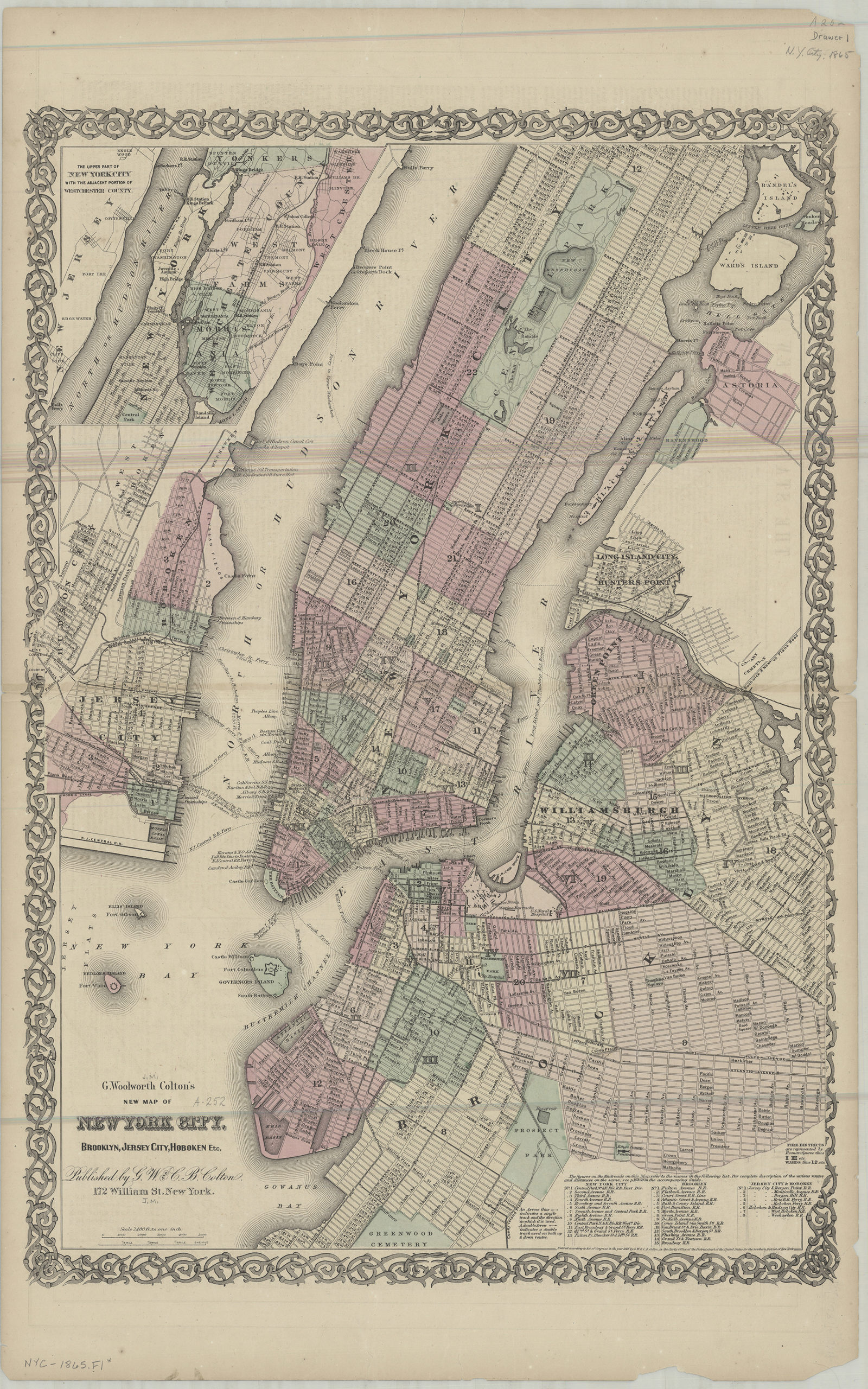
Creator
G.W. & C.B. Colton & Co.,Publisher
Brooklyn Historical SocietyCitation
G. Woolworth Colton’s new map of York City, Brooklyn, Jersey City, Hoboken etc; [ca. 1865], Map Collection, NYC-1865.Fl; Brooklyn Historical Society.Scale
Scale [1:28,800] 1 in to