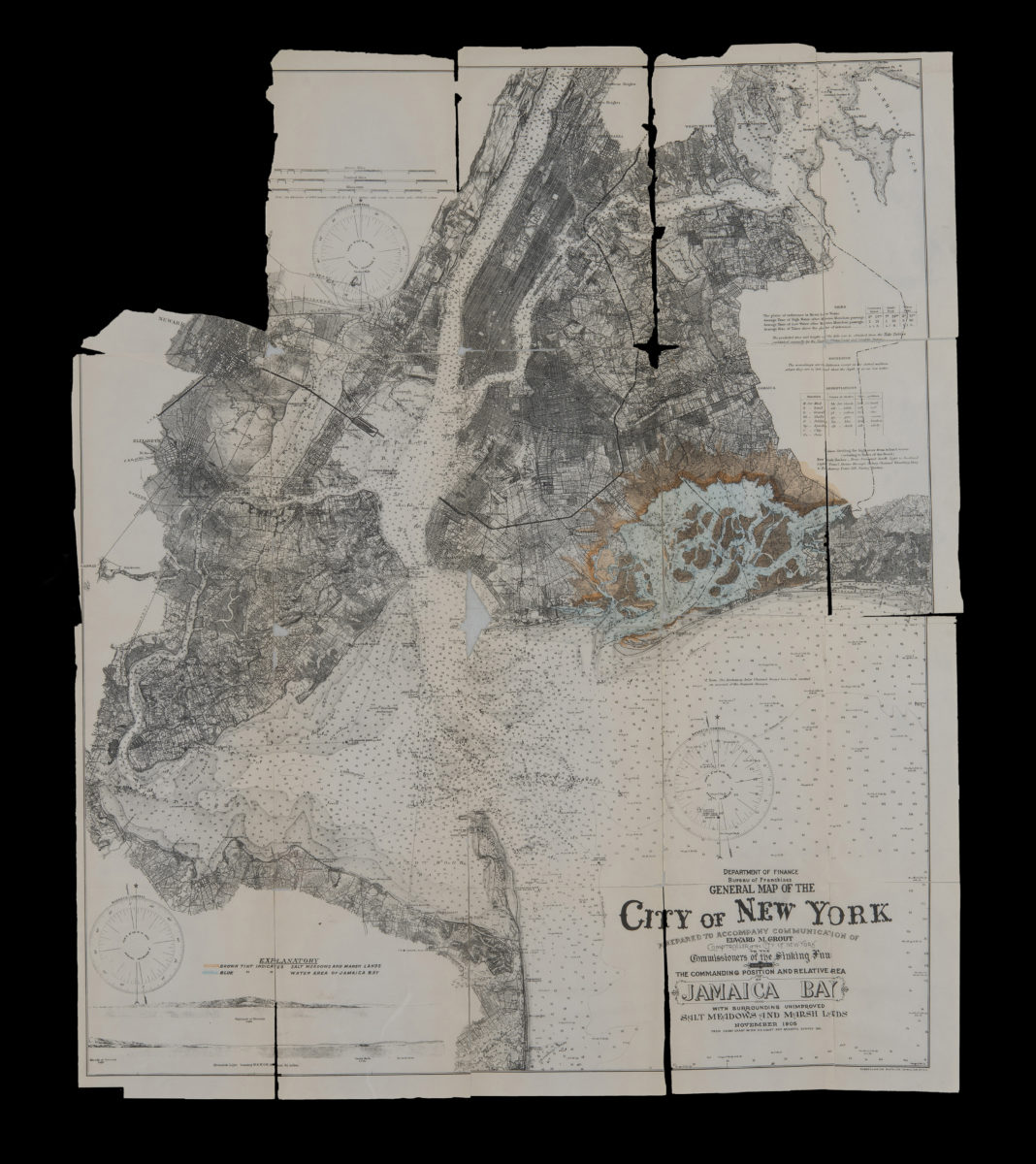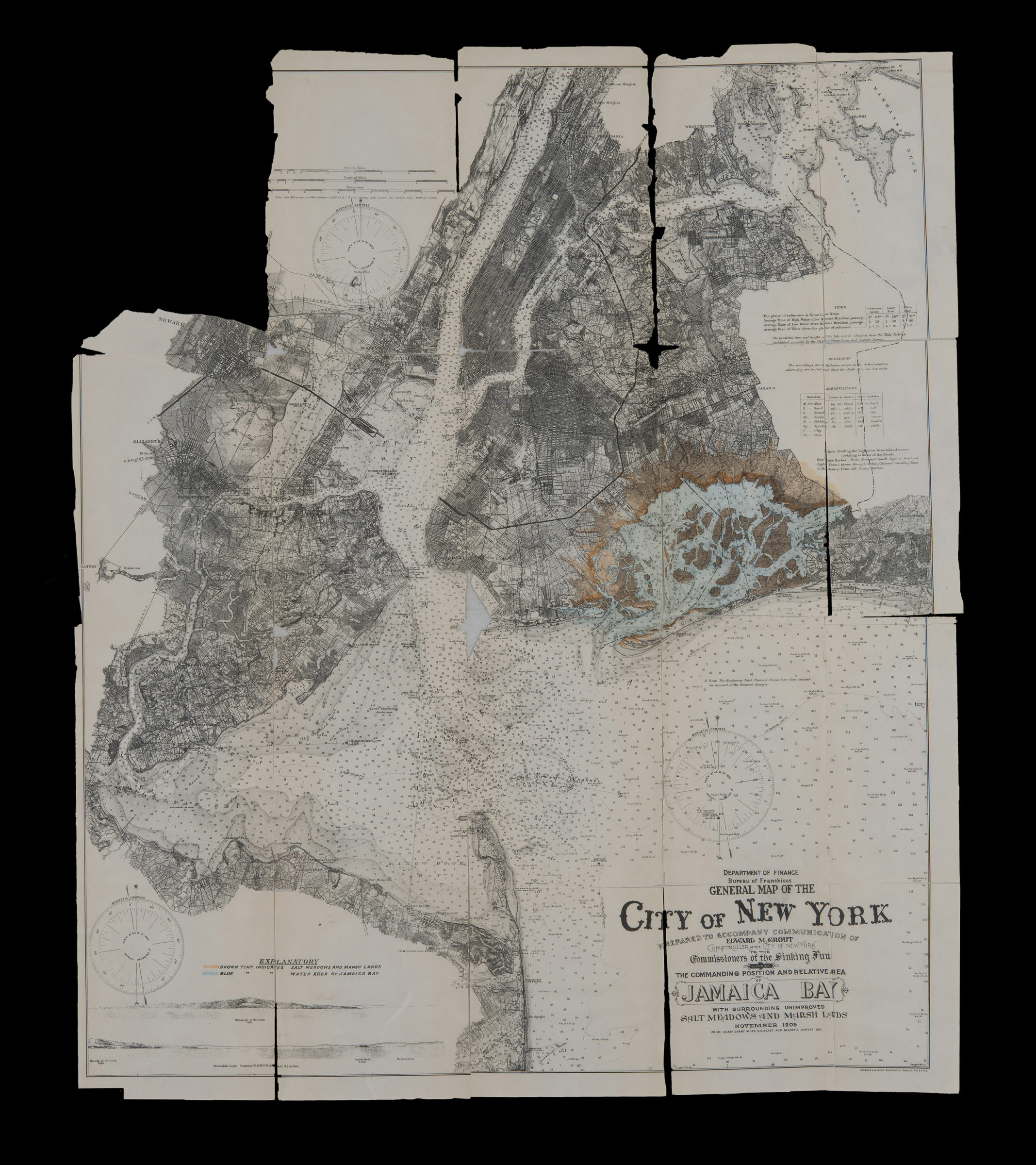
General map of the City of New York: prepared to accompany communication of Edward M. Grout, Comptroller of the City of New York, to the Commissioners of the Sinking Fund showing the commanding position and relative area of Jamaica Bay November 1905 1905
Map No. NYC-1905.Fl
Depths shown by isolines and soundings. Extracted from: Improvement and development of Jamaica Bay and the water front of the city of New York other than that of Manhattan Island, Edward M. Grout. “From Coast Chart no 120 U.S. Coast and Geodetic Survey 1901.”
Map area shown
Genre
Bathymetric mapsRelation
Full catalog recordSize
73 × 62 cmDownload
Low Resolution Image
Creator
New York (N.Y.).; Department of Finance.; Bureau of Franchises,Publisher
Brooklyn Historical SocietyCitation
General map of the City of New York: prepared to accompany communication of Edward M. Grout, Comptroller of the City of New York, to the Commissioners of the Sinking Fund showing the commanding position and relative area of Jamaica Bay November 1905; 1905, Map Collection, NYC-1905.Fl; Brooklyn Historical Society.Scale
Scale [1:80500]Loading zoom image...