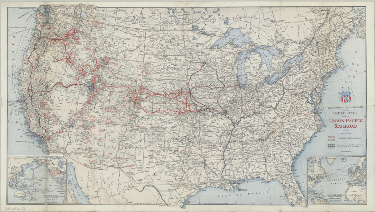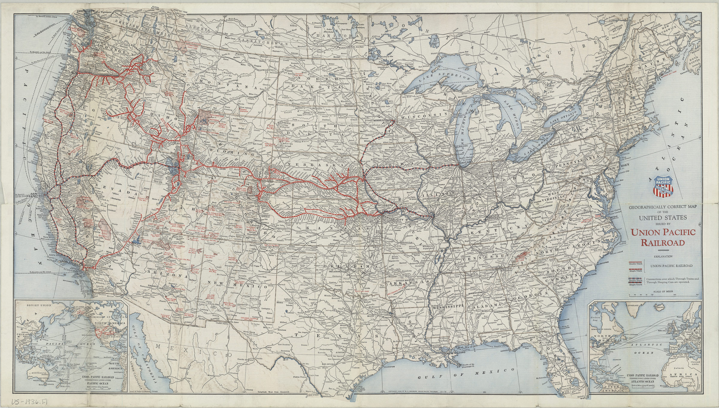
Geographically correct map of the United States: issued by Union Pacific Railroad [ca. 1936]
Map No. US-1936.Fl
Relief shown by landforms and spot heights. Shows national parks and monuments and tracks of the Union Pacific Railroad. Copyright, 1936 by W.S. Basinger, Union Pacific Railroad. Inset maps: Union Pacific Railroad connecting lines over Atlantic Ocean — Union Pacific Railroad connecting lines over Pacific Ocean. History of and information on the Union Pacific and its passenger services on verso.
Map area shown
Genre
MapsRelation
Full catalog recordSize
43 × 78 cmDownload
Low Resolution Image
Creator
Rand McNally and Company,Publisher
Brooklyn Historical SocietyCitation
Geographically correct map of the United States: issued by Union Pacific Railroad; [ca. 1936], Map Collection, US-1936.Fl; Brooklyn Historical Society.Scale
Scale [ca. 1:6,336,000. [Loading zoom image...