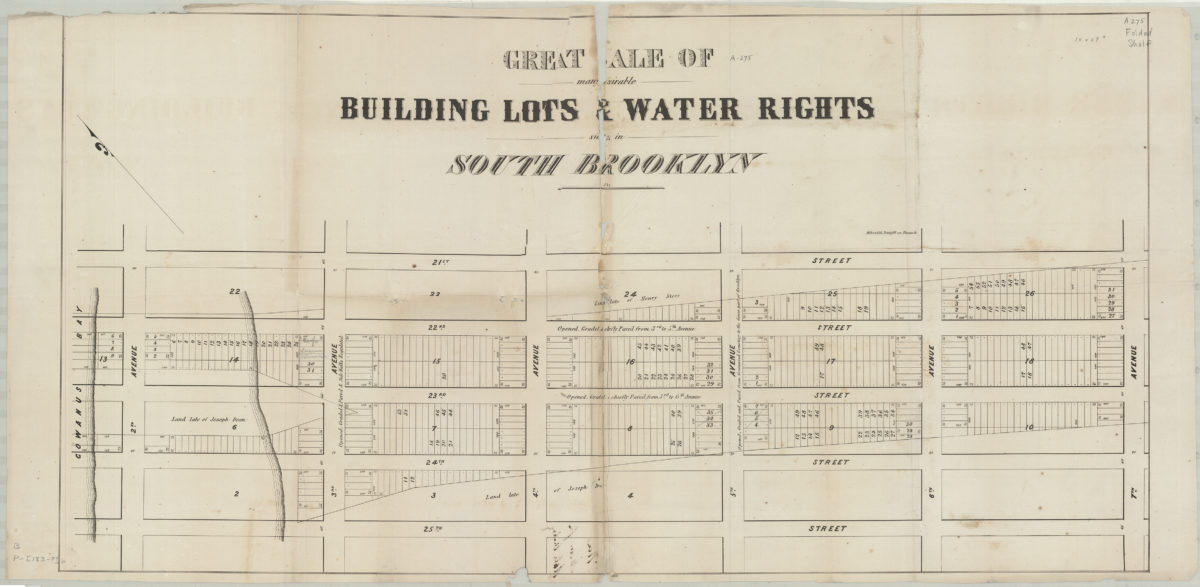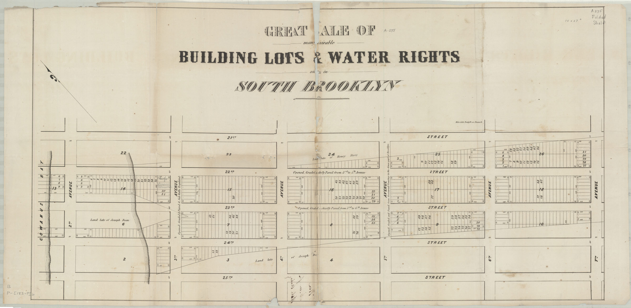
Great sale of many desirable building lots & water rights situate[d] in South Brooklyn [183?]
Map No. B P-[183-?].Fl.Folio;B P-[183-?].Fl.Folio c.2;B P-[183-?].Fl.Folio c.3
Cadastral map covering area northwest from 7th Ave. to the Gowanus Bay and northeast from 25th St. to 21st St. (modern-day Sunset Park). Shows property (including block numbers, lot numbers, and dimensions), names of landowners, and street conditions. Oriented with north to the upper left. “2651”–Lower center margin. BHS has 3 copies.
Map area shown
Genre
Cadastral mapsRelation
Full catalog recordSize
45 × 88 cmDownload
Low Resolution Image
Creator
Miller & Co.,Publisher
Brooklyn Historical SocietyCitation
Great sale of many desirable building lots & water rights situate[d] in South Brooklyn; [183?], Map Collection, B P-[183-?].Fl.Folio;B P-[183-?].Fl.Folio c.2;B P-[183-?].Fl.Folio c.3; Brooklyn Historical Society.Scale
Scale not givenLoading zoom image...