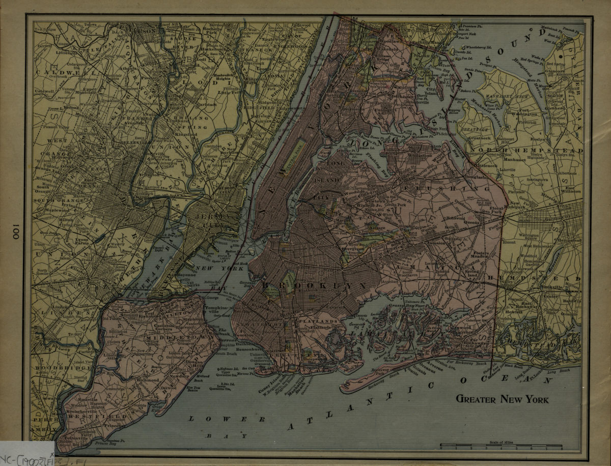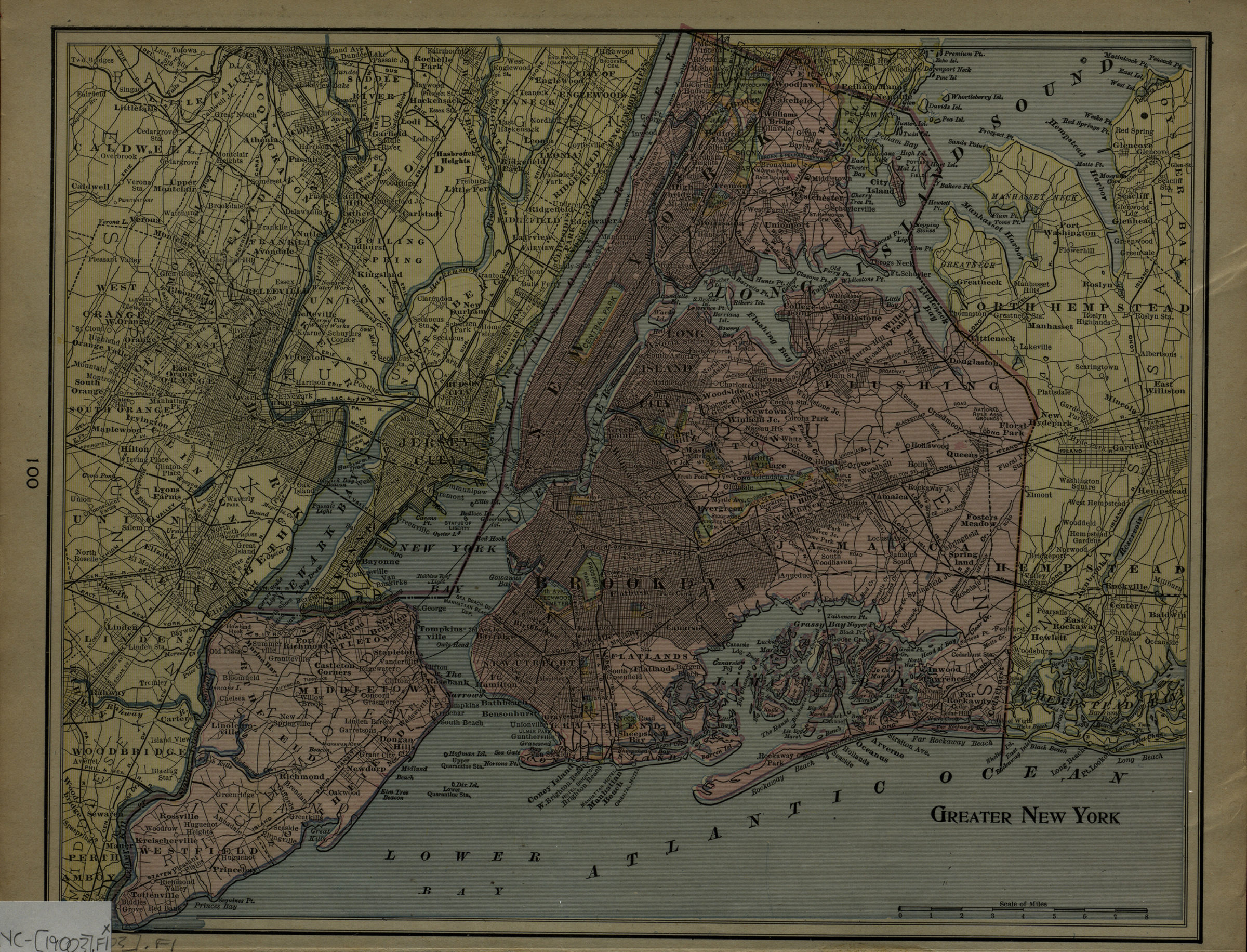
Greater New York [1900]
Map No. NYC-[1900?].Fl
Map covers the 5 boroughs of New York City, and portions of New Jersey and Long Island. Extracted from an unknown atlas. On verso: partial map of Mahatntan.
Places
Map area shown
Genre
MapRelation
Full catalog recordSize
27 × 34 cmDownload
Low Resolution Image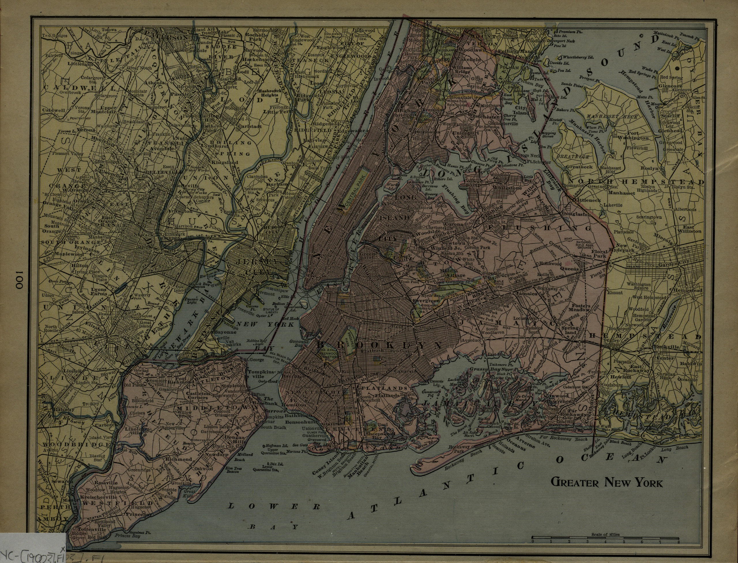
Creator
George F. Cram Company,Publisher
Brooklyn Historical SocietyCitation
Greater New York; [1900], Map Collection, NYC-[1900?].Fl; Brooklyn Historical Society.Scale
Scale approximately 1:69,Loading zoom image...