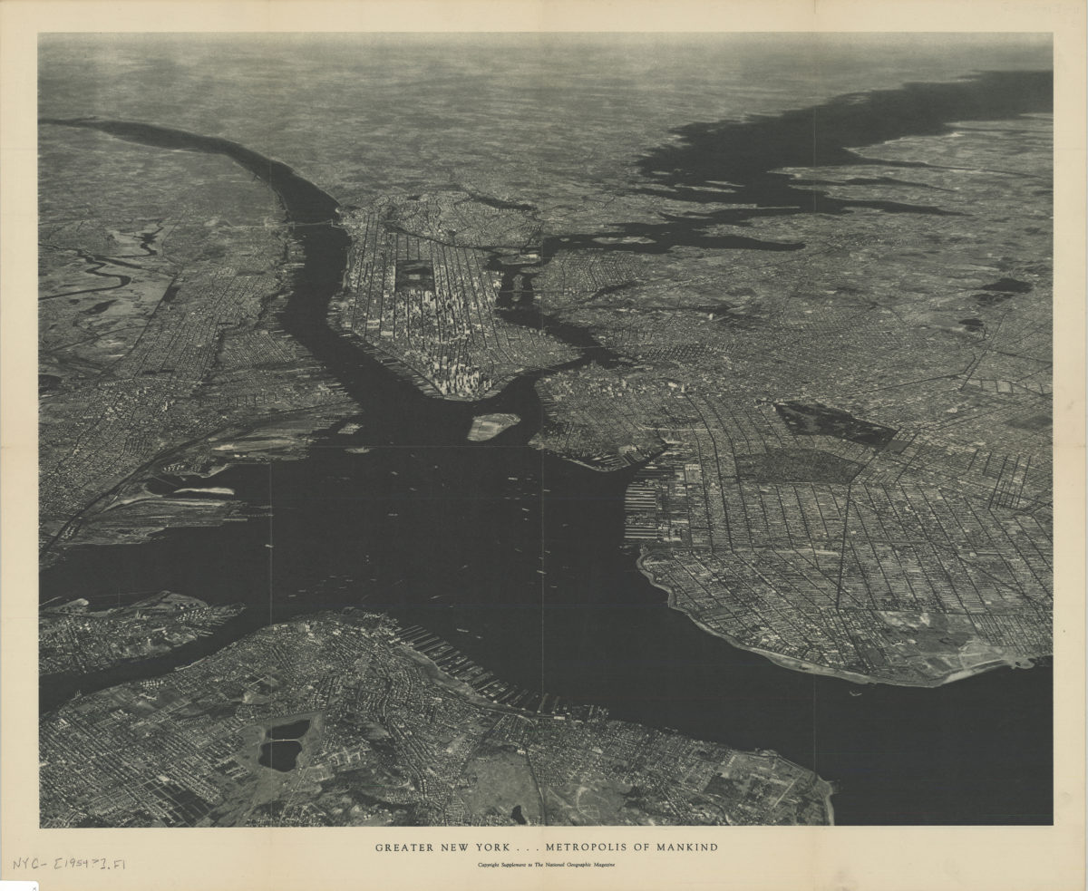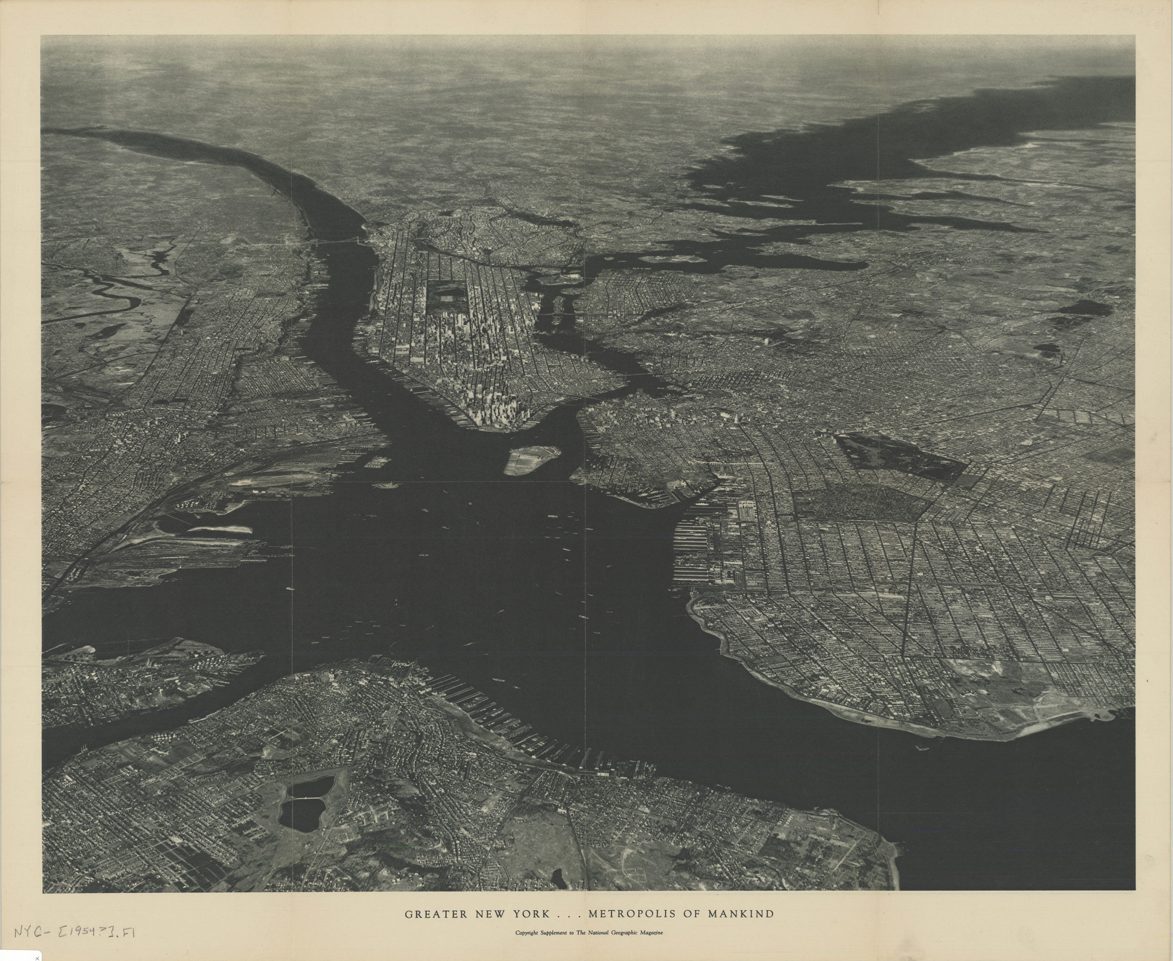

Greater New York, metropolis of mankind [1954]
Map No. NYC-[1954?].Fl
“U.S. Army Air Corps official photograph … encompasses an area estimated to be more than 3,000 square miles.” Title on verso: Greater New York in a single photograph. “Copyright supplement to the National Geographic Magazine,” Dec. 1954. On verso: diagram identifying chief points of interest.
Map area shown
Relation
Full catalog recordSize
44 × 56 cmDownload
Low Resolution Image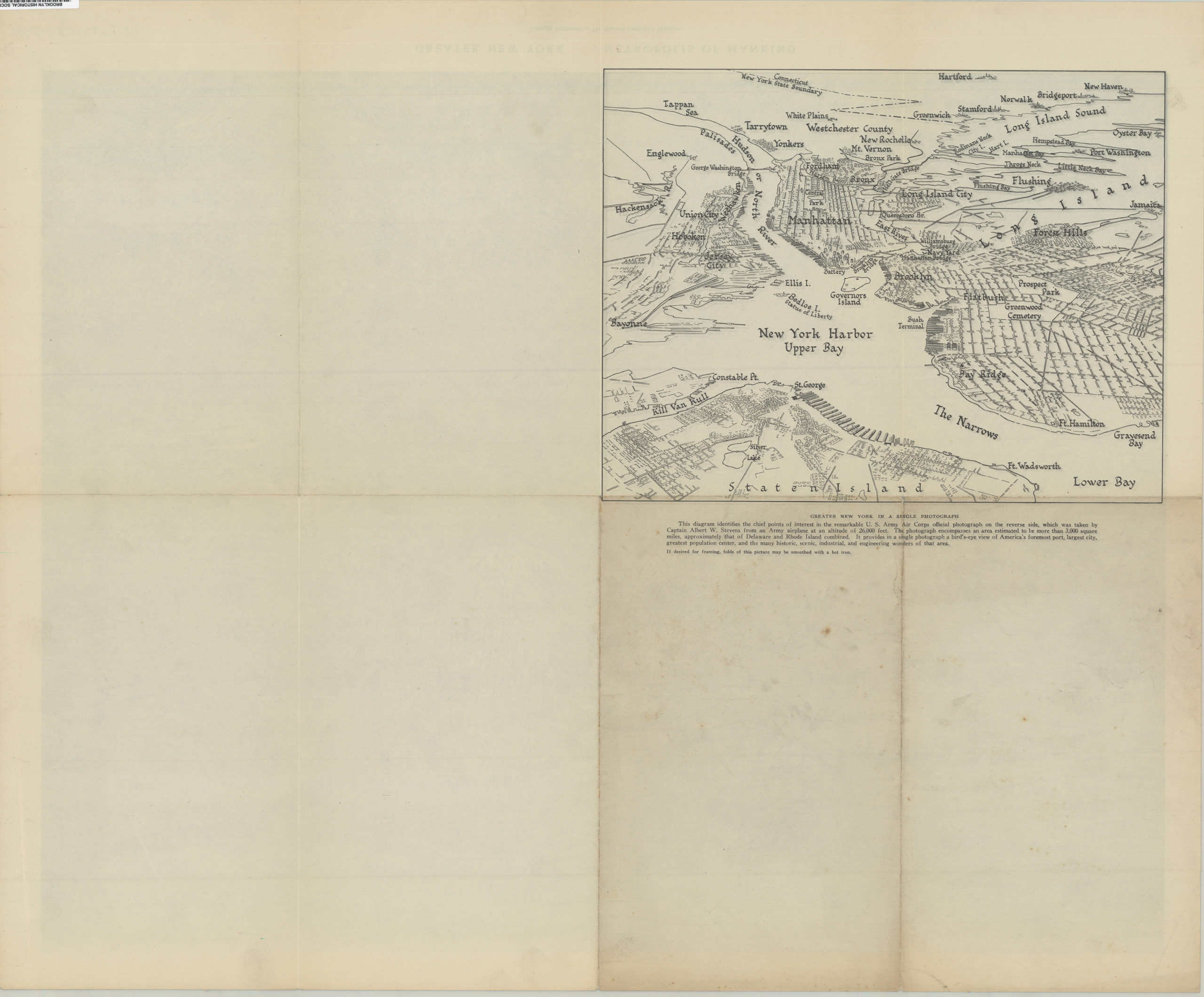
Creator
National Geographic Society (U.S.).; Cartographic Division,Publisher
Brooklyn Historical SocietyCitation
Greater New York, metropolis of mankind; [1954], Map Collection, NYC-[1954?].Fl; Brooklyn Historical Society.Scale
Scale not givenLoading zoom image...