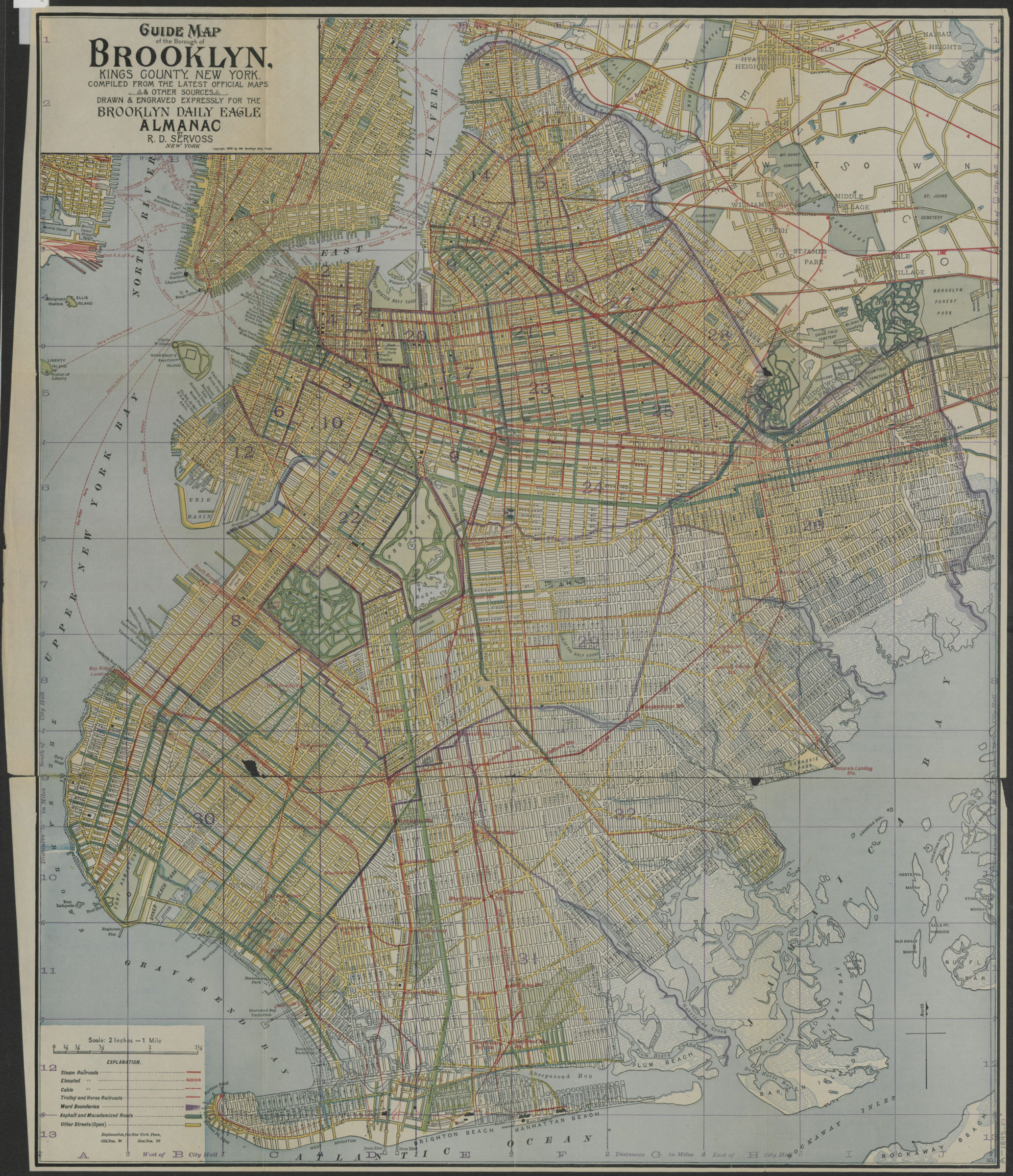
Guide map of the Borough of Brooklyn, Kings County, New York: compiled from the latest official maps & other sources, drawn & engraved expressly for the Brooklyn Daily Eagle Almanac [ca. 1898]
Map No. B A-1898.Fl
Transportation map. Covers Brooklyn, New York (N.Y.) Shows existing and proposed streets and various, steam, elevated, cable, trolley and horse railroads. Also shows and names piers. Direction and publication attributed to the Daily Eagle by cataloger. Engraving attributed to Servoss on 1896 ed. Includes key. NYHS copy creased, frayed, discolored. Patched with tape on verso. Encapsulated. M008393
Map area shown
Relation
Full catalog recordSize
61 × 51 cmDownload
Low Resolution Image
Creator
Servoss, R. D.; Brooklyn Daily Eagle almanac,Publisher
Brooklyn Historical SocietyCitation
Guide map of the Borough of Brooklyn, Kings County, New York: compiled from the latest official maps & other sources, drawn & engraved expressly for the Brooklyn Daily Eagle Almanac; [ca. 1898], Map Collection, B A-1898.Fl; Brooklyn Historical Society.Scale
Scale [1:126,720] 2 inLoading zoom image... 