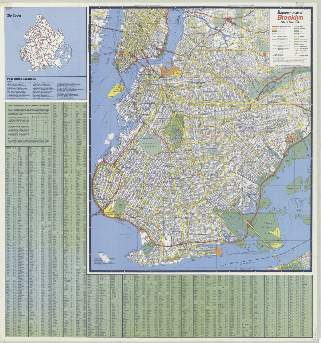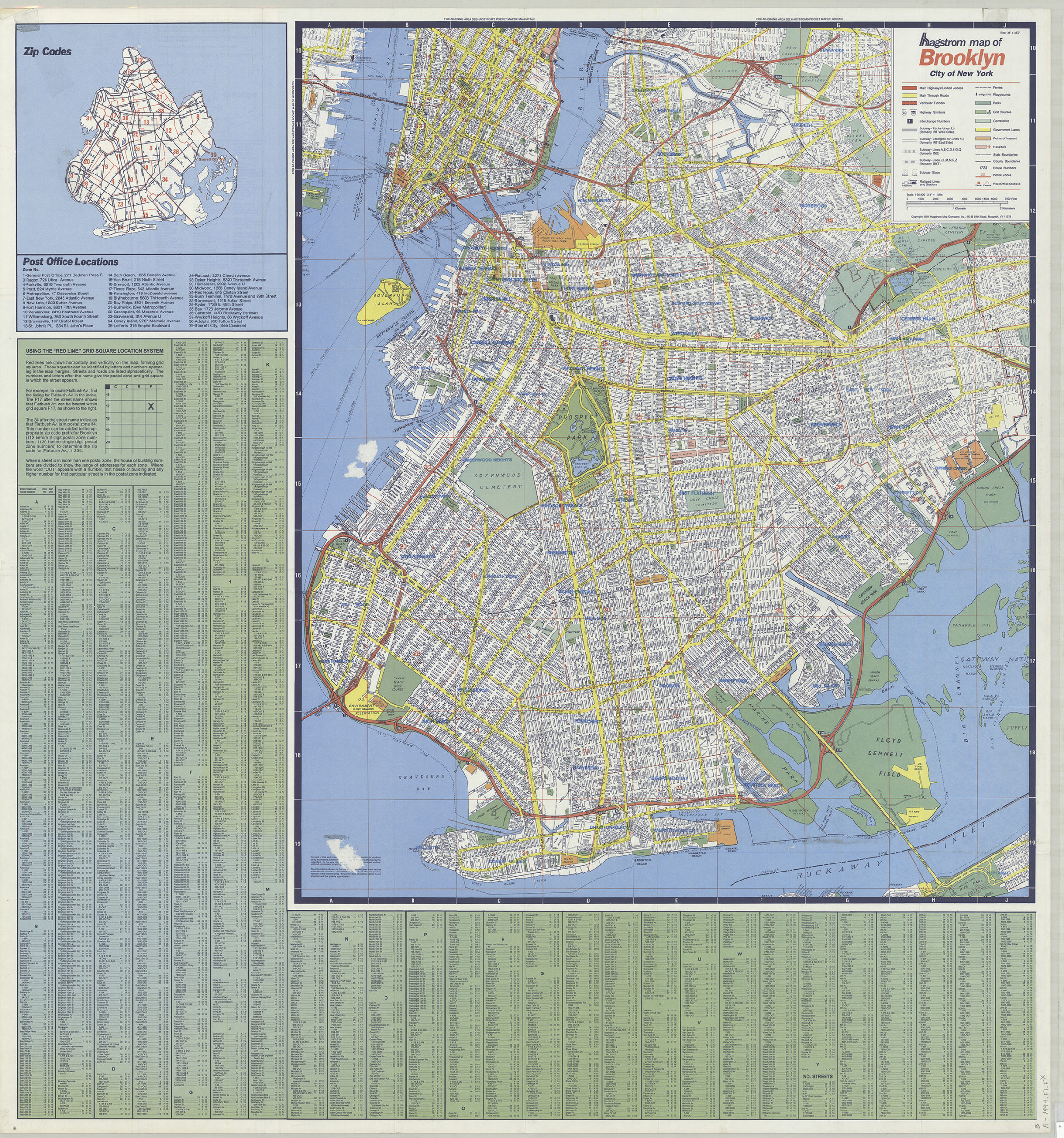
Hagstrom map of Brooklyn, city of New York [ca. 1994]
Map No. B A-1994.Fl.Folio
Street map covers Brooklyn, lower Manhattan, and the Jersey City waterfront. Also shows roads, subway lines and stops, railroad lines and stations, and postal zones. Includes street index and ancillary zip code map.
Map area shown
Genre
Zoning mapsRelation
Full catalog recordSize
90 × 84 cmDownload
Low Resolution Image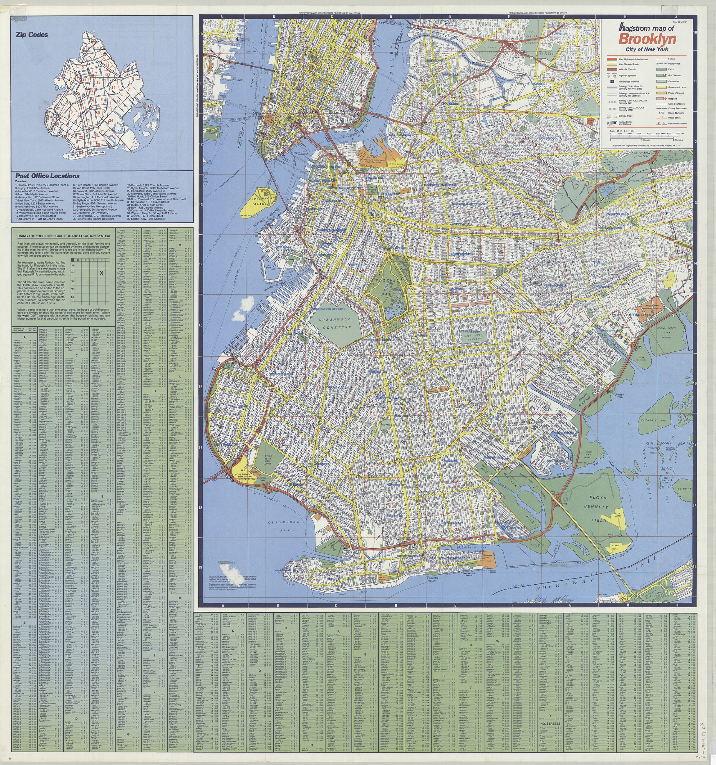
Creator
Hagstrom Map Company,Publisher
Brooklyn Historical SocietyCitation
Hagstrom map of Brooklyn, city of New York; [ca. 1994], Map Collection, B A-1994.Fl.Folio; Brooklyn Historical Society.Scale
Scale [ca. 1:26,500]Loading zoom image...