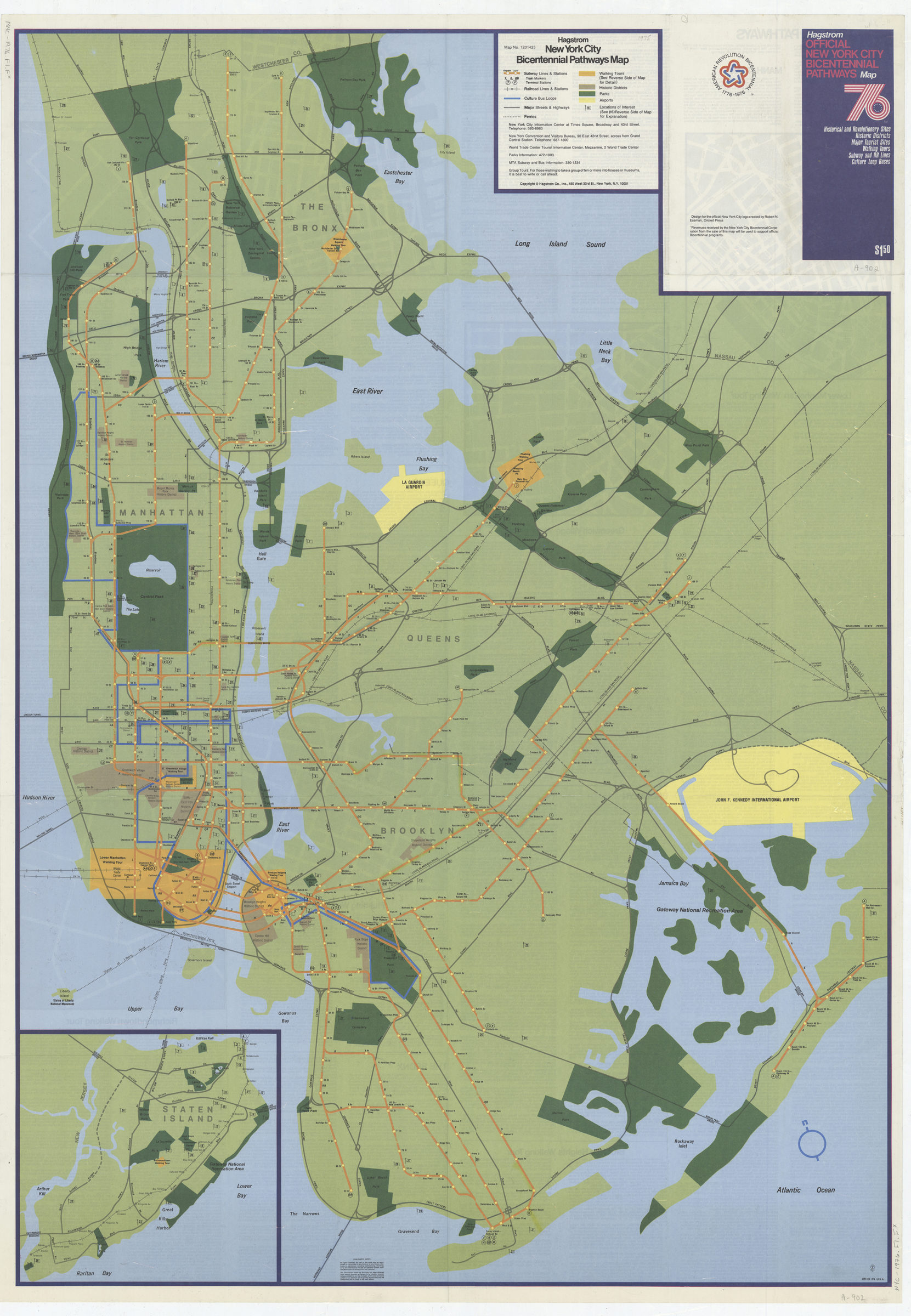

Hagstrom New York City Bicentennial pathways map [1975]
Map No. NYC-1976.Fl.Folio
“Map no. 1201425.” Shows “historical and Revolutionary sites, historic districts, major tourist sites, walking tours, subway and RR lines, culture loop buses,” On verso: text, descriptive walking tour itineraries and 6 local maps: Lower Manhattan, Greenwich Village, Brooklyn Heights, Flushing, Westchester Square, and Richmondtown.
Map area shown
Relation
Full catalog recordSize
109 × 77 cmDownload
Low Resolution Image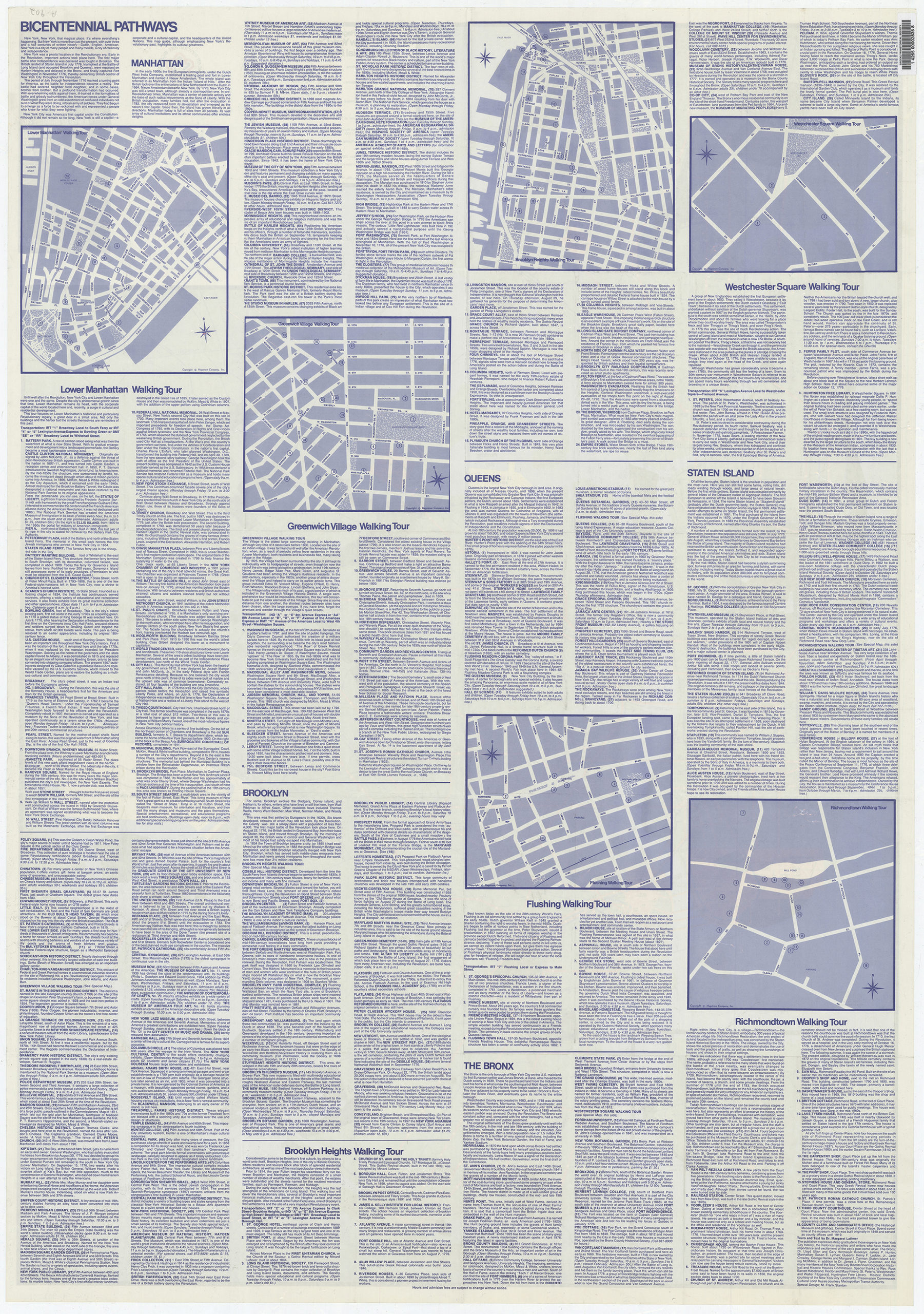
Creator
Hagstrom Company,Publisher
Brooklyn Historical SocietyCitation
Hagstrom New York City Bicentennial pathways map; [1975], Map Collection, NYC-1976.Fl.Folio; Brooklyn Historical Society.Scale
Scale not givenLoading zoom image... 