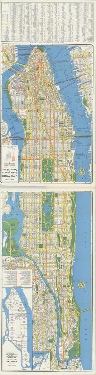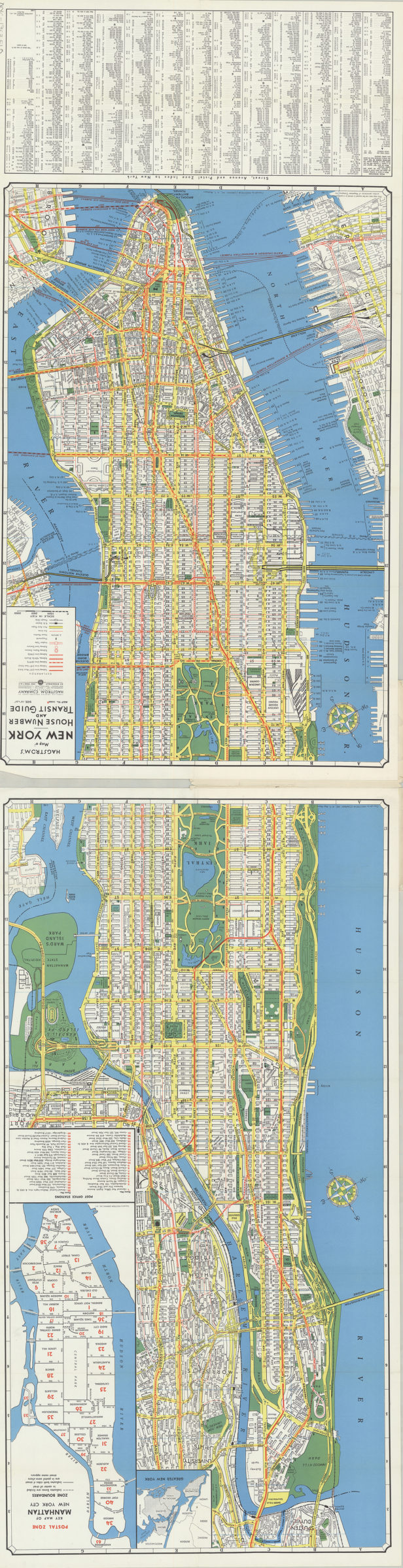
Hagstrom’s map of New York, house number and transit guide: compiled, printed and published by Hagstrom Company Incorporated [1963]
Map No. NYC-1963.Fl.O
Covers Manhattan and a portion of the Bronx as it borders the East River. On cover: Contents: house number guide, subway, elevated, automobile routes, surface lines, postal zones. Includes index. Insets: Greater New York — Postal zone key map of Manhattan, New York City [with list of post office stations]. “Map no. 2000A.” Date based on Hagstrom code: C-RG.
Subjects
Places
Map area shown
Relation
Full catalog recordSize
133 × 39 cmDownload
Low Resolution Image
Creator
Hagstrom Company,Publisher
Brooklyn Historical SocietyCitation
Hagstrom’s map of New York, house number and transit guide: compiled, printed and published by Hagstrom Company Incorporated; [1963], Map Collection, NYC-1963.Fl.O; Brooklyn Historical Society.Scale
Scale approximately 1:17,Loading zoom image...