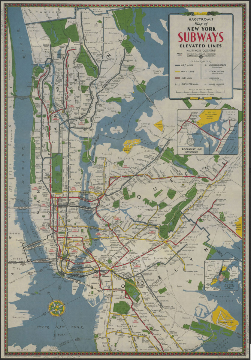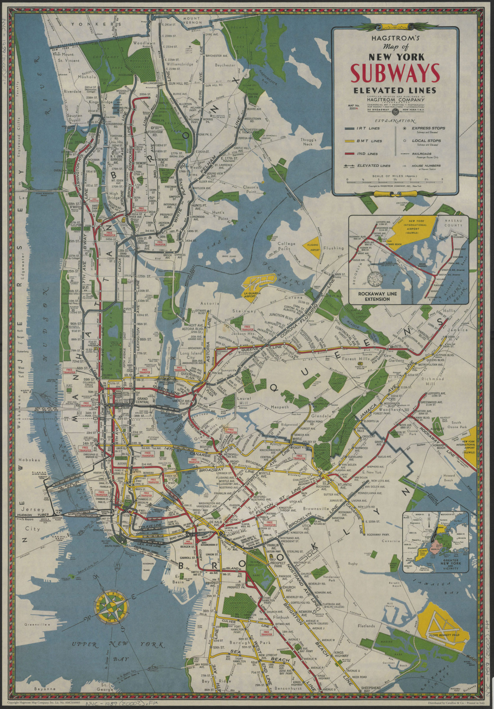
Hagstrom’s map of New York subways, elevated lines: compiled, printed and published by Hagstrom Company Incorporated [200?]
Map No. NYC-1959(2000?).Fl
Facsimile. Original title. Facsim. omits from the original: Coney Island, northeast tip of Staten Island and service information for the subway and elevated lines. Oriented with north towards the upper left. Insets: Rockaway line extension — Greater New York and vicinity. “Printed in Italy.” “Copyright Hagstrom Map Company, Inc. Lic. No. AMC303905.”
Map area shown
Genre
Transportation mapsRelation
Full catalog recordSize
69 × 47 cmDownload
Low Resolution Image
Creator
Hagstrom Company,Publisher
Brooklyn Historical SocietyCitation
Hagstrom’s map of New York subways, elevated lines: compiled, printed and published by Hagstrom Company Incorporated; [200?], Map Collection, NYC-1959(2000?).Fl; Brooklyn Historical Society.Scale
Scale [ca. 1:50,688]Loading zoom image...