Hagstrom’s map of Queens N.Y. City: house number & transit guide: compiled, printed, and published by Hagstrom Company Incorporated [1948]
Map No. Q-1948.Folded
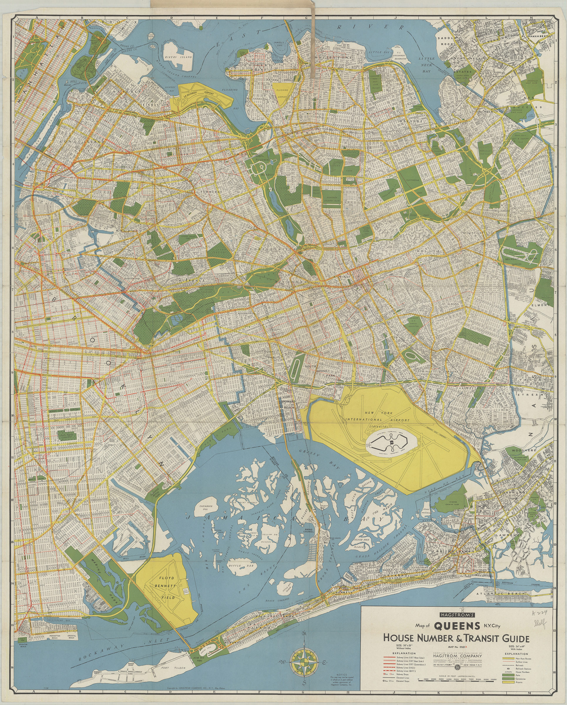
Street map covers Queens and a portion of eastern Brooklyn. Also shows major roads, subways, elevated railroads, and street cars. Accompanying index sheet affixed to inside of cover. On cover: color illustration and publisher’s map list. “Map No. 2060A.” Date based on Hagstrom code: T-SM.
Subjects
Places
Map area shown
Relation
Full catalog recordSize
91 × 73 cmDownload
Low Resolution Image
Creator
Hagstrom Company,Publisher
Brooklyn Historical SocietyCitation
Hagstrom’s map of Queens N.Y. City: house number & transit guide: compiled, printed, and published by Hagstrom Company Incorporated; [1948], Map Collection, Q-1948.Folded; Brooklyn Historical Society.Scale
Scale approximately 1:30,Loading zoom image... 