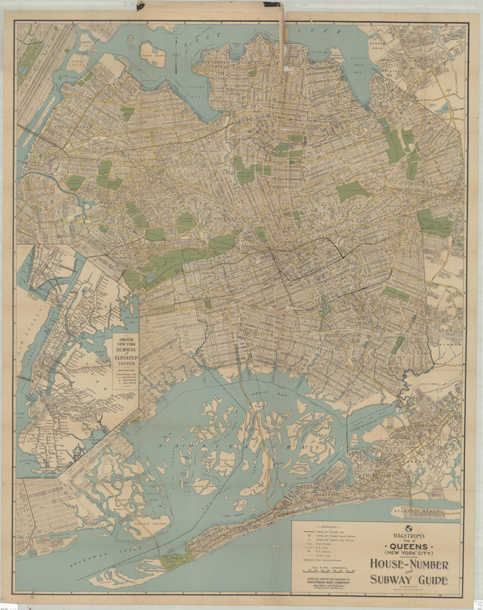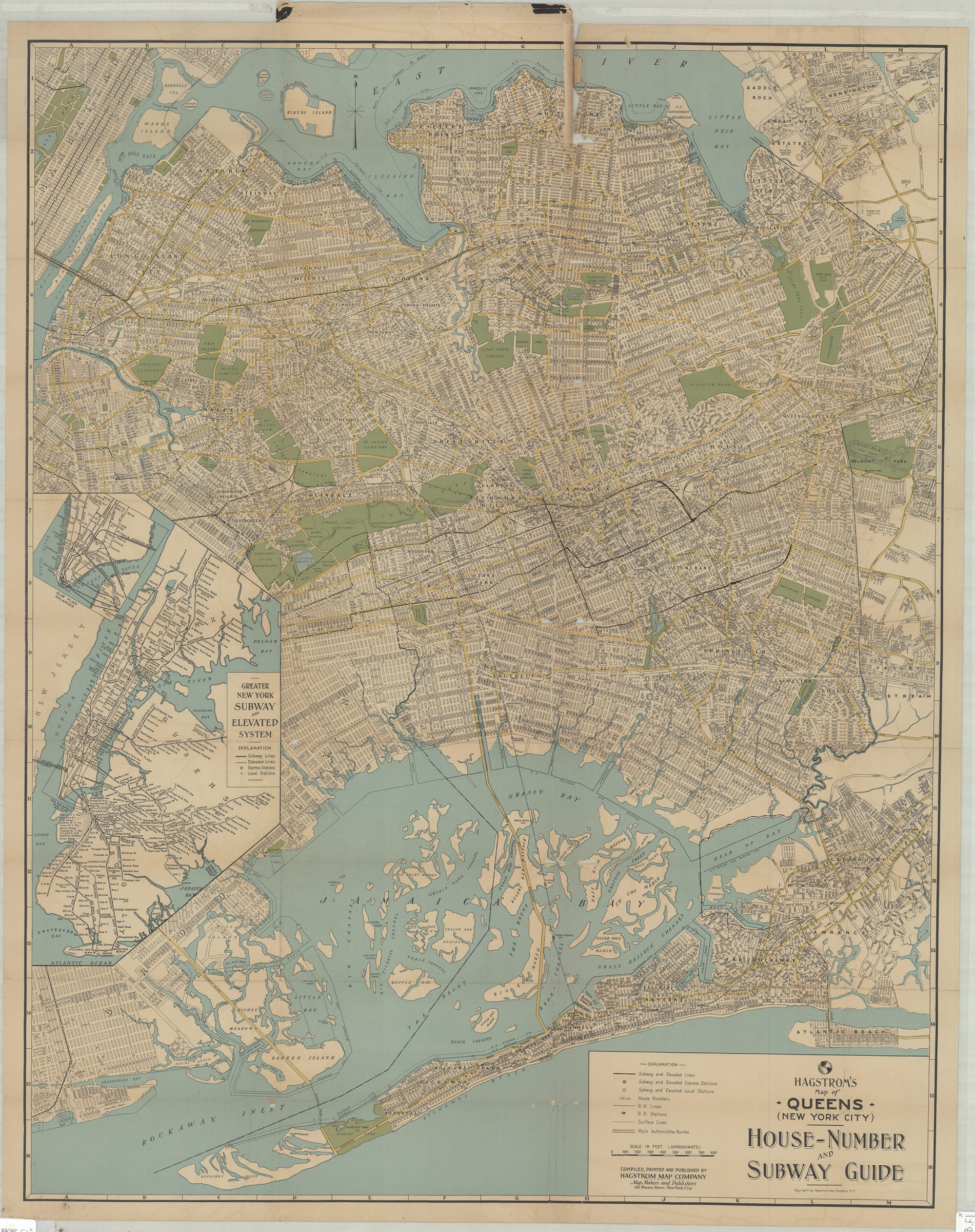
Hagstrom’s map of Queens (New York City): house-number and subway guide: compiled, printed, and published by Hagstrom Map Company, map makers and publishers [1928]
Map No. Q-1928.Fl
General-content street map of the Borough of Queens and adjacent portions of neighboring areas. Also shows major roads, subways, elevated railroads, railroads, and surface lines. Title from panel. “Copyright by Hagstrom Map Company N.Y.” Accompanying index sheet affixed to inside of cover. Includes inset of “Greater New York subway and elevated system” and sub-inset of Lower Manhattan subways. Color illustration and publisher’s map list on cover.
Subjects
Places
Map area shown
Genre
Road mapsRelation
Full catalog recordSize
86 × 68 cmDownload
Low Resolution Image
Creator
Hagstrom Map Company,Publisher
Brooklyn Historical SocietyCitation
Hagstrom’s map of Queens (New York City): house-number and subway guide: compiled, printed, and published by Hagstrom Map Company, map makers and publishers; [1928], Map Collection, Q-1928.Fl; Brooklyn Historical Society.Scale
Scale approximately 1:31,Loading zoom image...