Hagstrom’s map of Richmond (Staten Island), N. Y. City: house number & transit guide: compiled, printed, and published by Hagstrom Company [1963]
Map No. S.I.-[1963?].Fl
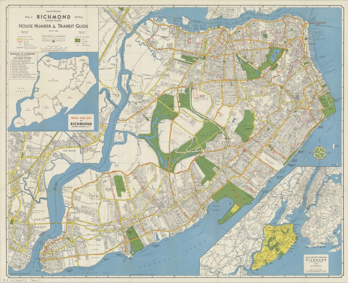
Insets: Postal zone map of Richmond (Staten Island, N.Y.) — Auto routes through Richmond (Staten Island) and vicinity. Accompanying index sheet affixed to inside of cover. Postal zone map includes list of post office stations keyed to inset map. Shows “proposed Narrows Bridge.” “Map no. 2080A.”
Map area shown
Relation
Full catalog recordSize
60 × 74 cmDownload
Low Resolution Image
Creator
Hagstrom Company,Publisher
Brooklyn Historical SocietyCitation
Hagstrom’s map of Richmond (Staten Island), N. Y. City: house number & transit guide: compiled, printed, and published by Hagstrom Company; [1963], Map Collection, S.I.-[1963?].Fl; Brooklyn Historical Society.Scale
Scale approximately 1:27,Loading zoom image...