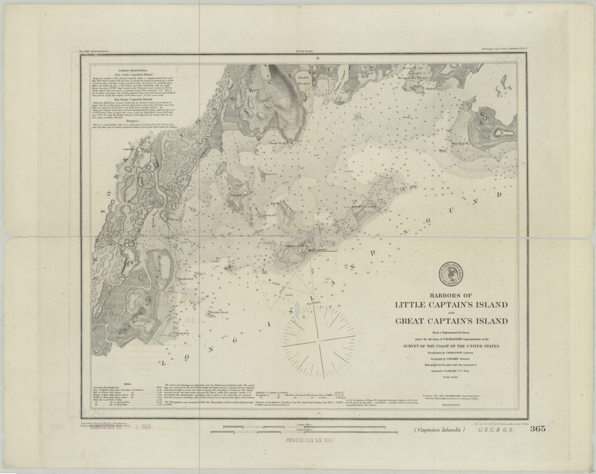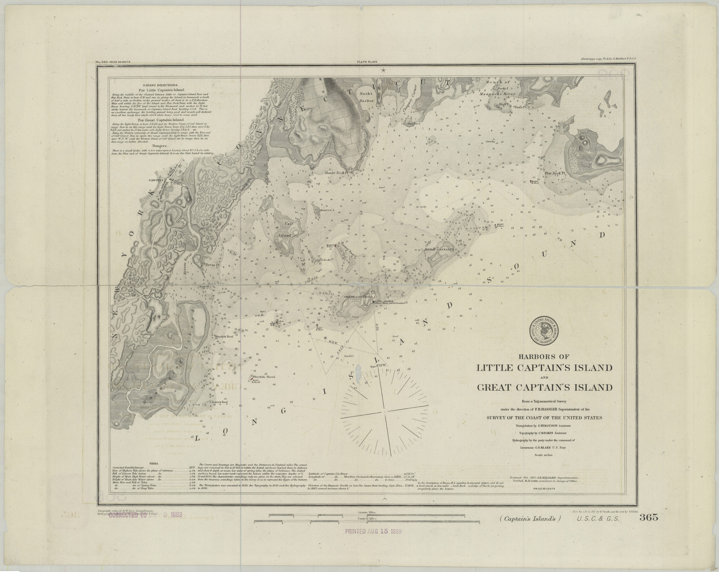

Harbors of Little Captain’s Island and Great Captain’s Island: from a trigonometrical survey under the direction of F.R. Hassler superintendent of the Survey of the Coast of the United States [1882]
Map No. U.S.C.S.-365.Fl
Covers the southern portion of the Long Island Sound from Manursing Island, N. Y., to Byram, C.T., and shows roads, buoys, and sea floor terrain. “Re-issued Feb. 1882 J.E. Hilgard Superintendent.” “The Triangulation was executed in 1834, the Topography in 1836, and the Hydrography in 1836.” Stamped “Printed Aug 15 1889.” Stamped “Corrected to Sept 2 1889.” “No. 365”–Upper left margin. “Plate No. 826”–Upper center margin. “Electrotype copy No. 2 by G. Mathiot U.S.C.S.”–Upper right margin. Depths shown by shading and soundings. Relief shown by contours and spot heights.
Map area shown
Relation
Full catalog recordSize
45 × 58 cmDownload
Low Resolution Image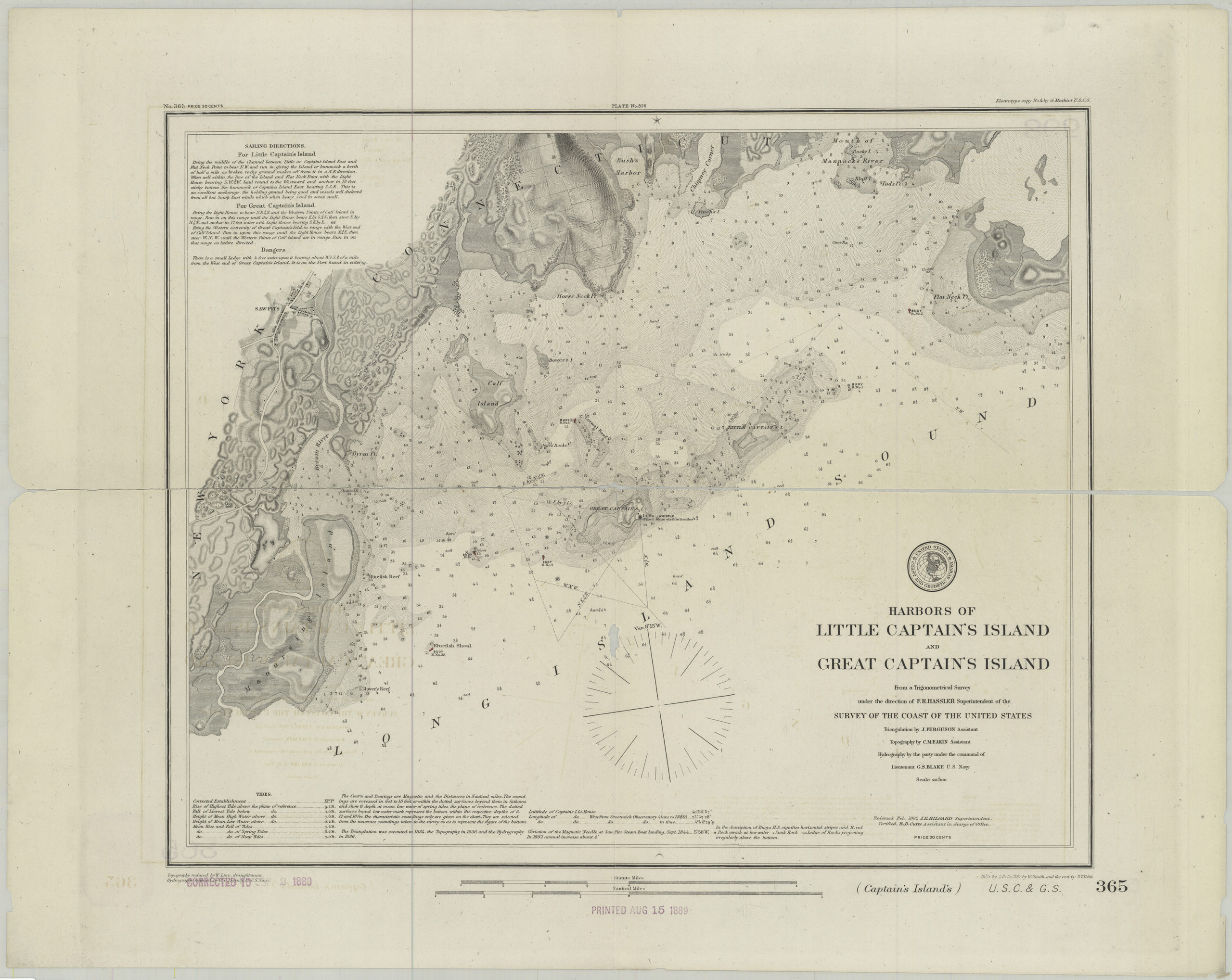
Creator
U.S. Coast and Geodetic Survey, U.S. Coast and Geodetic Survey,Publisher
Brooklyn Historical Society, Brooklyn Historical SocietyCitation
Harbors of Little Captain’s Island and Great Captain’s Island: from a trigonometrical survey under the direction of F.R. Hassler superintendent of the Survey of the Coast of the United States; [1882], Map Collection, U.S.C.S.-365.Fl; Brooklyn Historical Society.Scale
Scale 1:20,000Loading zoom image...