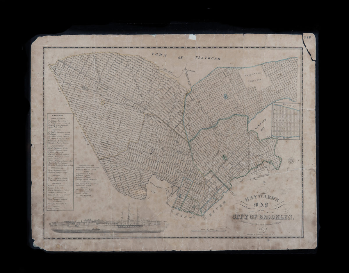
Hayward’s map of the city of Brooklyn: copied from the Commissioner’s map 1843
Map No. B A-1843.Fl
Shows wards and ferry piers. Oriented with north to the lower left. Includes ill. of Brooklyn Heights, inset continuation map, and list of churches and public buildings.
Map area shown
Genre
MapRelation
Full catalog recordSize
36 × 50 cmDownload
Low Resolution Image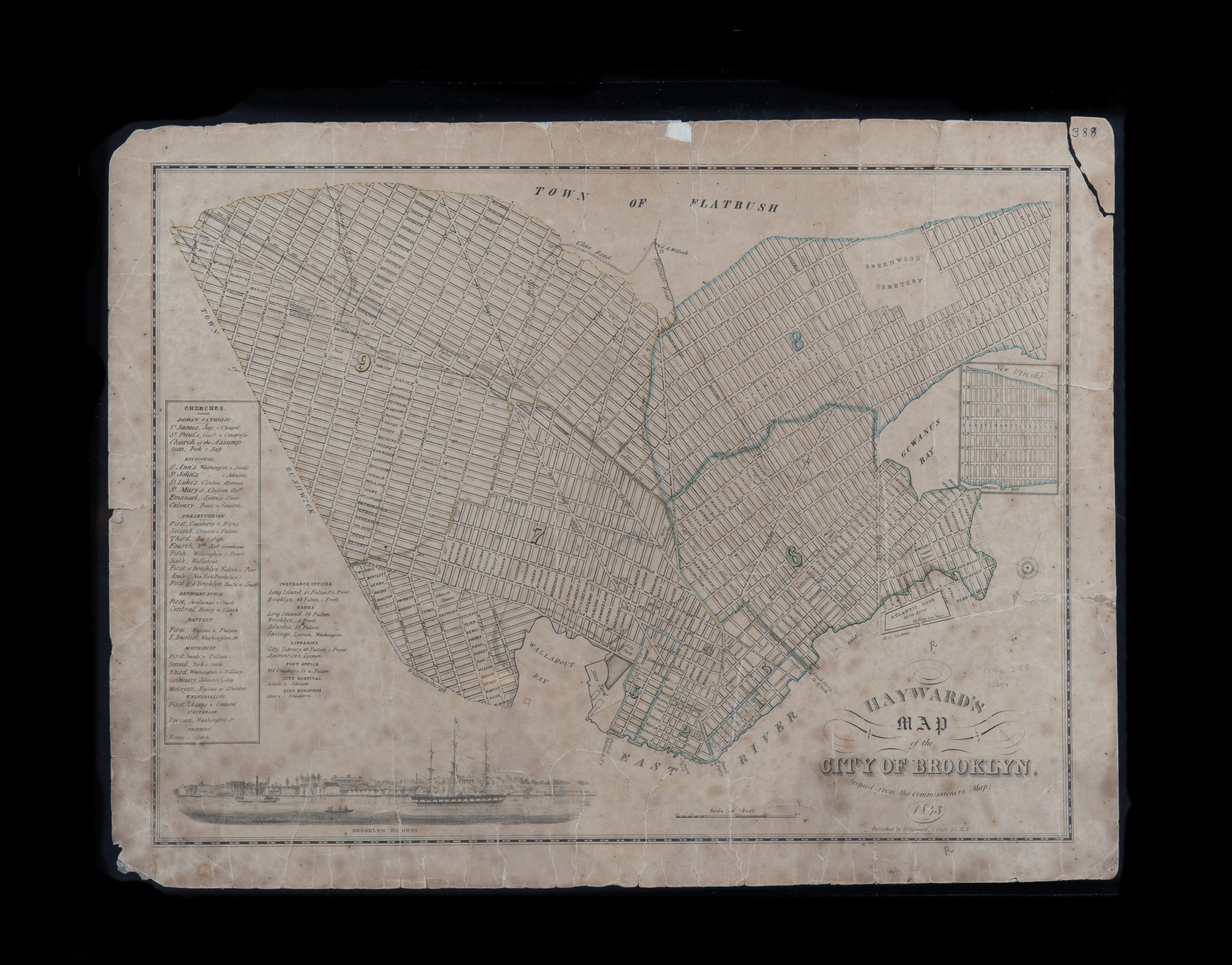
Creator
Hayward, George,Publisher
Brooklyn Historical SocietyCitation
Hayward’s map of the city of Brooklyn: copied from the Commissioner’s map; 1843, Map Collection, B A-1843.Fl; Brooklyn Historical Society.Scale
Scale [ca. 1:19,000]Loading zoom image...