Hayward’s new map of the city of Brooklyn: with the latest improvements 1867
Map No. B A-1867a.Fl
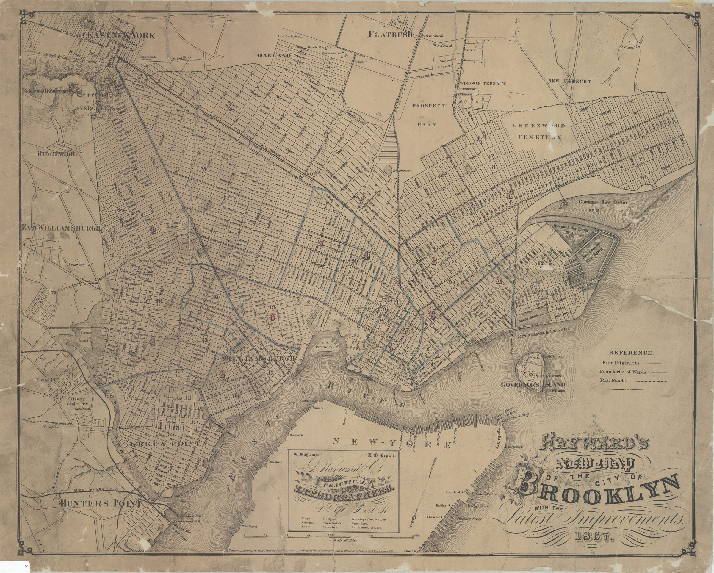
Covers the city of Brooklyn north from 59 St. to Green Point and east to the Cemetery of the Evergreens. Also minimally details parts of New Utrecht, Flatbush, East New York, East Williamsburgh, Hunter’s Point, Lower Manhattan, and Governor’s Island. Shows wards, fire districts, railroads, and ferry lines. Relief shown by hachures. Oriented with north to the lower left. Place of publication and publisher inferred from advertisement. Includes key and advertisement. “Entered according to Act of Congress by G. Hayward in the Clerk’s Office of the District Court of the Southern District of NY in the year 1867.”
Map area shown
Genre
MapRelation
Full catalog recordSize
45 × 56 cmDownload
Low Resolution Image
Creator
Hayward, George,Publisher
Brooklyn Historical SocietyCitation
Hayward’s new map of the city of Brooklyn: with the latest improvements; 1867, Map Collection, B A-1867a.Fl; Brooklyn Historical Society.Scale
Scale [ca. 1:22,781]Loading zoom image... 