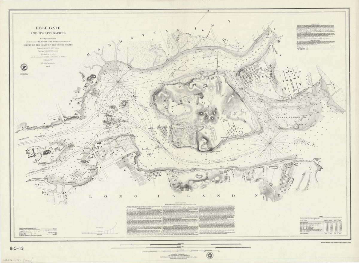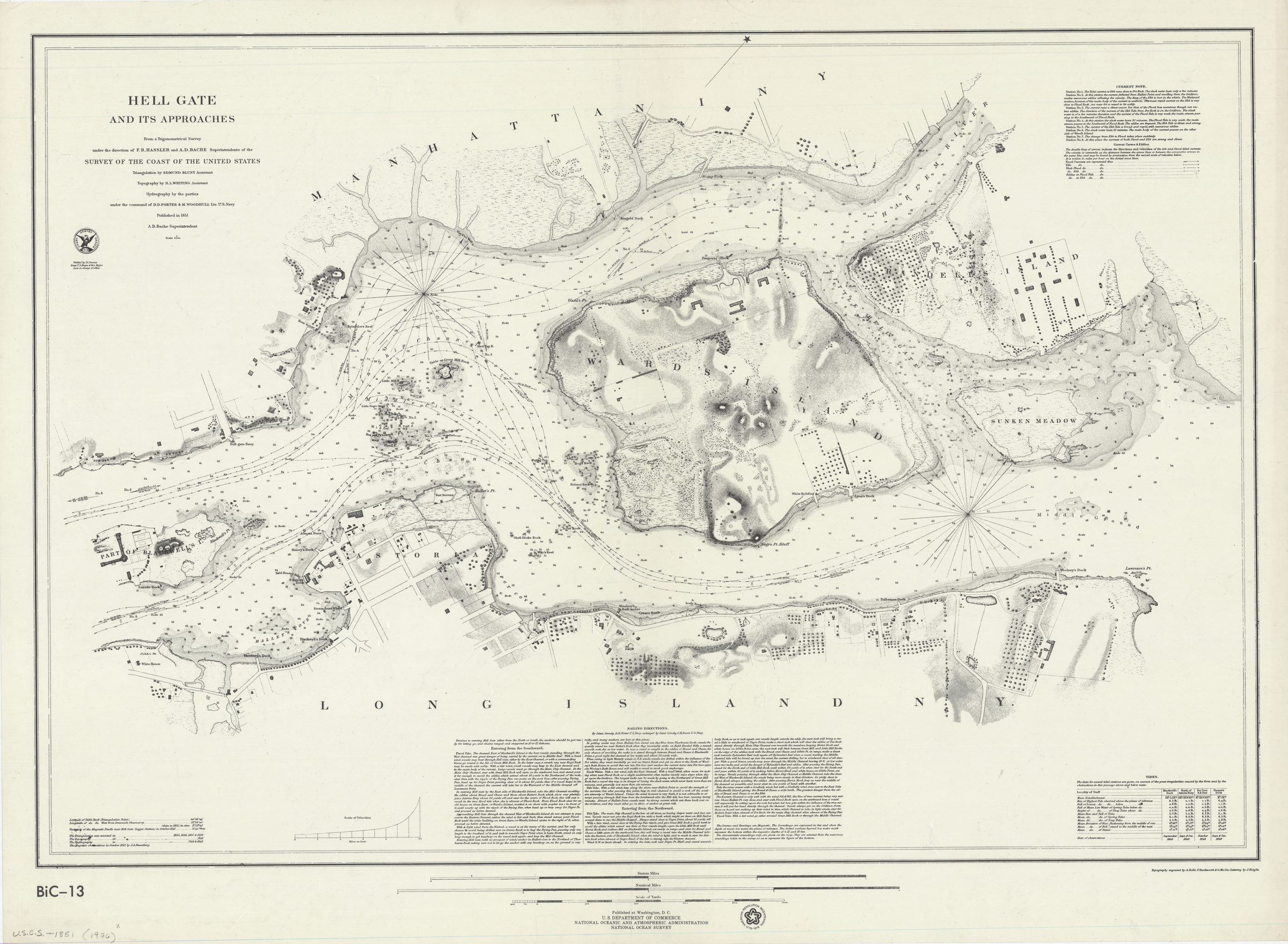
Hell Gate and its approaches: from a trigonometrical survey under the direction of F.R. Hassler and A.D. Bache, superintendents of the Survey of the Coast of the United States [1976]
Map No. U.S.C.S.-1851 (1976).Fl
Facsimile showing Astoria, Ward’s Island, Sunken Meadow, and portions of Randell’s Island, Blackwell’s Island, Long Island and Manhattan. Also shows structures, seafloor terrain, and currents. Relief shown by hachures. Depths shown by bathymetric tints and soundings. Oriented with north to the upper right. “American Revolution Bicentennial, 1776-1976.” Includes sailing directions, note on currents, tidal table, scale of velocities, text and seal. “BiC-13”–Lower left.
Map area shown
Relation
Full catalog recordSize
62 × 90 cmDownload
Low Resolution Image
Creator
United States Coast Survey,Publisher
Brooklyn Historical SocietyCitation
Hell Gate and its approaches: from a trigonometrical survey under the direction of F.R. Hassler and A.D. Bache, superintendents of the Survey of the Coast of the United States; [1976], Map Collection, U.S.C.S.-1851 (1976).Fl; Brooklyn Historical Society.Scale
Scale 1:5,000Loading zoom image...