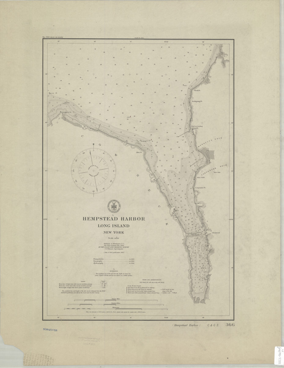
Hempstead Harbor, Long Island, New York 1909
Map No. U.S.C.S.-366(1909).Fl
Depths shown by bathymetric tints and soundings (in feet). “Published at Washington, D.C., Jan. 1905, reissued Mar. 1909, by the Coast and Geoditic Survey, O.H. Tittmann, Superintendent.” Triangulation in 1885, Topography in 1886, Hydrography in 1886.” Includes tidal information. “No. 366.”
Map area shown
Relation
Full catalog recordSize
54 × 37 cmDownload
Low Resolution Image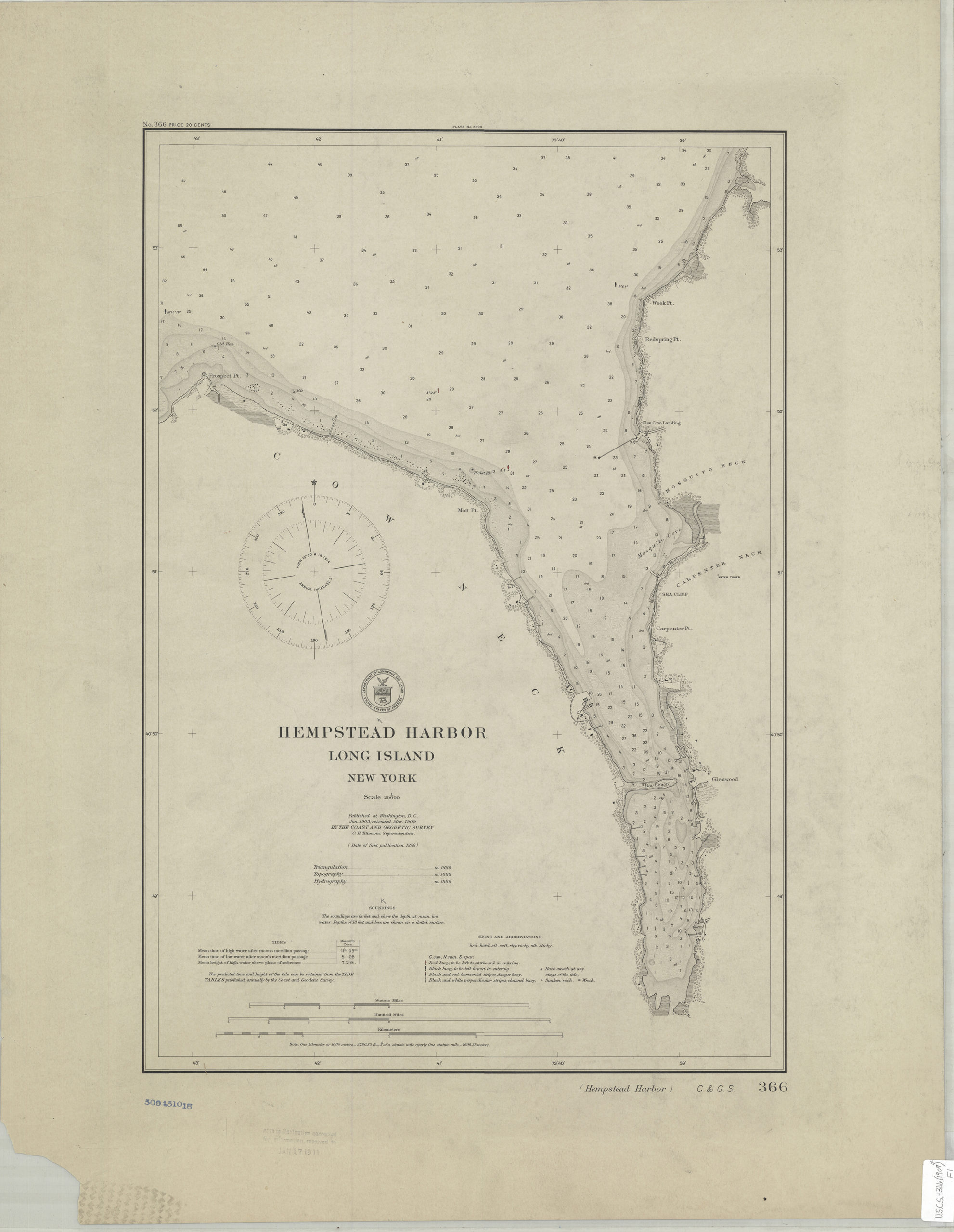
Creator
U.S. Coast and Geodetic Survey,Publisher
Brooklyn Historical SocietyCitation
Hempstead Harbor, Long Island, New York; 1909, Map Collection, U.S.C.S.-366(1909).Fl; Brooklyn Historical Society.Scale
Scale 1:20,000Loading zoom image...