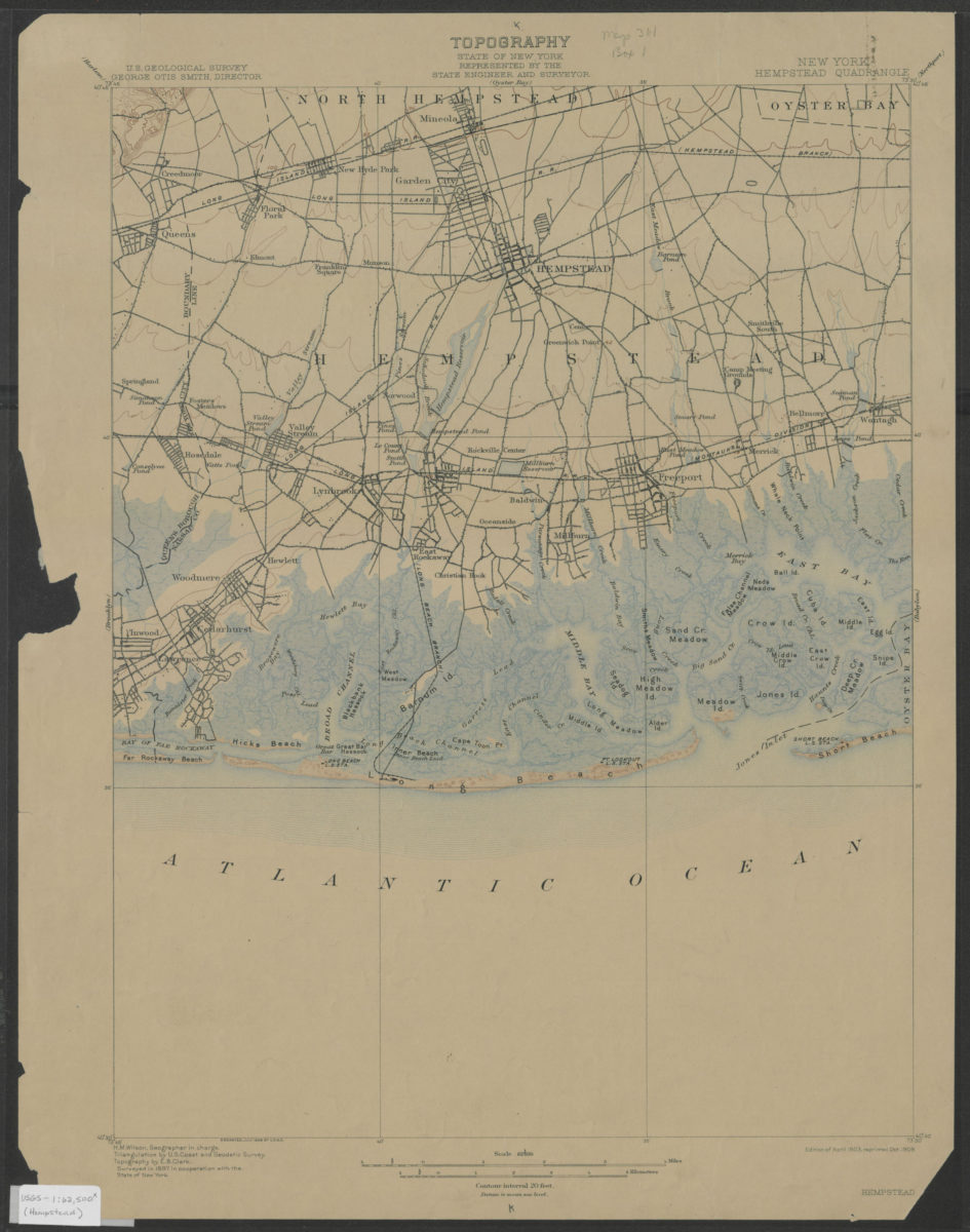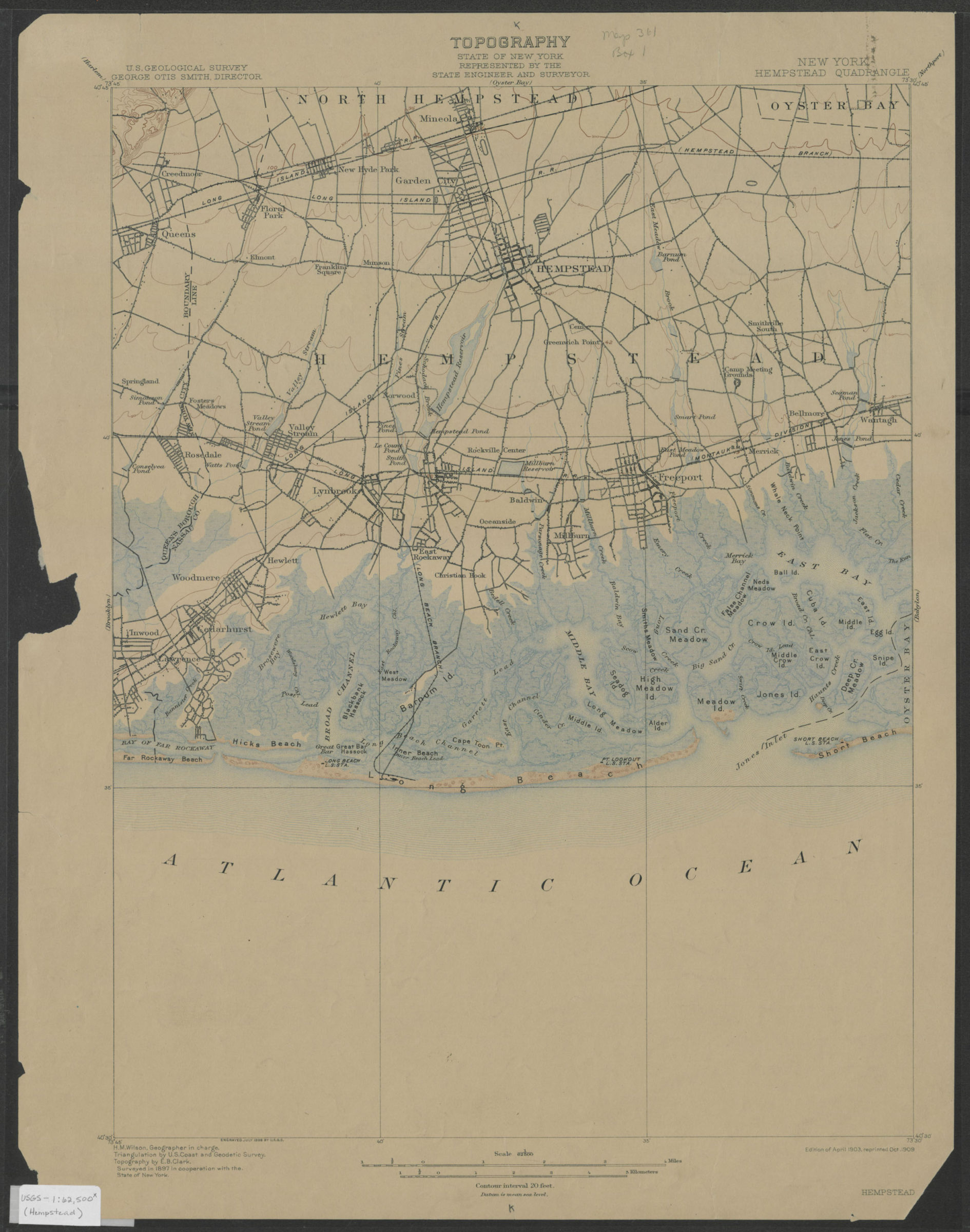
Hempstead quadrangle, New York: U.S. Geological Survey 1903; 1909
Map No. USGS-1:62,500 (Hempstead).Fl
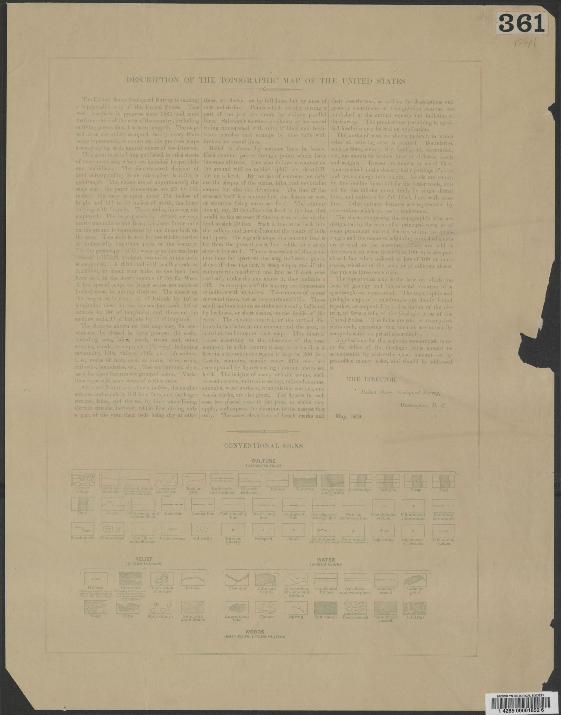
Shows portions of Nassau and Queens Counties. “Surveyed in 1897 with the cooperation of the State of New York.” Relief shown by contours and spot heights. “H.M. Wilson, Geographer in charge. Triangulation by U.S. Coast and Geodetic Survey. Topography by E.B. Clark.” “Engraved July 1898 by U.S.G.S.” “Edition of April 1903, reprinted Oct. 1909.” Text and legend on verso.
Map area shown
Genre
Topographic mapsRelation
Full catalog recordSize
51 × 42 cmDownload
Low Resolution Image
Creator
Geological Survey (U.S.),Publisher
Brooklyn Historical SocietyCitation
Hempstead quadrangle, New York: U.S. Geological Survey; 1903; 1909, Map Collection, USGS-1:62,500 (Hempstead).Fl; Brooklyn Historical Society.Scale
Scale 1:62,500Loading zoom image...