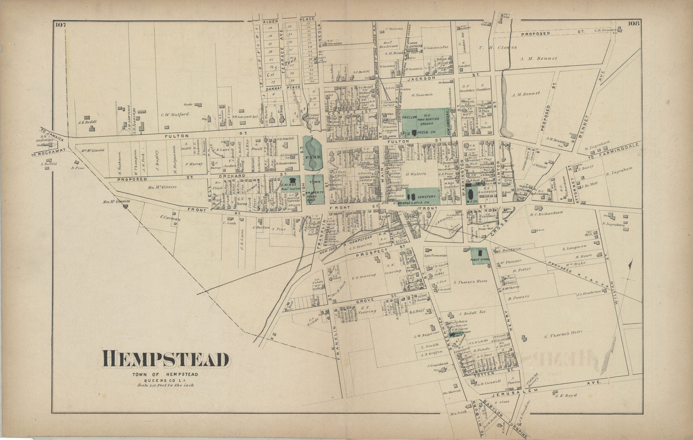

Hempstead, town of Hempstead, Queens Co., L.I. [1873]
Map No. L.I.-[1873]b.Fl
Cadastral map. Shows property (including lot numbers and buildings), names of landowners, churches, and schools. Extracted from: Atlas of Long Island, New York. New York : Beers, Comstock & Cline, 1873, p. 106-109. On verso: 2 ancillary maps. Ancillary maps: Rockville Centre, Hempstead Town, Queens Co. (Scale [1:11,880]. 60 rods to the in.) — Pearsalls, Hempstead Town, Queens Co. (Scale [1:11,880]. 60 rods to the in.).
Subjects
Places
Map area shown
Genre
Cadastral mapsRelation
Full catalog recordSize
36 × 25 cmDownload
Low Resolution Image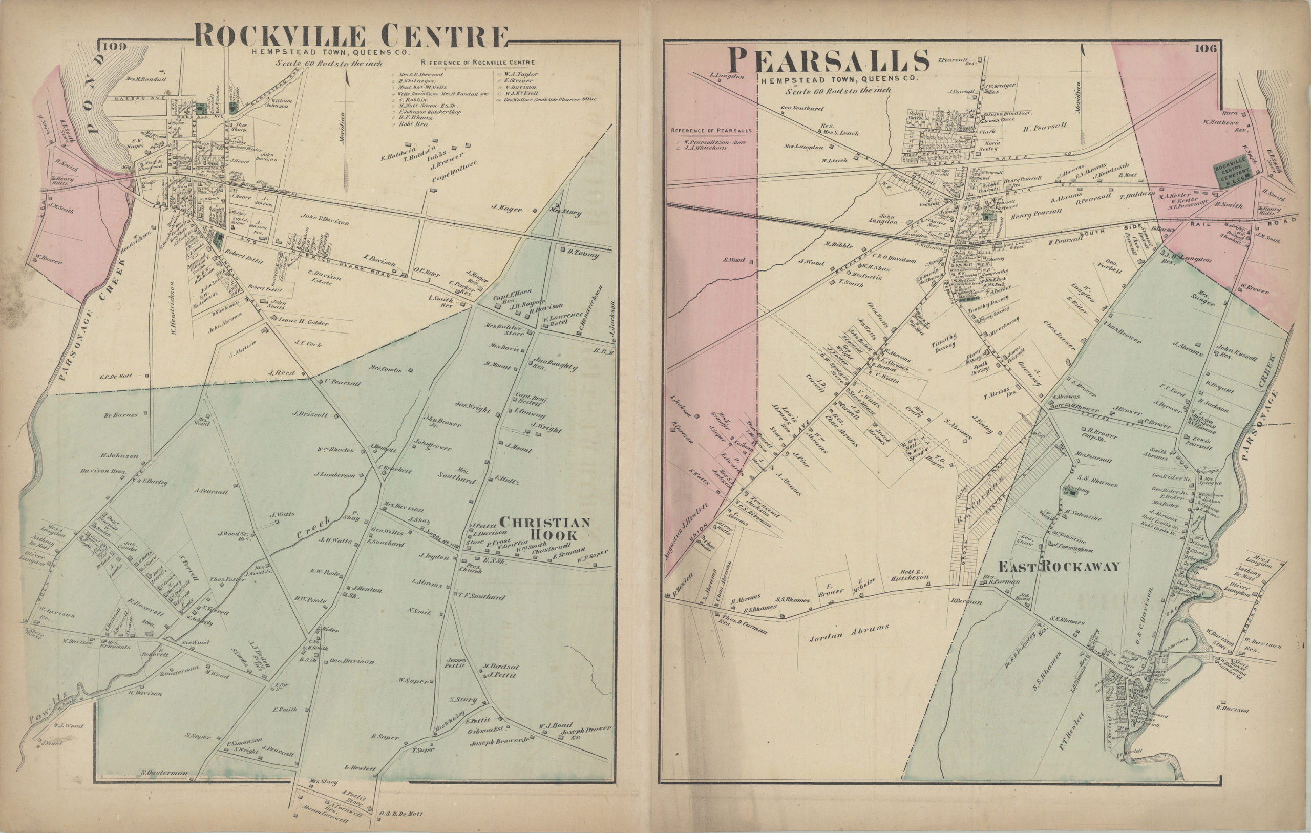
Creator
Beers, F. W.; Beers, Comstock & Cline,Publisher
Brooklyn Historical SocietyCitation
Hempstead, town of Hempstead, Queens Co., L.I.; [1873], Map Collection, L.I.-[1873]b.Fl; Brooklyn Historical Society.Scale
Scale [1:4,200] 1 in to 3Loading zoom image... 