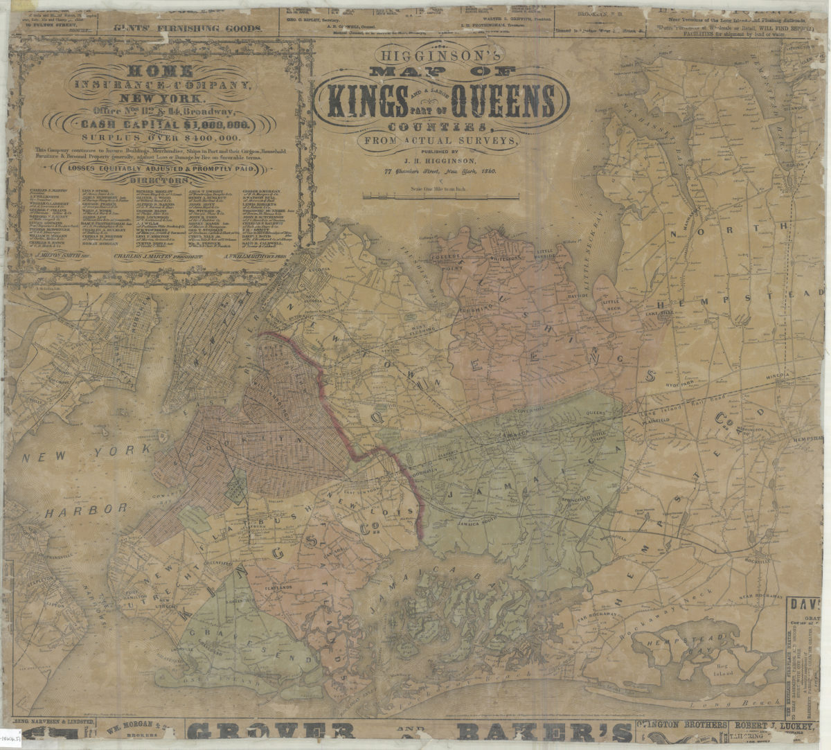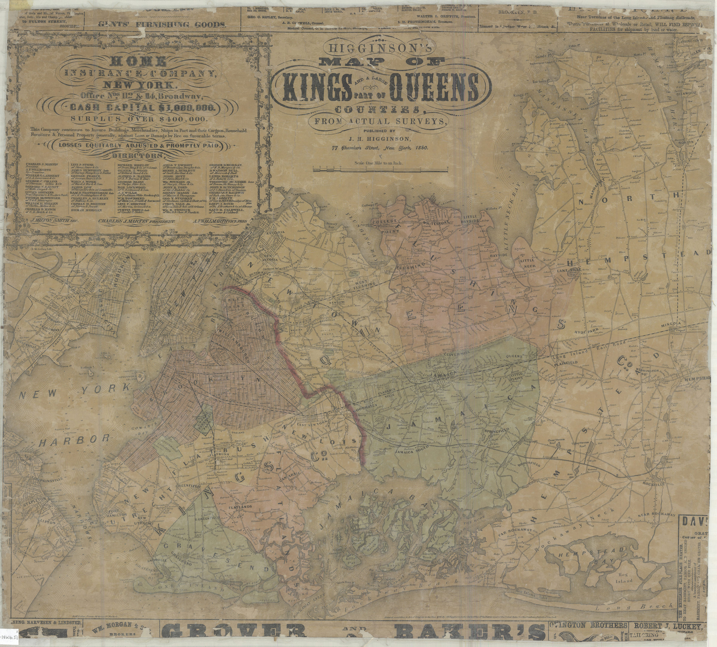
Higginson’s map of Kings and a large part of Queens Counties: from actual surveys 1860
Map No. NYC-1860b.Fl
Cadastral map covering the entirety of Kings and Queens Counties also covers Nassau County east to Hempstead, Blackwells Island, Ellis Island, Bedloe’s Island, Governors Island and portions of Lower Manhattan Hoboken, Jersey City, and Staten Island. Shows political divisions, railroads, ferry lines, and names of property owners. Relief shown by hachures. Depths shown by soundings and isolines. “Entered according to Act of Congress in the Year 1860 by J.H. Higginson in the Clerks Office of the District Court of the United States for the Southern District of New York.” Includes advertisements.
Subjects
Places
Map area shown
Genre
Cadastral mapsRelation
Full catalog recordSize
54 × 66 cmDownload
Low Resolution Image
Creator
Higginson, J. H.,Publisher
Brooklyn Historical SocietyCitation
Higginson’s map of Kings and a large part of Queens Counties: from actual surveys; 1860, Map Collection, NYC-1860b.Fl; Brooklyn Historical Society.Scale
Scale [1:63,360] 1 in toLoading zoom image...