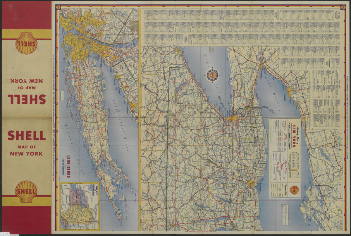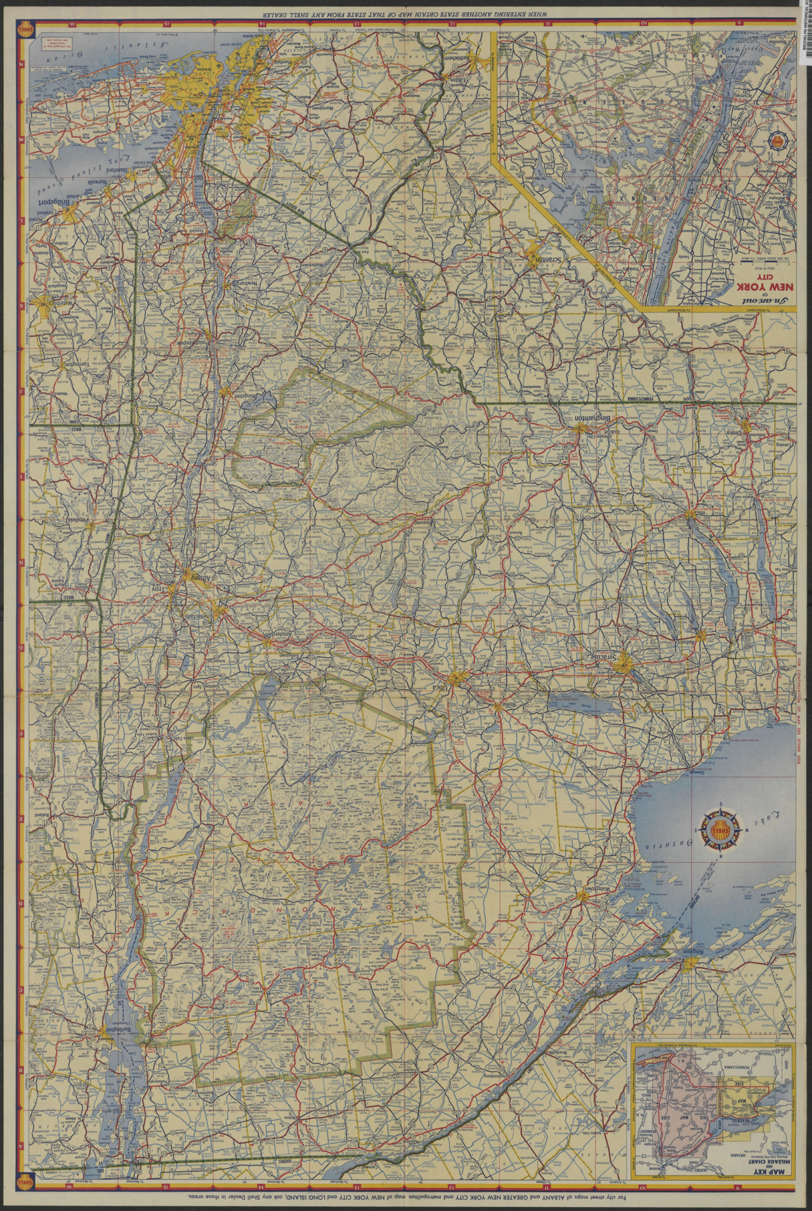
Highway map of New York [1953]
Map No. NYS-[1953].Fl
Road map also covering portions of Ontario, Quebec, Pennsylvania, New Jersey, Connecticut, Massachusetts, and Vermont. Shows parks and areas of dense population. Relief shown by hachures and spot heights in feet. “Copyright by the H.M. Goushá Company.” Publication date derived from code: 10-AA-1953-1. Includes index to counties, cities and towns, points of interest, historic sites, and state parks mileage chart and ancillary maps. Ancillary maps: Long Island (Scale [ca. 1:506,880]. 1 in. equals approx. 8 miles) — In an’ out of New York City (Scale [ca. 1:237,600]. 1 in. equals approx. 3 3/4 miles). “532-J-10-AA.”
Map area shown
Genre
Road mapsRelation
Full catalog recordSize
68 × 46 cmDownload
Low Resolution Image
Creator
H.M. Gousha Company,Publisher
Brooklyn Historical SocietyCitation
Highway map of New York; [1953], Map Collection, NYS-[1953].Fl; Brooklyn Historical Society.Scale
Scale [ca. 1:792,000] 1 iLoading zoom image...